Last Day of Road Trip for Colorado Traveling Ducks

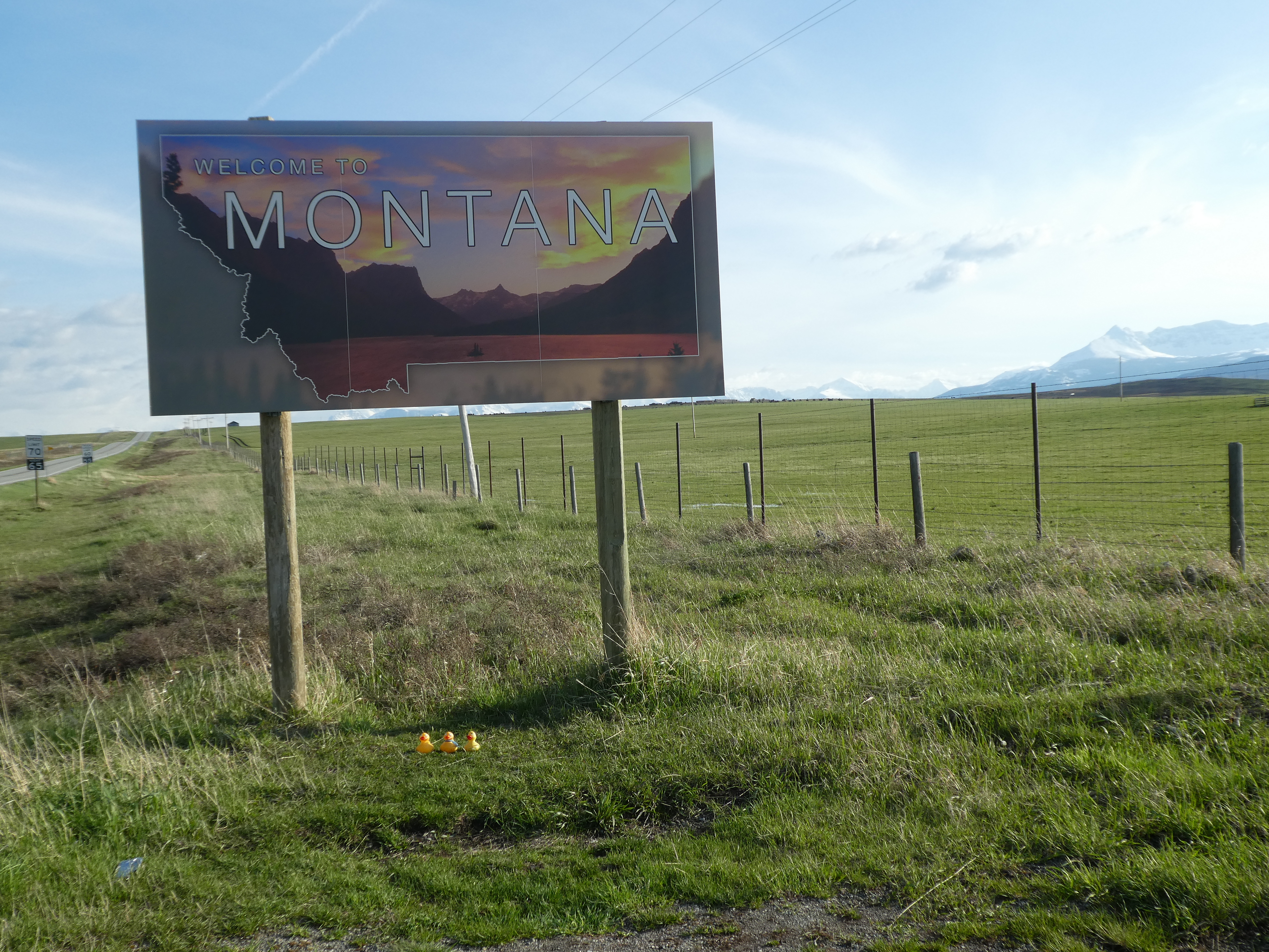
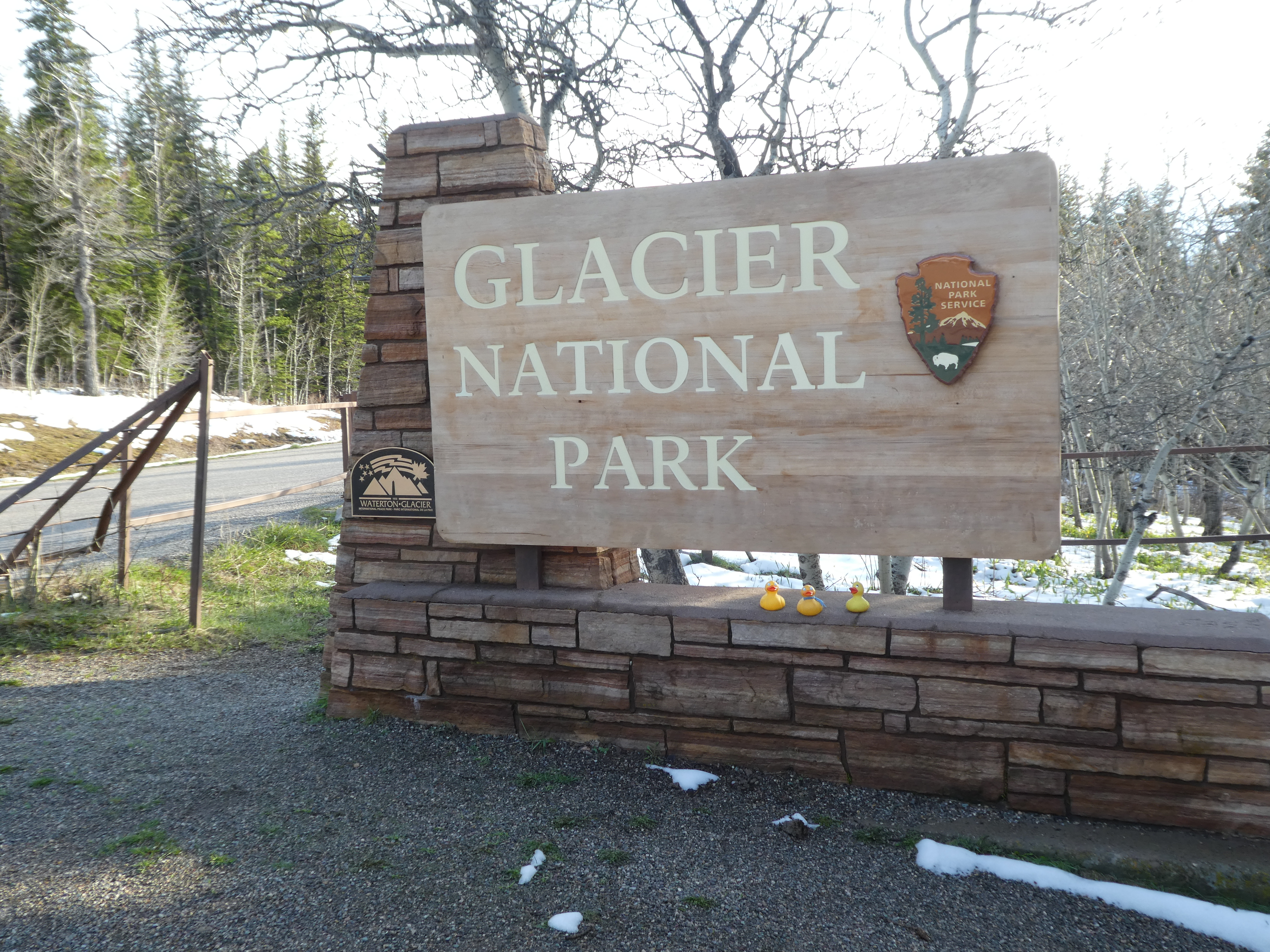
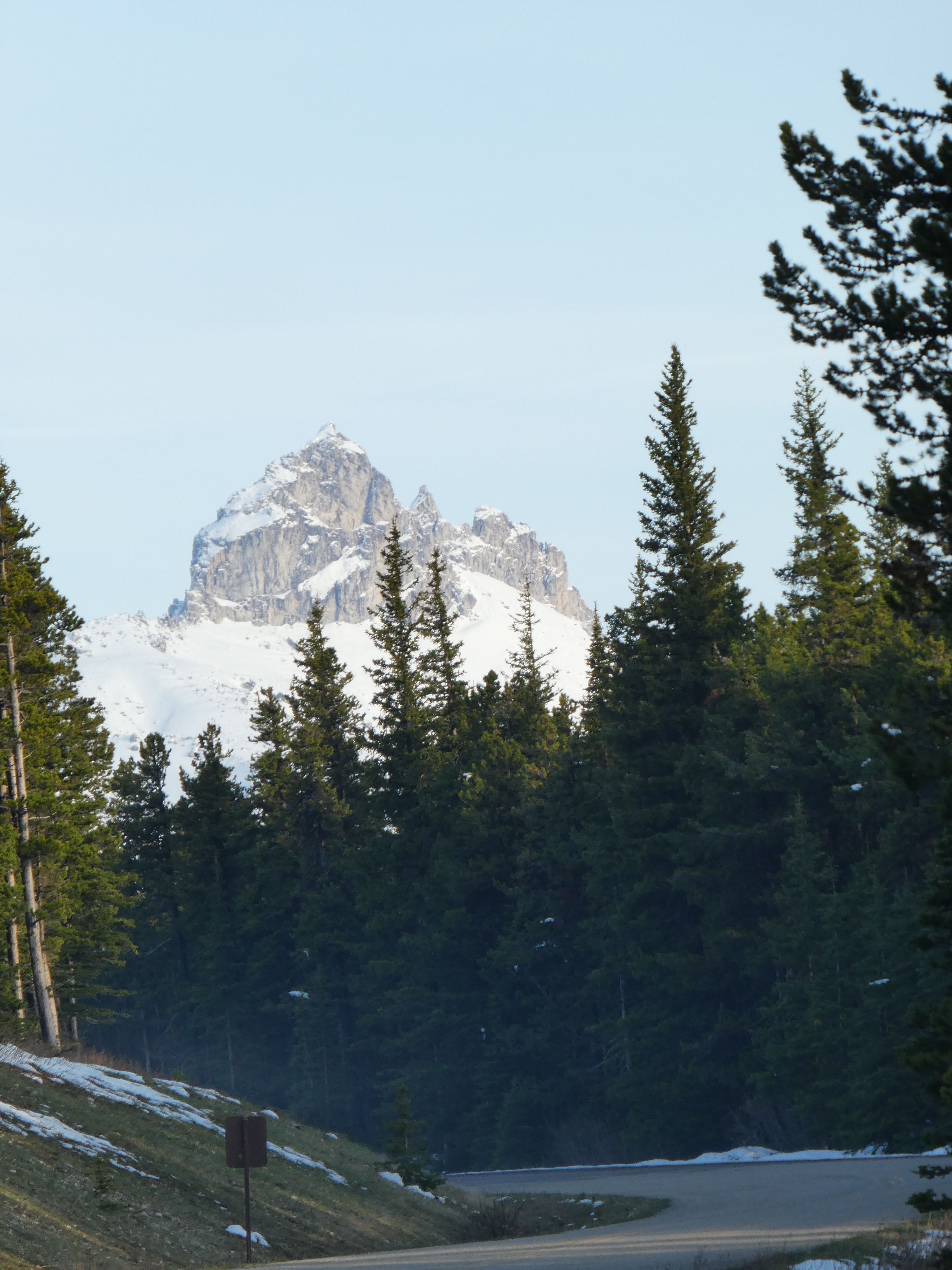
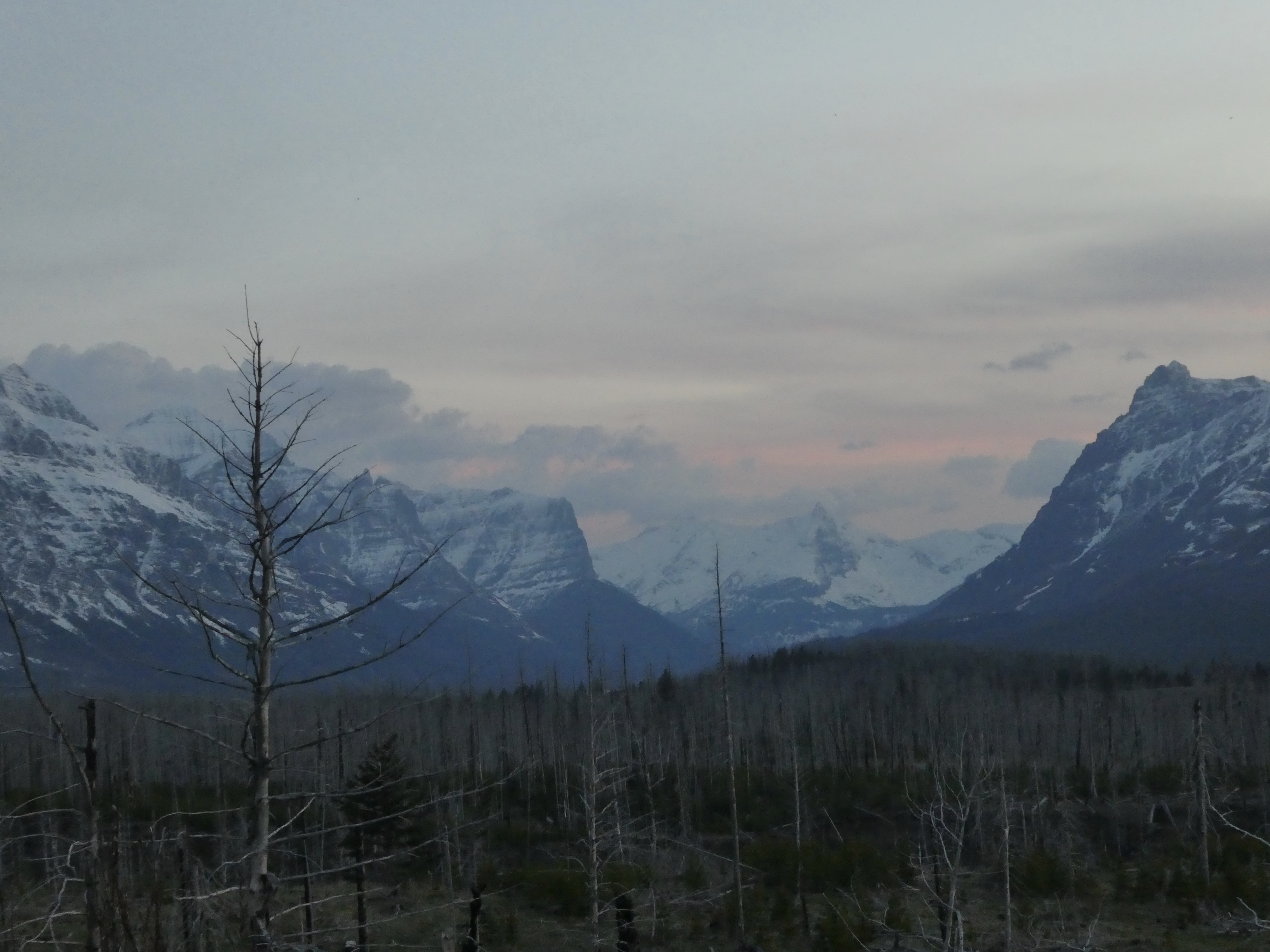
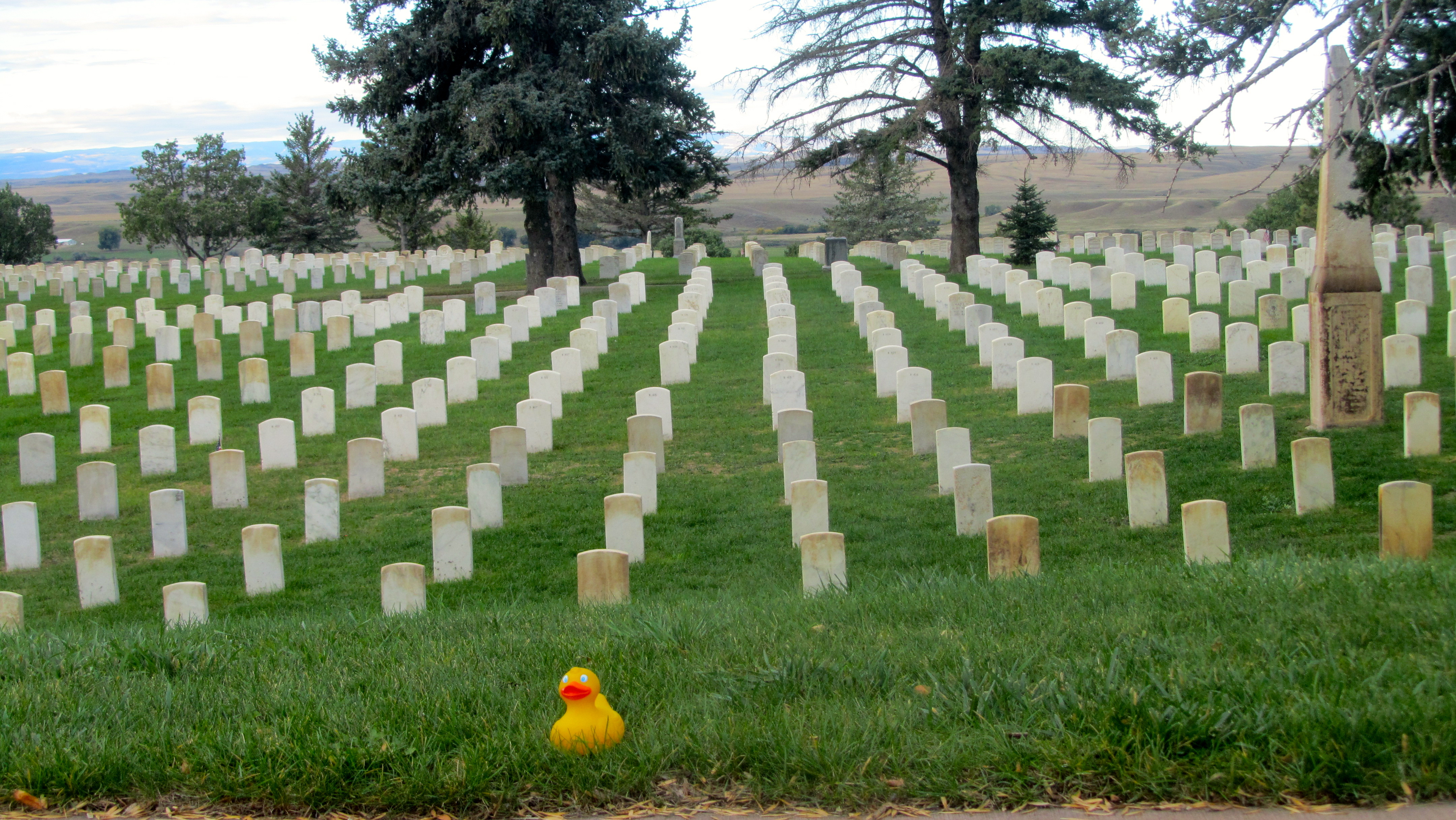
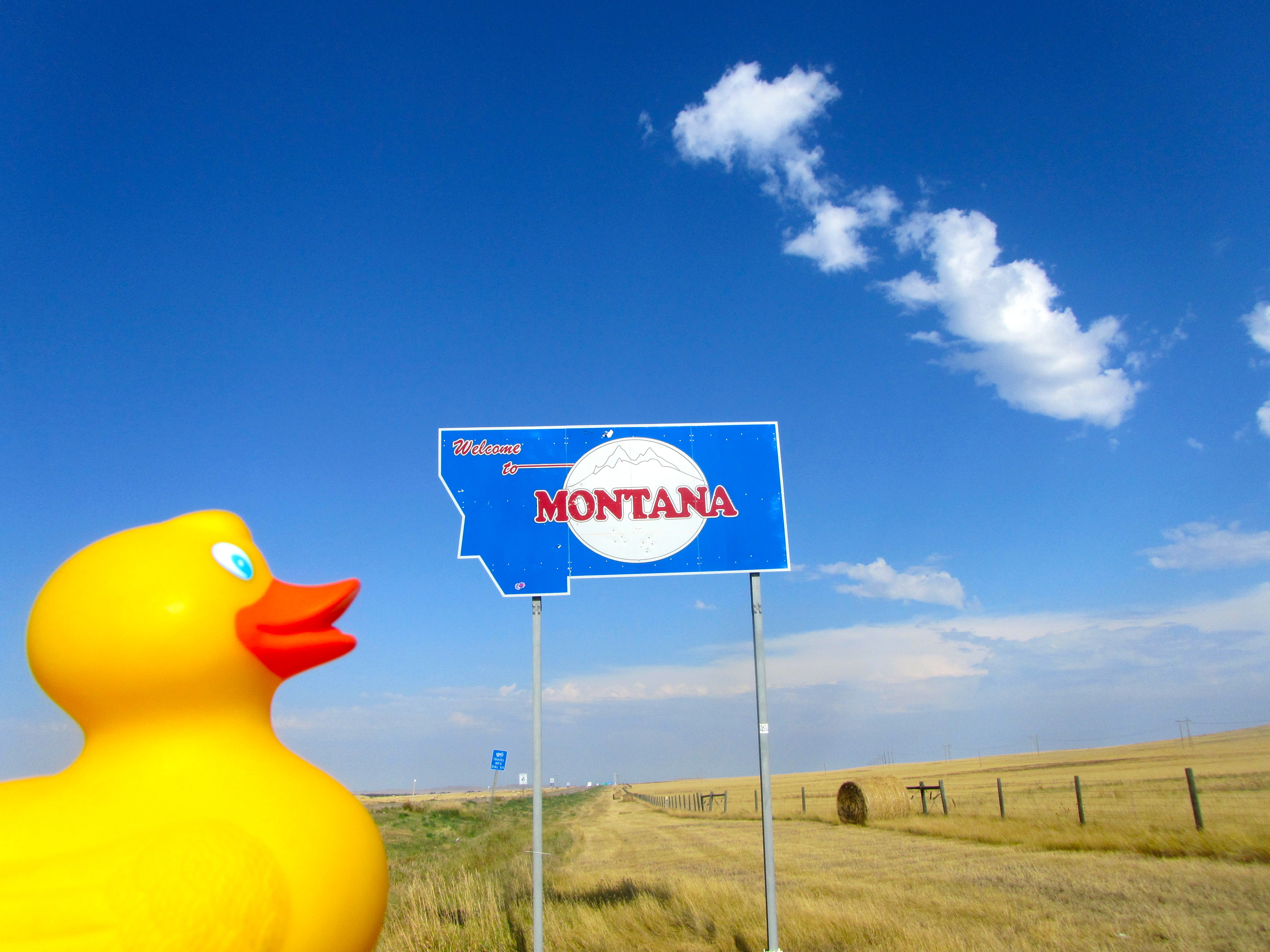
We should be home today, but the weather in Denver is definitely not as nice as it is here in northern Montana.   So, we get another day of road trip vacation.   We love it!   Our National Parks do not allow dogs to go on trails, so we are not in the park today.   The dogs may bark or try to chase the wildlife.  A dog trying to chase a bear, moose or elk may not end well.   We are following the river along the southern boundary.

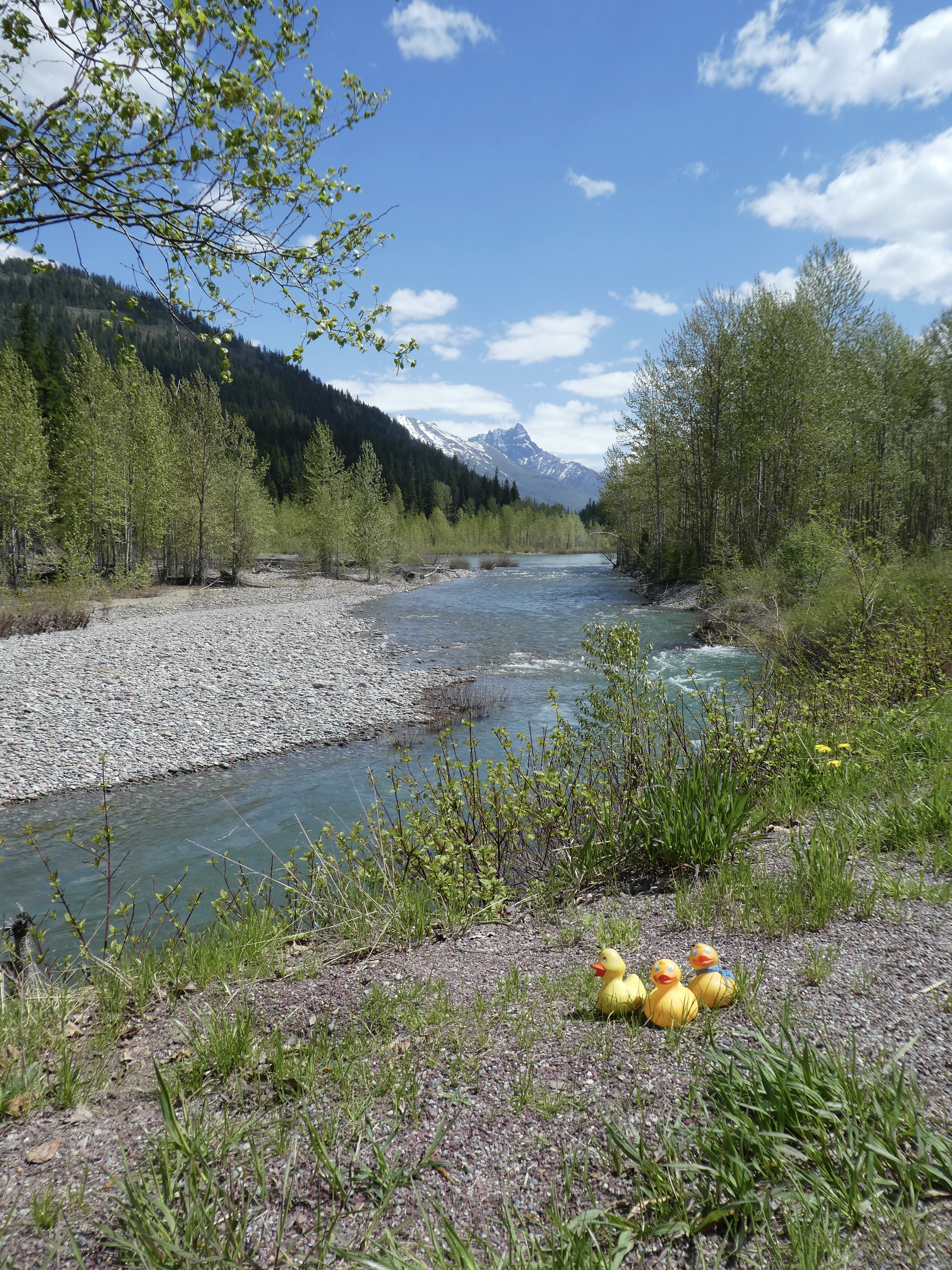
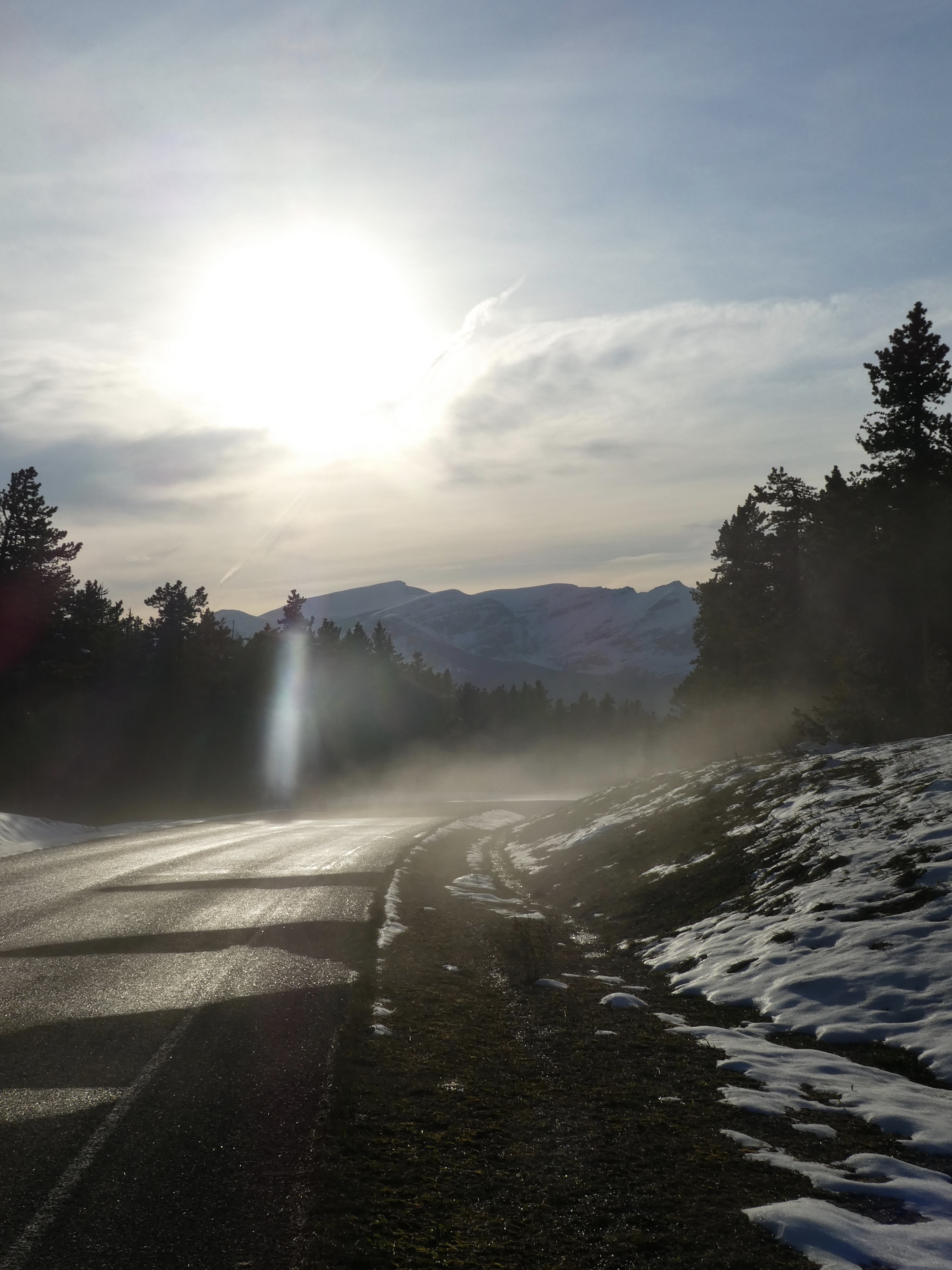
Driving along southern boundary of Glacier National Park in Montana

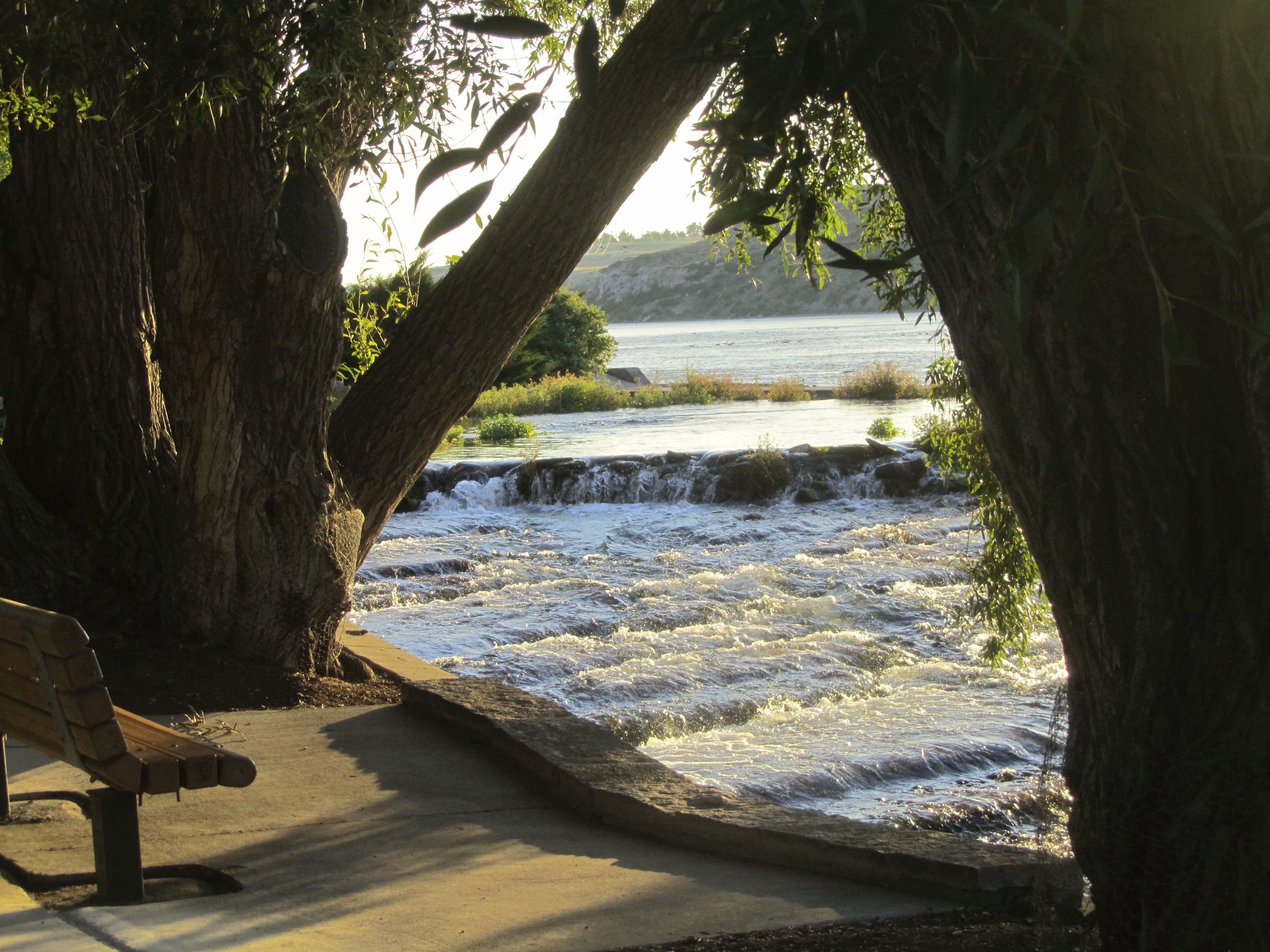
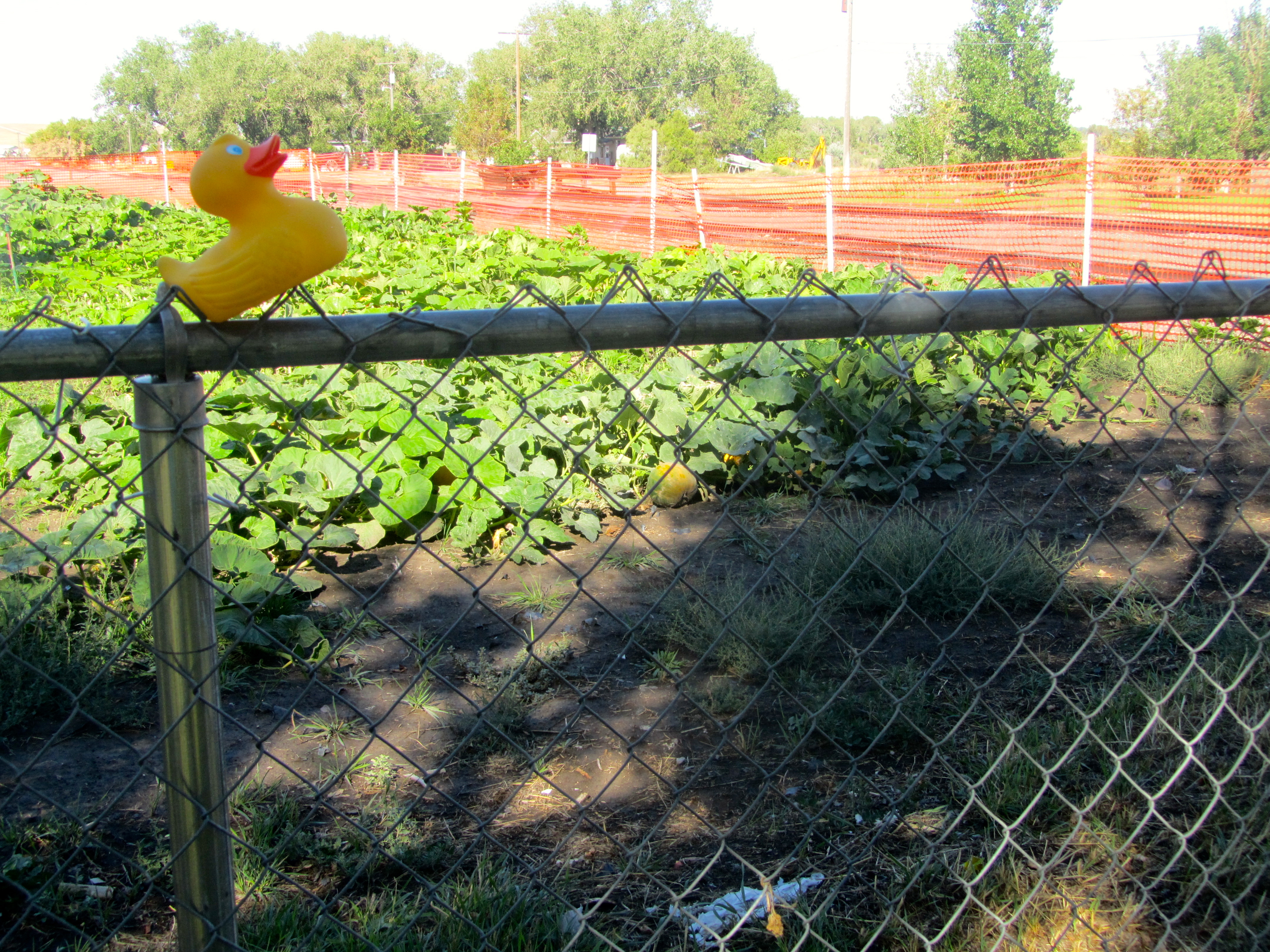
Now humans, ducks and Chloe, the Colorado Traveling Dog, can all enjoy walking by the river.   We saw the turn off for a boat ramp, and had to get to the river.

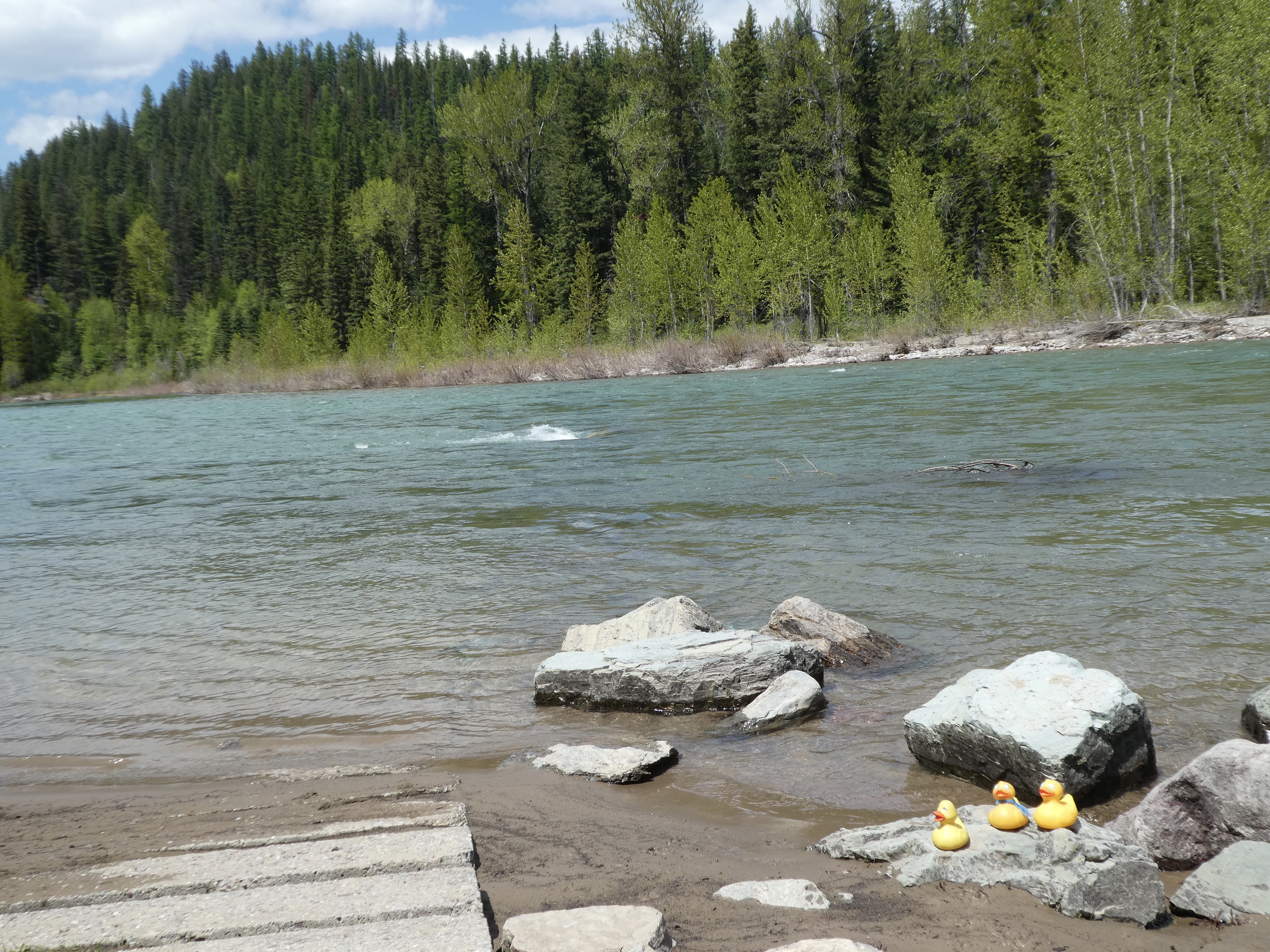
Boat ramp. Middle Fork of the Flathead River

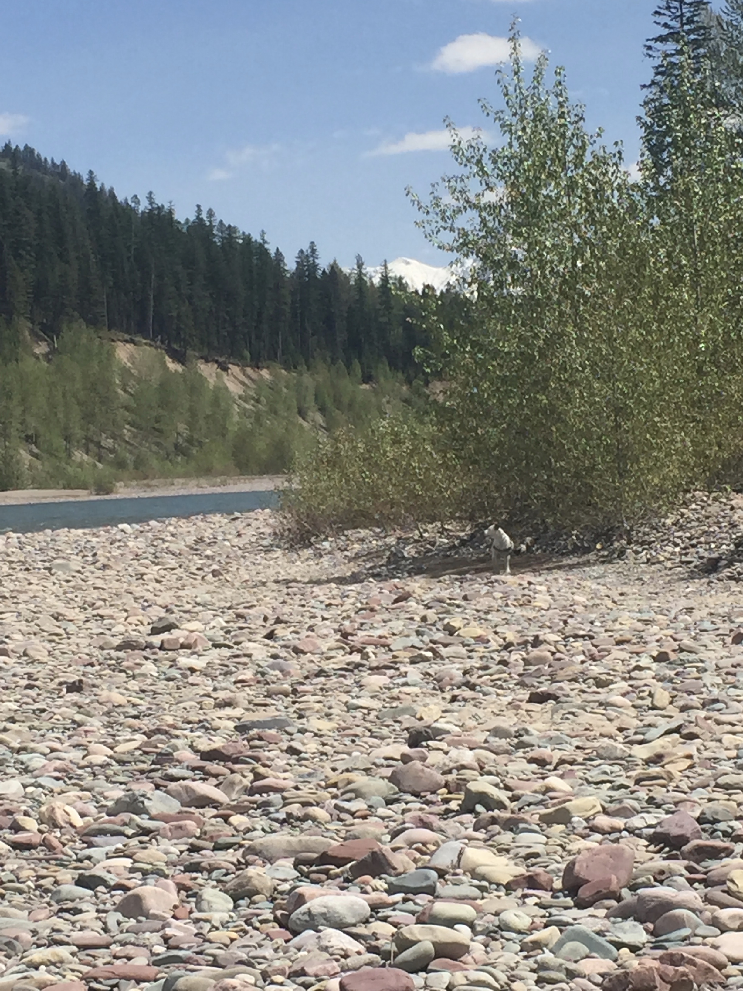
This is the Middle Fork of the Flathead River.   Back closer to the road we looked through the trees and wanted to get to this part of the river.

We want to walk on those rocks

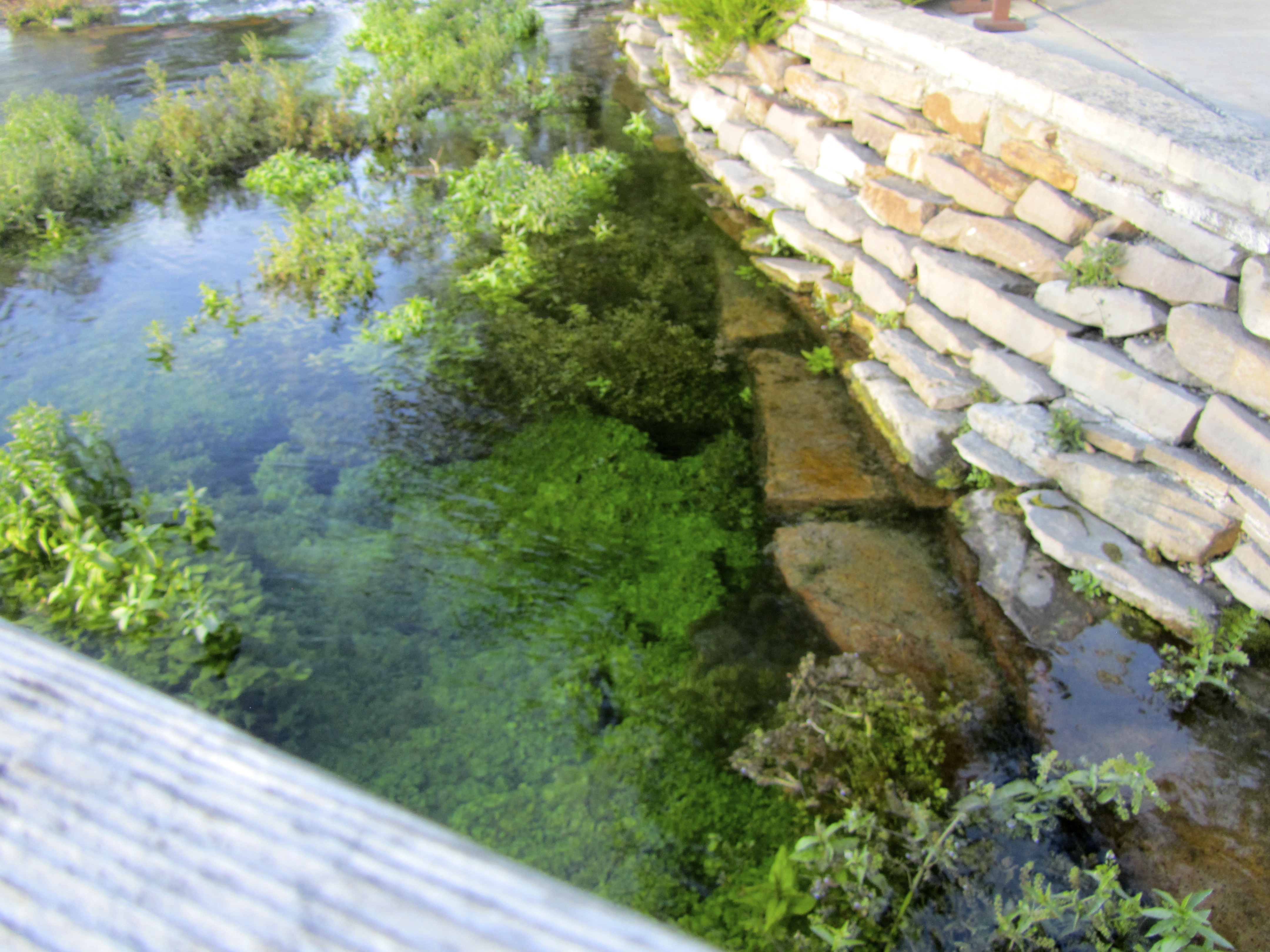
But the river bank was rather steep.   This thick vegetation was green and beautiful.
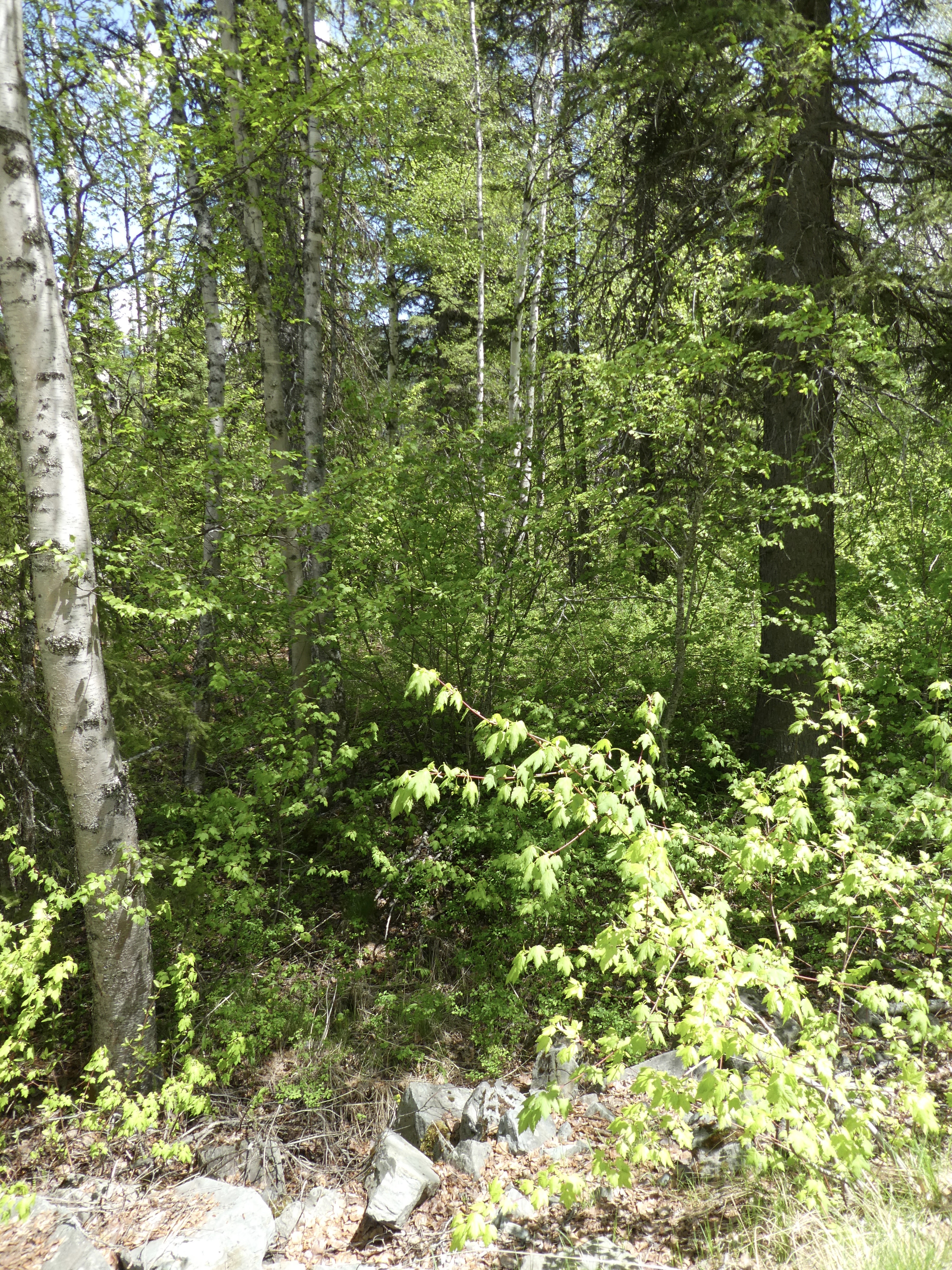
Dense forest

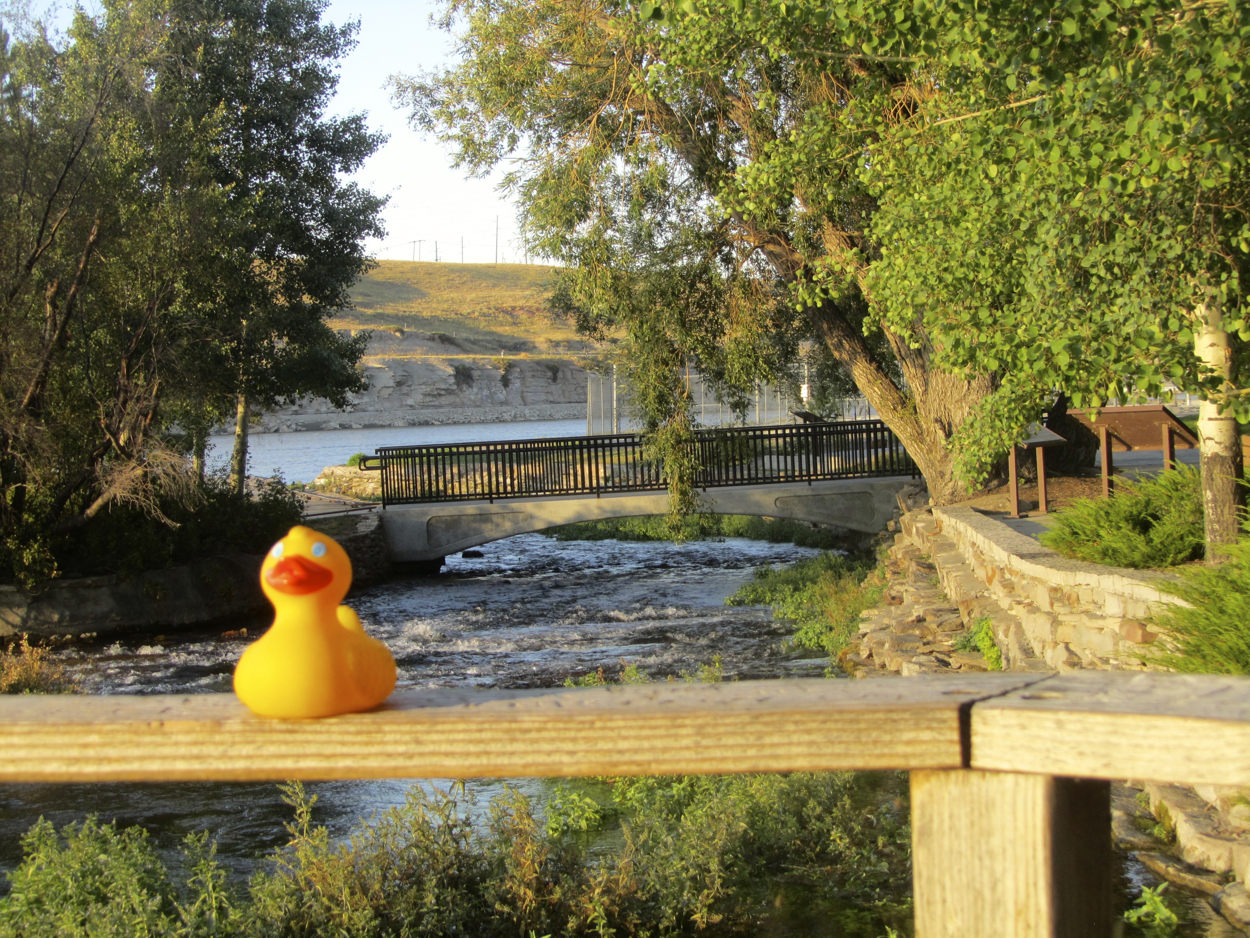
Not a group to give up, we did get down the embankment to the river.   Chloe followed the humans and now is frolicking and exploring.

Chloe by the river

Soapy’s mom walked along the river looking at the different types of rocks.

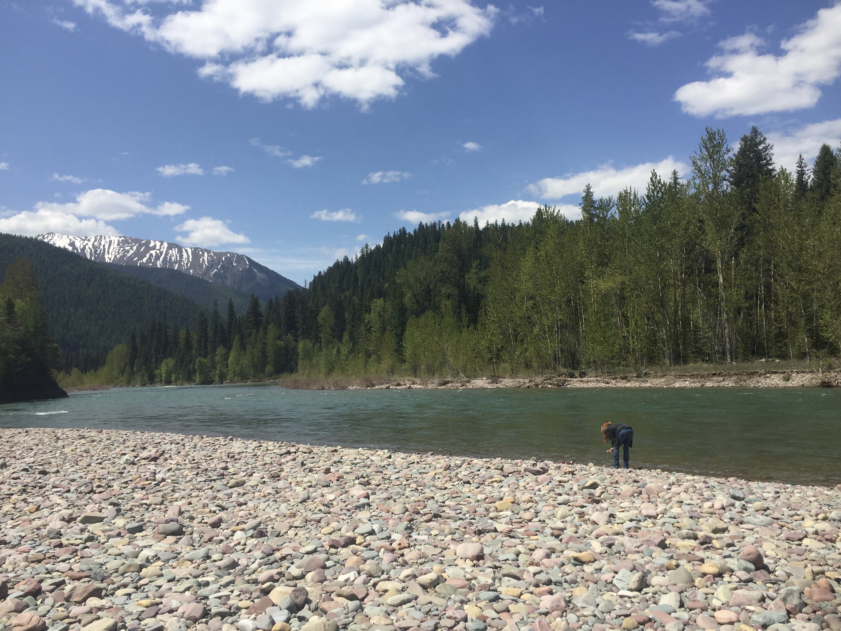
Soapy’s mom looking at rocks

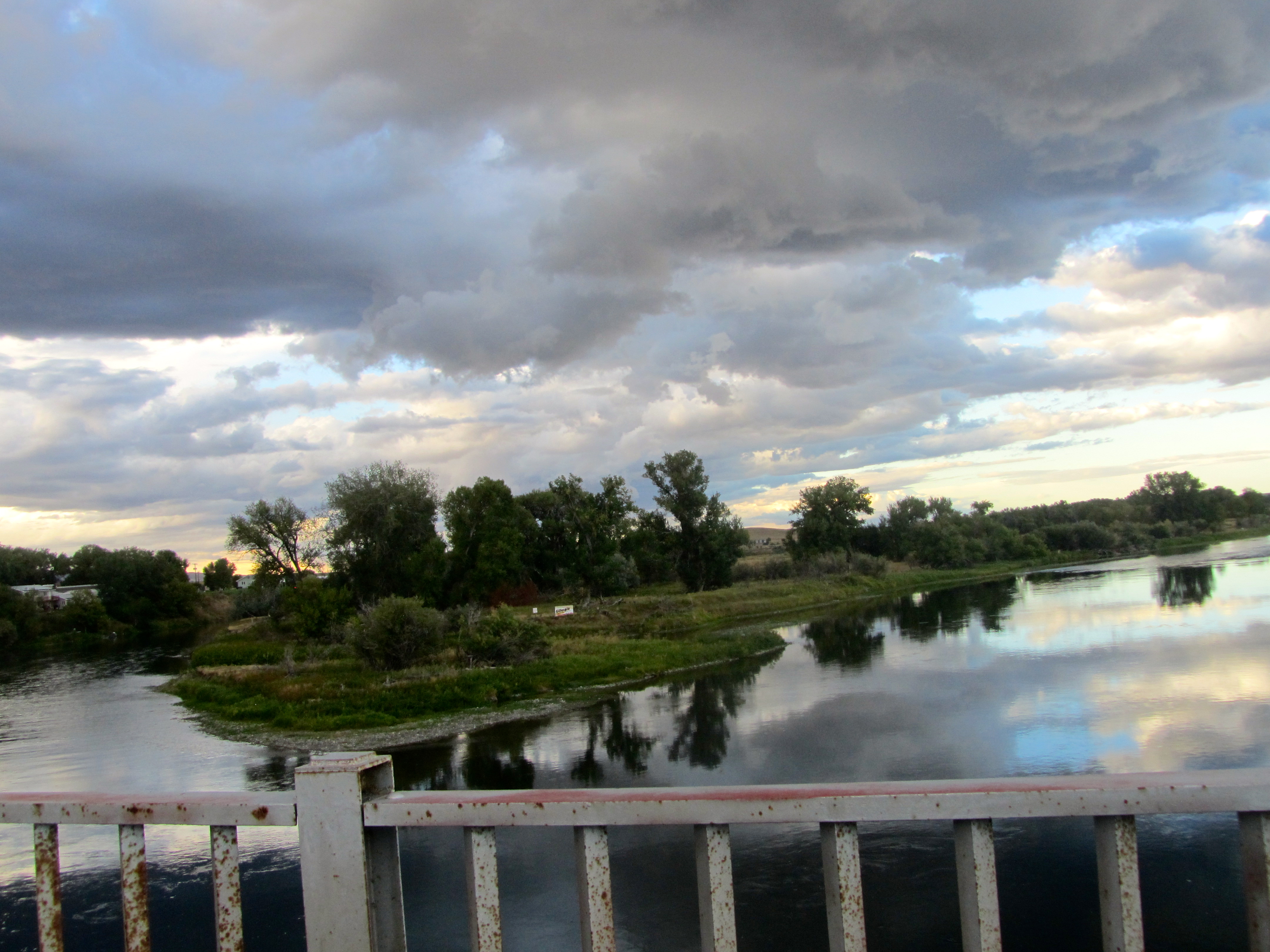
We spent most of the day wandering along rivers.   Another stop at Dairy Queen, then off to Bozeman, Montana for the night.   Our moms said we could drive from Bozeman to Denver the next day, but it would be a long drive.   Not much stopping.   When we left the motel in the morning, the weather had certainly changed.

Stormy sky leaving Bozeman, Montana

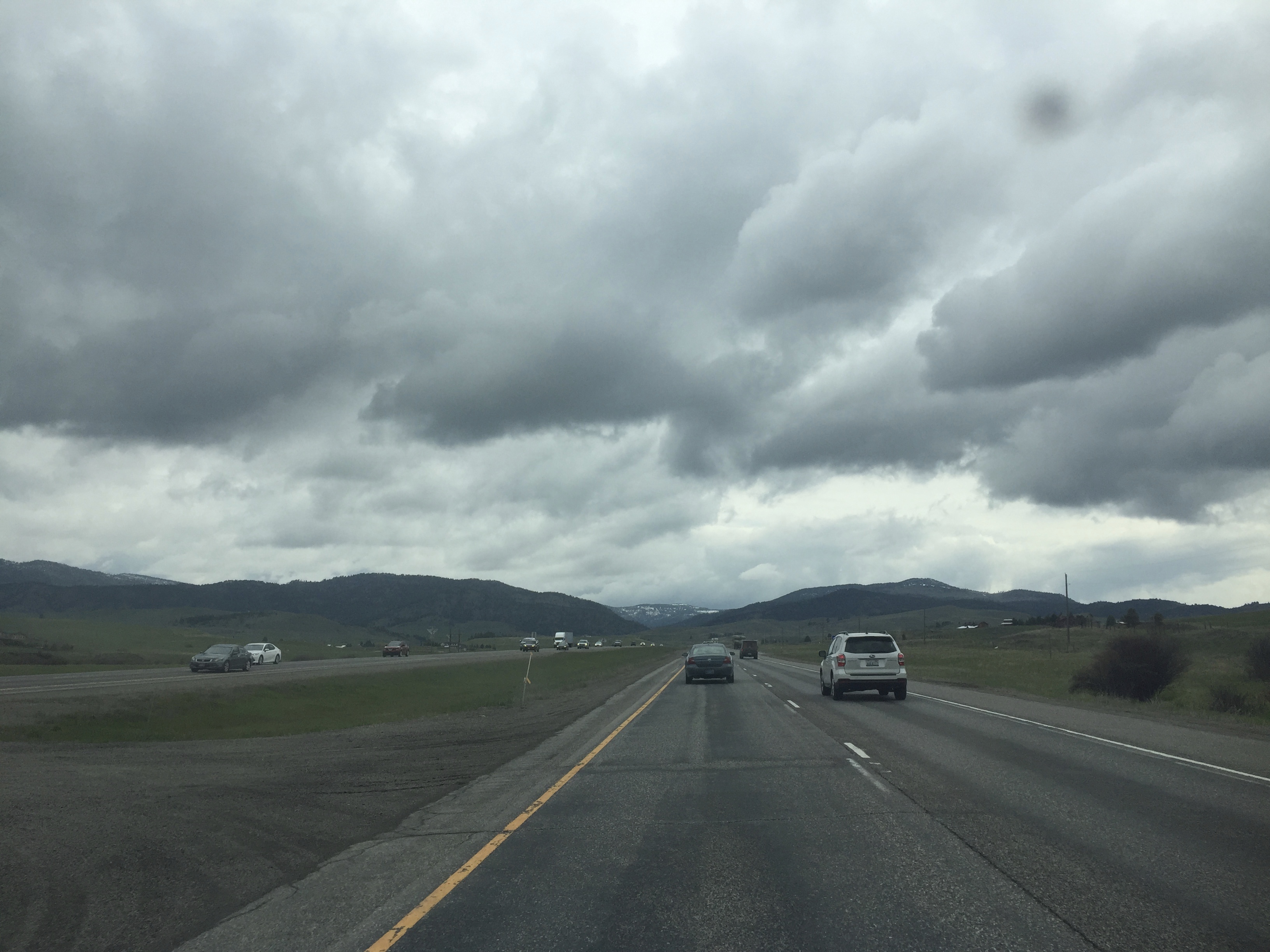
Leaving Bozeman, we really didn’t want to stop much and walk along trails.   Those storm clouds look serious.   From Montana, we drove into and through Wyoming.

Stormy through Montana and into Wyoming

The sky stills looks stormy.   We had some sun, some clouds, and of course, some rain.   So, humans….Why are we heading home today?    But it is OK.   The sun will shine soon in Denver and we are only an hour away from the Continental Divide and our 14,000 foot mountains.    We loved our trip, but we love Colorado also.

Hello Montana. Colorado Traveling Ducks Return to the United States

I, Zeb the Duck, and my fellow Colorado Traveling Ducks, Soapy Smith Duck, and Eider Duck, loved our road trip.   We loved visiting Alaska.  We appreciated the beauty and friendly people in Canada.   But it is always good to get back home.   While not near Colorado yet, we entered the United States and are now in the state of Montana.

Entering Montana, USA

Entering Montana just east of Glacier National Park, we are in the Blackfeet Nation.

Entering Blackfeet Nation

Such a beautiful area.   This was late May so the snow covered mountains greeted us.   We appreciated these metal sculptures.

Metal sculptures

This, Chief Mountain, is 9080 feet ( 2768 meters) above sea level.

Chief Mountain

While we were admiring Chief Mountain, a Montana State Patrol car pulled over to talk to us.   Yes, mom was a little nervous.  Why do humans get nervous when police cars stop to talk to them?   He was so nice.  He just wanted to tell us to take the first right turn ahead and we would see great scenery and better views of Chief Mountain.   We took the advice of the officer.   He was right.   This is Chief Mountain.

Chief Mountain

Continuing, we soon entered Glacier National Park.

Glacier National Park

Driving on the road, the mountains were beautiful with a sunbeam shining through the clouds and trees and steam from the road rising to meet us.

Beautiful

Isn’t the world a beautiful place?   Driving and admiring the mountains, we entered Waterton Glacier International Peace Park.   Glacier National Park is in the USA and Waterton National Park is in Canada.

Waterton-Glacier International Peace Park

Our countries have good relations so the two parks are the International Peace Park.   These snowy mountains fascinate us.

Snowy mountain

This is late May and the weather is getting warmer.   As the mountain snow melts, we begin to see small streams and small rapids.

Snow is melting

Now we have arrived at another customs station.

US Canada Customs station

We do not want to return to Canada tonight, so we turn around and admire more scenery.

Chief Mountain with lake

Chief Mountain is a great backdrop for this lake.   But we also encountered these horses grazing.

Horses

This gray horse is grazing close to the road.

Horse

He seems more interested in the grass than he is in us.   Hey humans, it is getting late and we have not seen any motels that are open.   Many will open this weekend.   Monday is Memorial Day, the official beginning of summer traveling season.   Driving further we can’t resist one more photo of the Rocky Mountains.

Evening mountain view

Ok, now to get serious and look for a motel.   We spend the night in Browning, Montana.   Next time we will show you more of Montana, during the day.

Little Bighorn Battlefield

Zeb was on a battlefield.  And I survived!  Mom and I stopped at Little Bighorn Battlefield in Garryowen, Montana.

Little Bighorn Battlefield

Little Bighorn Battlefield

The battlefield is just off I-90 in southern Montana.  This battlefield is on the Little Bighorn River and is a national monument.   Some describe this battle as a clash of cultures. General George A. Custer, 36 years old and a Civil War hero, led 263 soldiers in a battle to defeat the Indians.  The battle did not go well for General Custer.  He and his men were defeated and killed by over 3,000 Indian warriors.  Unfortunately for Custer, this defeat overshadowed his military career, and all many Americans remember about him was that he was defeated and killed here.  He initiated the battle against the Indians, even though he was greatly out numbered.  (I believe that is an understatement)  Many believe that his defeat was the result of his ego.

We first stopped at the Visitor’s Center

Wall of Visitor's Center

Wall of Visitor’s Center

and watched a movie about the battle.  Then we walked to Last Stand Hill.

Last Stand Hill with memorial

Last Stand Hill with memorial

Here is a small cemetery where General Custer, his brother Tom and 39 other soldiers have stone markers.  General Custer’s grave marker is the black one, left of me.

Markers on Last Stand Hill

Markers on Last Stand Hill

There is a memorial on this hill.  Some U.S. soldiers are buried under the memorial.

Base of memorial on Last Stand Hill

Base of memorial on Last Stand Hill

Their names are carved on the memorial. Near Last Stand Hill there is a marker for the horses that were killed here.  I love when humans give credit to the animals!

Tribute to lost horses

Tribute to lost horses

All around the battlefield I saw white stone markers.  The markers are where the bodies were found.  There are also red granite markers

Marker for Lakota warrior

Marker for Lakota warrior

showing where Cheyenne and Lakota warriors died.  There are many more white markers than red ones. Near Last Stand Hill an Indian memorial is being built.  It is not finished so we were not allowed inside the area.  However, the wire sculpture was partially visible.

Partial finishing memorial to Indians

Partial finishing memorial to Indians

The memorial will be very nice when completed.  I hope I can come back to see the finished project. A park volunteer told us that this was the last battle won by the Indians.  We walked along trails through the battlefield.

Path through battlefield

Path through battlefield

It was strange to see so many markers and know that soldiers and warriors died here.  This land has open fields, hills and valleys with many place to attack without being seen and areas of trees by the Little Bighorn River.   Lots of places where you cannot easily be seen. Next we drove along a 5-mile road.  This road took us to various sections where the battle raged.  We saw lots of grave markers.  We saw the river, the hills and valleys, the steep ravines and much more.  This land is important to all people.  Many remember the soldiers that died here in June 1876 and many remember the Indians that died here.  For many Indian tribes, this is sacred land.  This battlefield is located on the Crow Reservation.  Also located on the Little Bighorn Battlefield ground is a National Cemetery.

National cemetery at Little Bighorn Battlefield

National cemetery at Little Bighorn Battlefield

The rows of grave markers look just the cemetery in Arlington, Virginia.

Grave markers

Grave markers

The cemetery has veterans of American Indian wars, the Spanish American War, World Wars I and II and the Korean war.  This is a sacred place for many people. You will love visiting Little Bighorn Battlefield.  There is so much to see and learn. This is a spiritual place for many.  Relax and you will feel the power of this land.  While you are here, walk around the fields and really feel this place.  For more information visit http://www.nps.gov/libi

Giant Springs State Park, Great Falls, Montana

Lewis and Clark were the first explorers to mention Giant Springs.

Giant Springs

Giant Springs

Lewis and Clark followed the Missouri River through this part of Montana.  Clark first wrote of the springs on June 18, 1805.  He said this was the largest fountain or natural springs he ever saw and that the water was very clear.

very clear water

very clear water

Lewis described the springs as a “beautiful fountain”.

Giant Springs State Park has one of the world’s largest fresh water springs and according to Guinness, the world’s shortest river.  Water from the springs emerges at 54 degrees all year.  From the springs, the water passes through a pool, over rapids, under a bridge and into the Missouri River.

Roe River.  One of the world's shortest rivers

Roe River. One of the world’s shortest rivers

From the springs to the Missouri, this shortest river, the Roe River, is 201 feet long.

Lewis and Clark reported that beaver were plentiful and within years the area had many fur trappers and fur traders.  Because of the warm springs, this was also a popular campsite for American Indians.  The springs provide lots of warm water– over 150 million gallons of water every day, which flows into the Missouri River.   That’s a lot of water!  It does not freeze, but I have become accustomed to swimming in much warmer water.  However, there are several live versions of my kind swimming here.  All the ducks love this place.

Ducks at Giant Springs

Ducks at Giant Springs

The Missouri River cuts through rock as shown in this picture with me.

Bank of Missouri River

Bank of Missouri River

On a hill above the river is a monument to Lewis and Clark.

Monument to Lewis & Clark Giant Springs State Park, Montana

Monument to Lewis & Clark
Giant Springs State Park, Montana

From this monument, the view

Giant Springs and Missouri River, Montana

Giant Springs and Missouri River, Montana

of the springs and Missouri River are breathtaking.

The city of Great Falls gave this park to the state and in 1970 Giant Springs State Park was formed.

Roe River at Giant Springs State Park, Montana

Roe River at Giant Springs State Park, Montana

It is a beautiful place.  I recommend that you come here.  Come to look, come to relax, come to hike or bike or fish, come for a picnic, but do come here.  I know you will love it as much as I do.  For more information visit www.stateparks.mt.gov

First Peoples Buffalo Jump State Park Ulm, Montana

First Peoples Buffalo Jump State Park is Near Great Falls, Montana

I, Zeb the duck, saw the Cascade County Courthouse,

County Courthouse, Great Falls, MT

County Courthouse, Great Falls, MT

located in Great Falls, Montana.  It is big and the grassy lawn even has cannons.  A sign on a cannon says it was donated, by Congress, to the Soldiers Memorial Committee.

This cannon is big

This cannon is big

I got to sit on the cannon.   Again I feel so little.

From Great Falls, we drove about 10 miles southwest on I-15 to Ulm, Montana.  First Peoples Buffalo Jump State Park is located here.

Ulm, MT

Ulm, MT

I had no idea what a buffalo jump was.  Now I know and you will too, in a minute. This buffalo jump is one of the most significant in the world.  WOW!  The American Indian did not have horses for many years, so hunting buffalo was difficult.  The buffalo jump was used by American Indians to kill buffalo, necessary for the survival of the American Indian tribes.

Meriwether (his real first name) Lewis of the Lewis and Clark Expedition, wrote about this buffalo jump in his journal on Wednesday, May 29, 1805.  “  one of the most active and fleet young men is selected and disguised in a robe of buffalo skin … he places himself at a distance between a herd of buffalo and a precipice proper for the purpose; the other Indians now surround the herd on the back and flanks and at a signal agreed on all show themselves at the same time moving forward towards the buffalo; the disguised Indian or decoy has taken care to place himself sufficiently near the buffalo to be noticed by them when they take to flight and running before them they follow him in full speed to the precipice; the Indian (decoy) in the mean time has taken care to secure himself in some cranny in the cliff…the part of the decoy I am informed is extremely dangerous.”

The buffalo are stampeded off the cliff to their death.  Other Indians waited with spears to kill those that did not die from the fall.  The entire camp worked on the buffalo to preserve meat, prepare hides, and use bone and horns.

Tipi at buffalo jump

Tipi at buffalo jump

The Indian used all parts of the buffalo.  History tells us that at least 14 tribes used this site to kill buffalo.  This hill is about 1 mile wide and 2 miles long.  One side is sloped so buffalo can be herded up the hill.  The stampeding buffalo jumped 40-60 feet to their death.  Below the cliffs that stretch more than a mile, the soil reveals compacted bison bones nearly 13 feet deep.

The visitor’s center has a museum and several displays on the walls showing how tribes camped here during the times of the buffalo stampede so they could prepare the buffalo for their use.  There are also stuffed buffalo on display.

I am on buffalo.  It is tall

I am on buffalo. It is tall

This is a very interesting place

Buffalo appear to be looking down on the scene

Buffalo appear to be looking down on the scene

and the staff was very helpful.  I am just happy that I was not a buffalo at that time. For more information visit www.stateparks.mt/gov  or www.lewisandclarktrail.com  Also, Wikipedia has information and facts on this site, formerly known as Ulm Pishkun Buffalo Jump State Park.

Next time I will tell you about my visit to another Montana State Park.  One with lots of water.

Zeb goes to Montana

Visiting Judith Gap and Cascade Montana

Early this morning we were on the road again.  From Spearfish, SD we drive north to Belle Fourche, then cut across a corner of Wyoming and then into Montana.  The sky is already bigger than any I have ever seen.

Entering Big Sky Country   Montana

Entering Big Sky Country
Montana

I am going to like Big Sky Country.  We enter at Alzada, MT.

We drive through Billings, head north on Hwy 3 and before Lewiston, MT we enter Judith Gap.  This town has a wind farm.

My first Montana wind farm in Judith Gap

My first Montana wind farm in Judith Gap

The wind turbines are on each side of the road, so we can see them clearly. The turbines begin spinning at 6 mph and shut off at 56 mph.  There are 90 wind turbines in this wind energy center.  Each turbine produces enough energy to power 350-400 homes.  In town, there is a park with one arm of a wind turbine on the ground.

The arms are thick

The arms are thick

It is big.  Each blade is 126 feet long and made of fiberglass and epoxy resin.

I am on the turbine arm

I am on the turbine arm

I feel tiny.  When the turbines are assembled, the top blade reaches about 400 feet in the air.  This blade on the ground incurred internal damage during construction and Invenergy donated it to the town of Judith Gap for this display.

Zeb and the humans stayed in Great Falls, MT a couple days.  Much of our time was spent on business in Cascade.  Cascade is about 20 minutes west of Great Falls.  I-15 from Great Falls to Cascade passes Square Butte.

Square Butte with me

Square Butte with me

This isolated butte was included in several paintings by cowboy artist Charles M. Russell, and it is now a famous Montana landmark.  And I saw it several times!  While mom’s friend was busy, we walked around town.  This is Sportsman’s Bar & Café where we had lunch. IMG_3942 Hamburgers and Reuben sandwiches.  Very good.  Makes me hungry remembering.   Cascade is rural Montana and people reuse buildings, they don’t tear them down to build another.

Service station building has new tenant

Service station building has new tenant

This former service station is now a beauty shop.

Cascade has a nice park with picnic tables, playground equipment

I was on this play equipment

I was on this play equipment

(I played there for awhile) and a large grassy area.  Looked perfect for family picnics and games.  On the edge of the park we saw a pumpkin patch.

Pumpkin patch

Pumpkin patch

Those pumpkin plants wander all over the area.  They will be bright orange for Halloween. Some may be pies and some carved for jack-o-lanterns.

Pumpkins do wander

Pumpkins do wander

This will be my first Halloween.  I will give you the duck perspective later.

The Missouri River flows through Cascade.  This is the river followed by Lewis and Clark, the explorers in the early 1800s.  The river is very peaceful in good weather.

Missouri River in Cascade

Missouri River in Cascade

This view from a bridge also shows a small island in the river.  Cascade was great town with friendly people.  I like Cascade, Montana.