Whitehorse, YT south to Watson Lake, YT with the Colorado Traveling Ducks

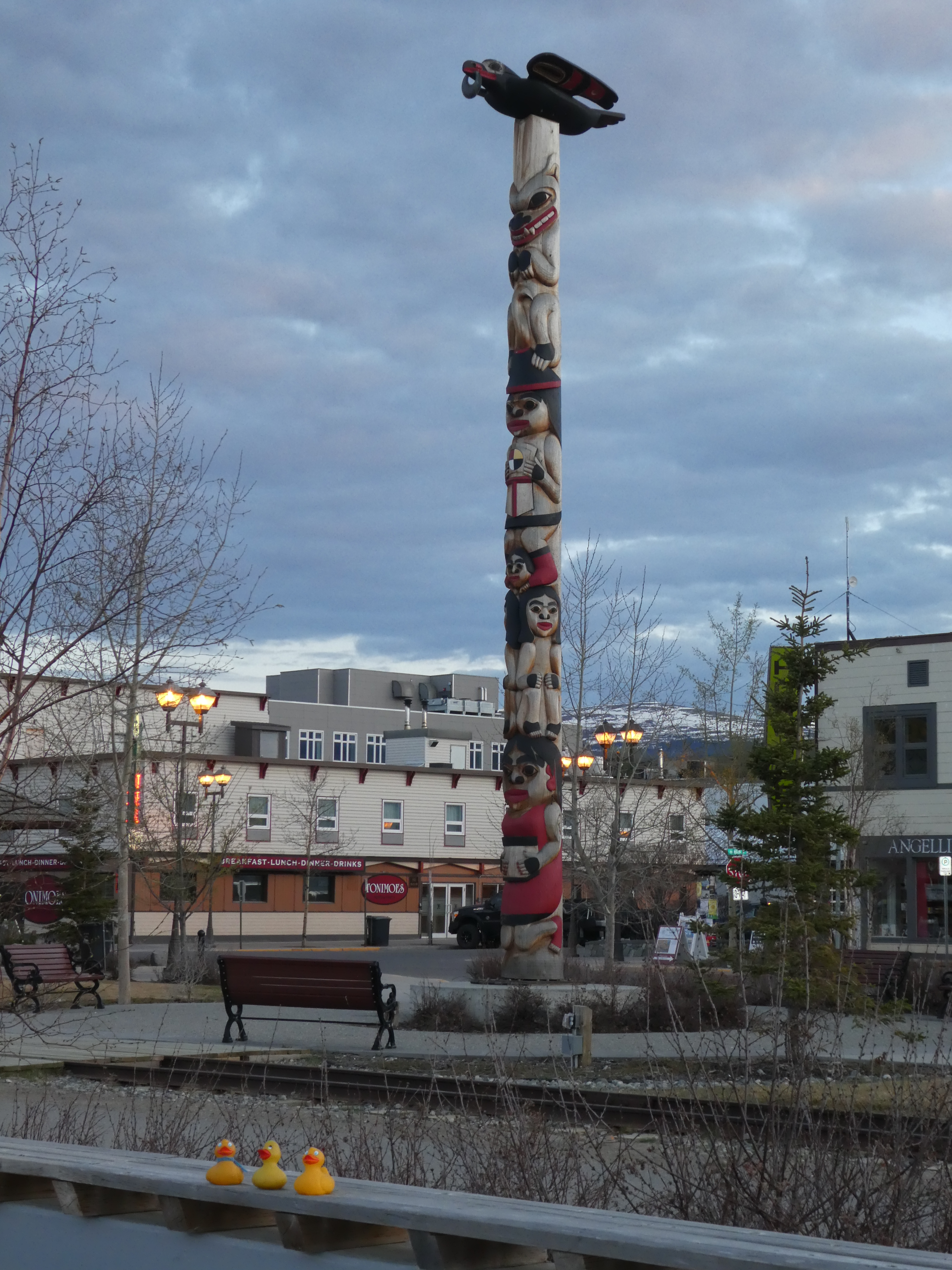
Arriving late in Whitehorse, I insisted on returning to my benches on the Yukon River.

Sun setting on the Yukon River

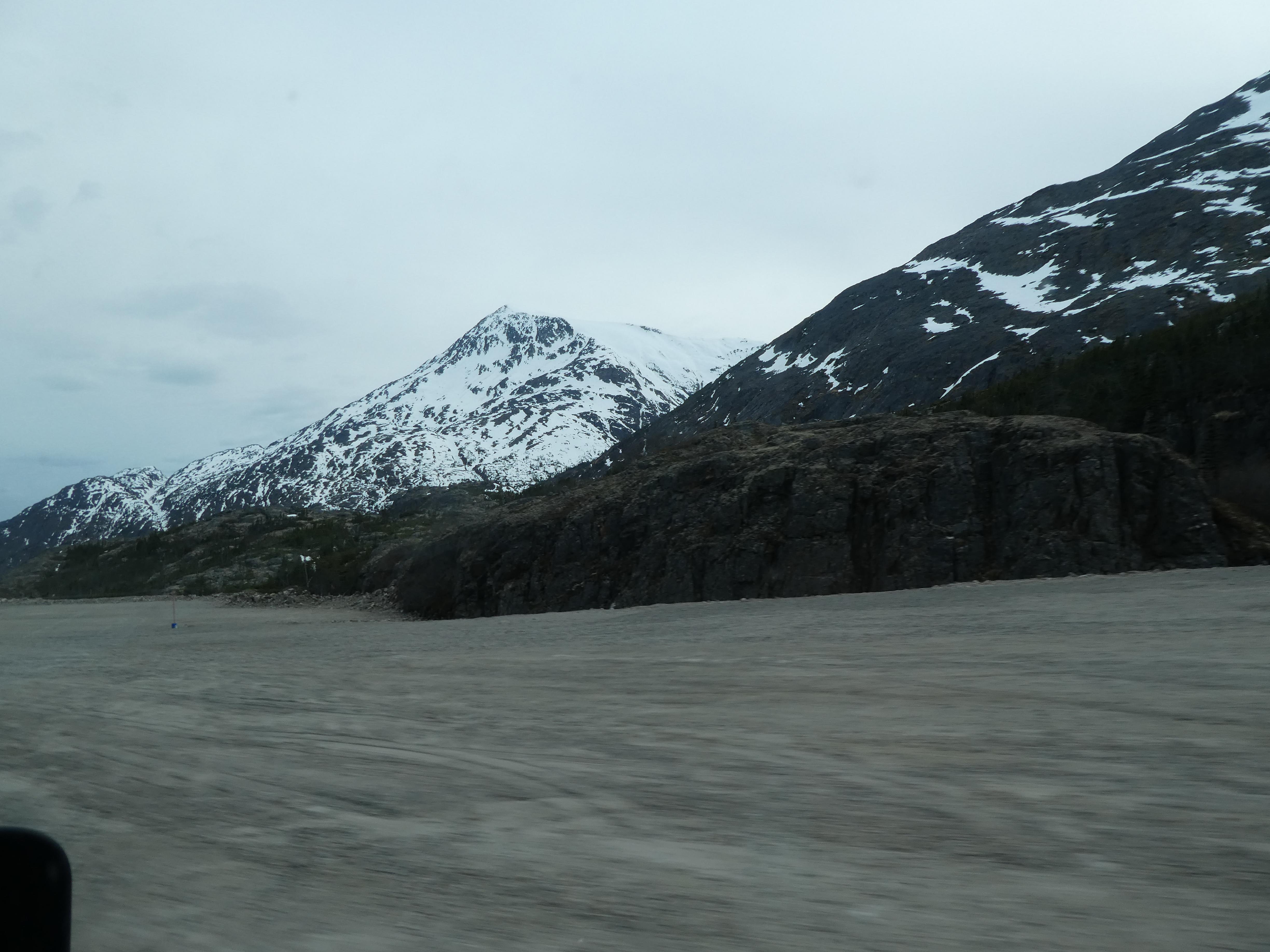
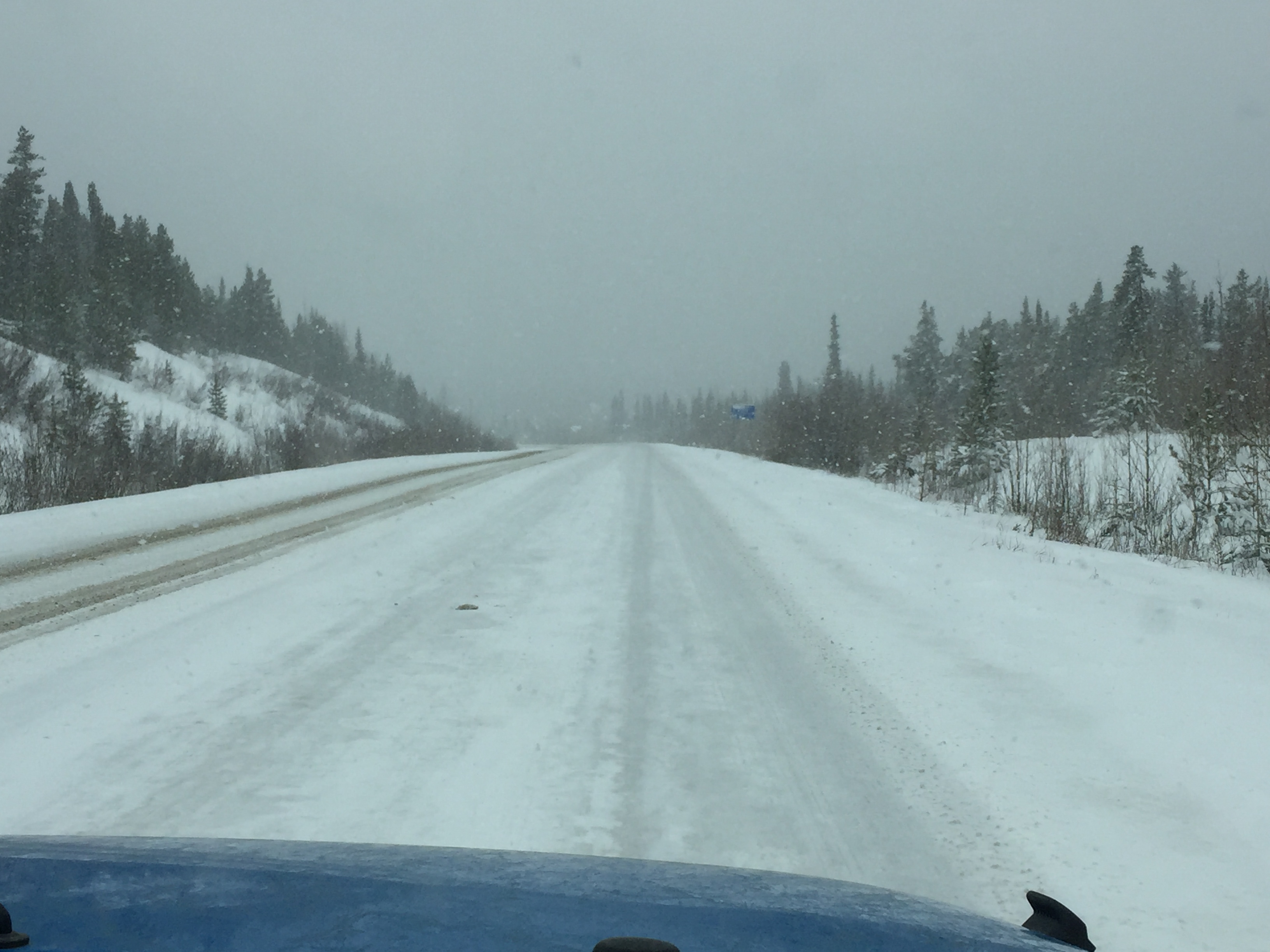
This is my favorite evening place in Whitehorse.   And it is after 10:00 p.m.   This is beautiful.   In the morning we drive south, time to return to Colorado.   This is a rest area we visited on the trip north.
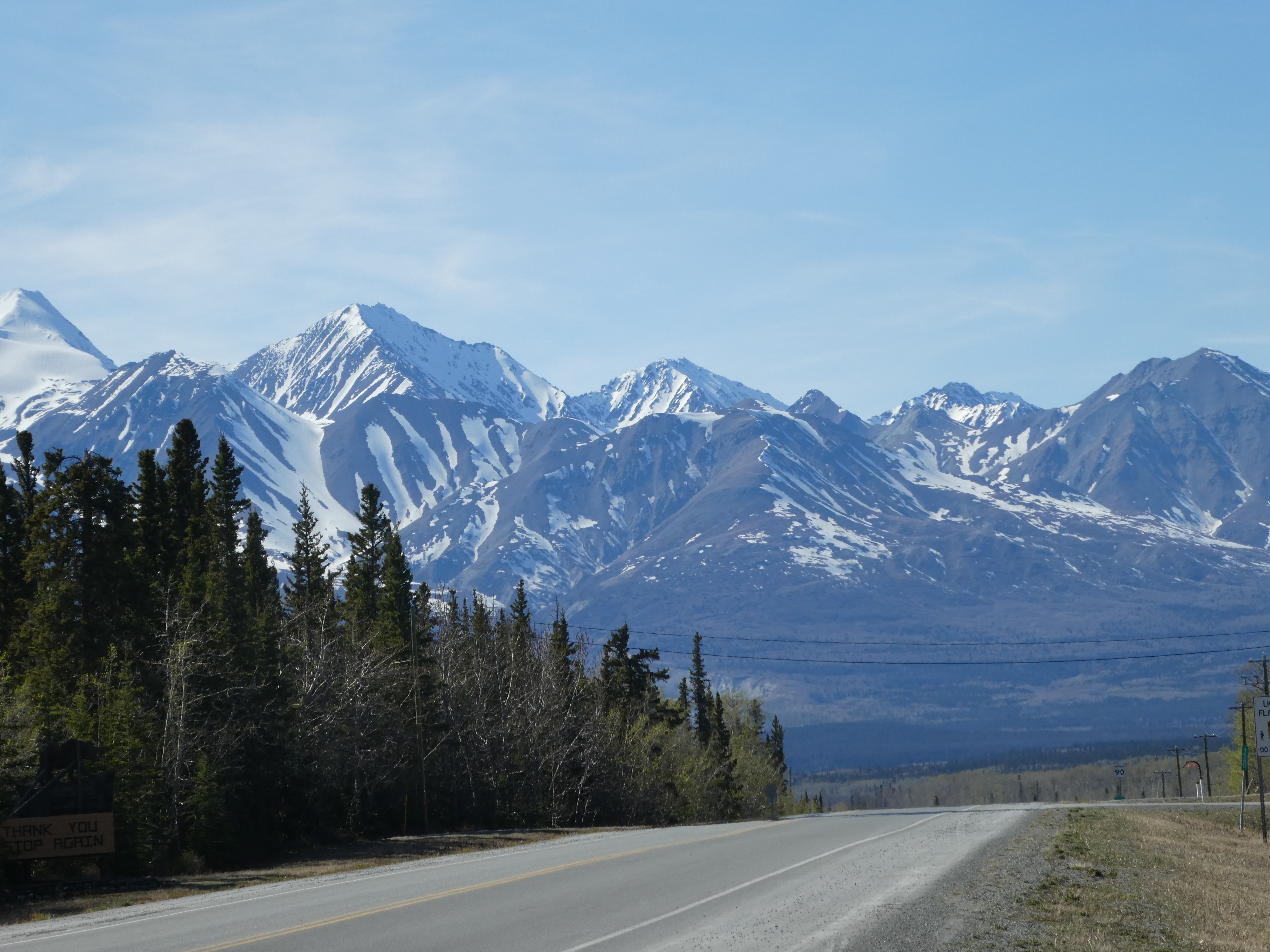
Rest area

There was a snow storm then.   Nicer with some sun today.   Continuing south we cross a Yukon River Bridge.
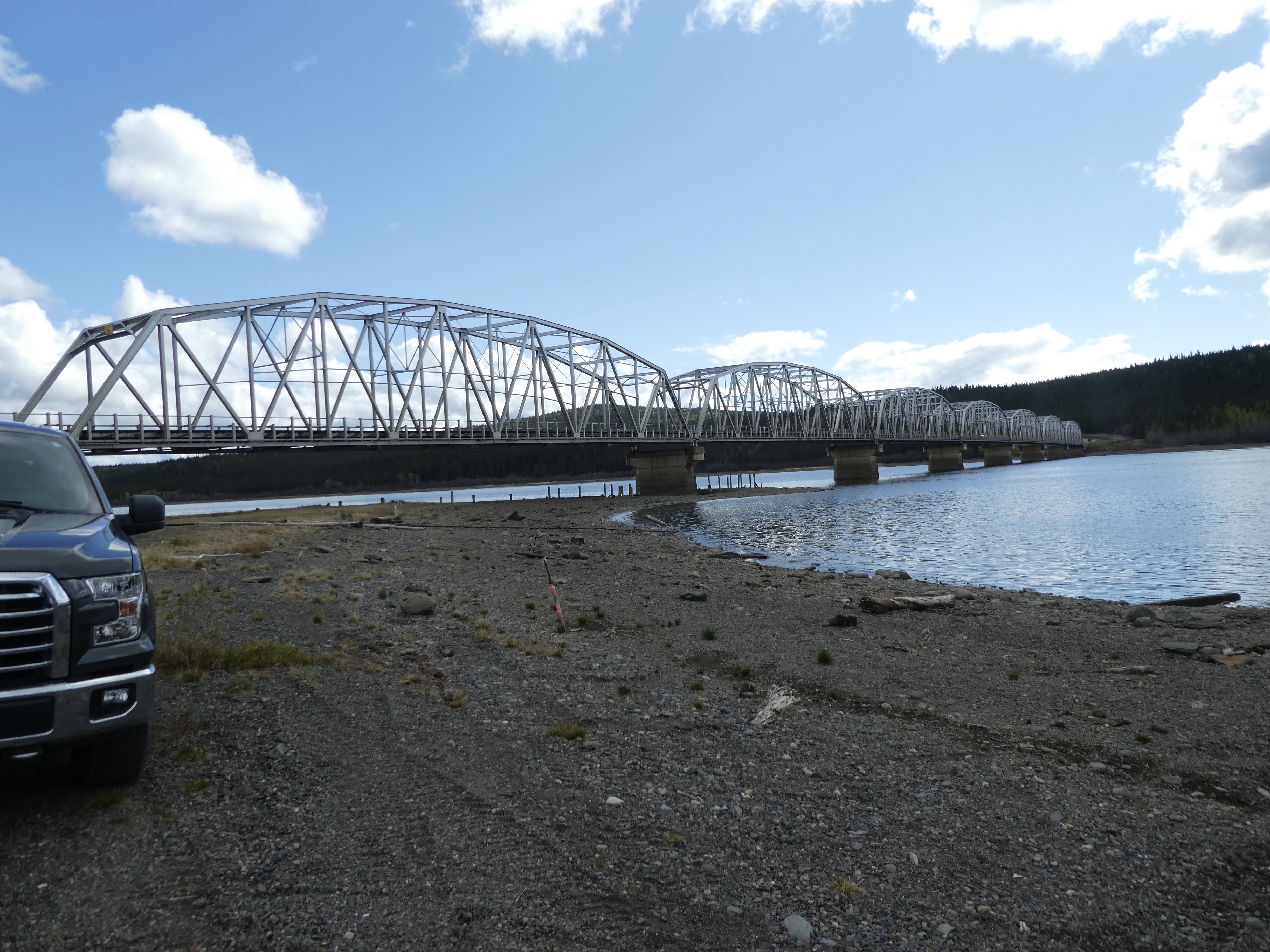
Yukon River Bridge

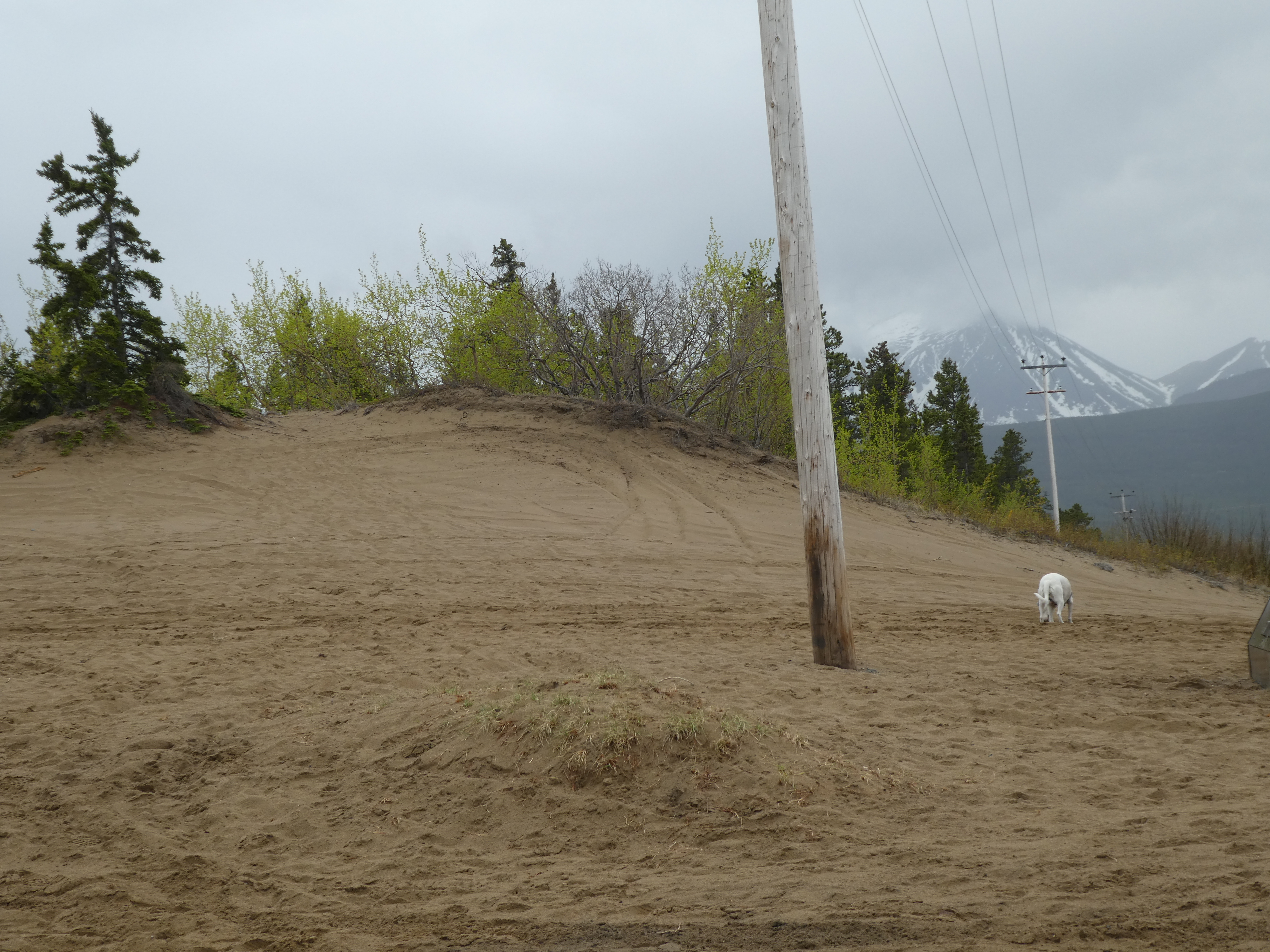
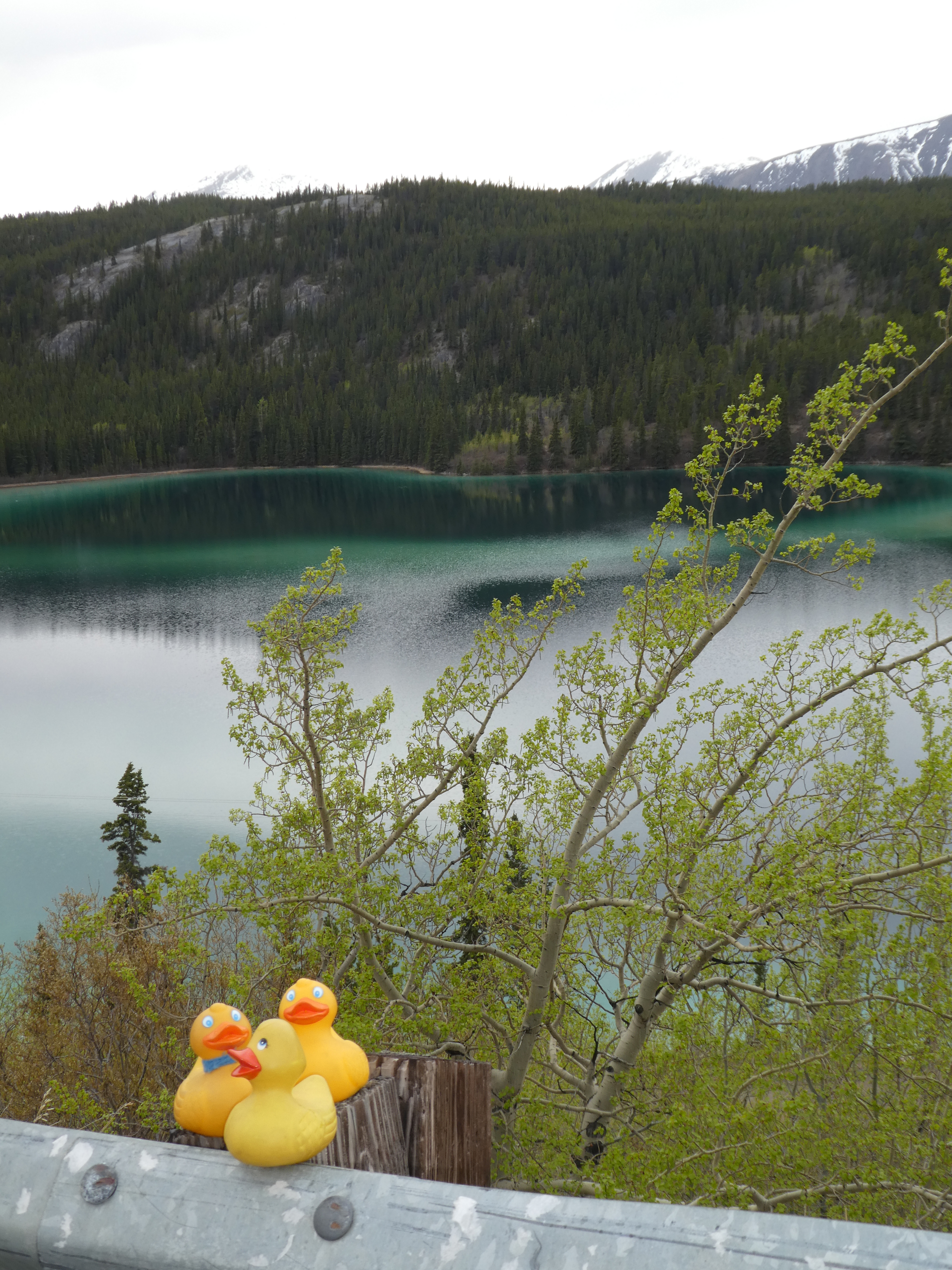
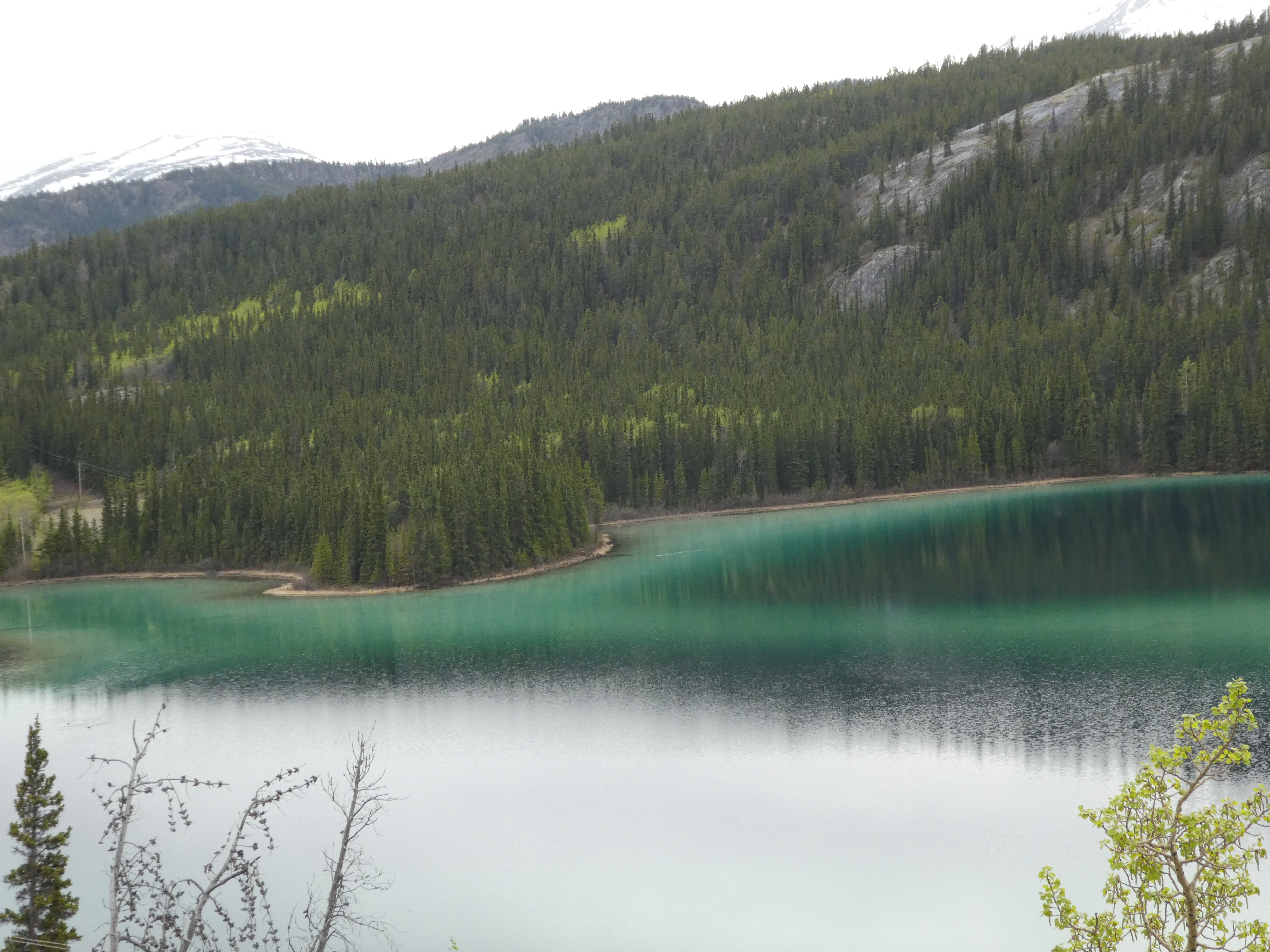
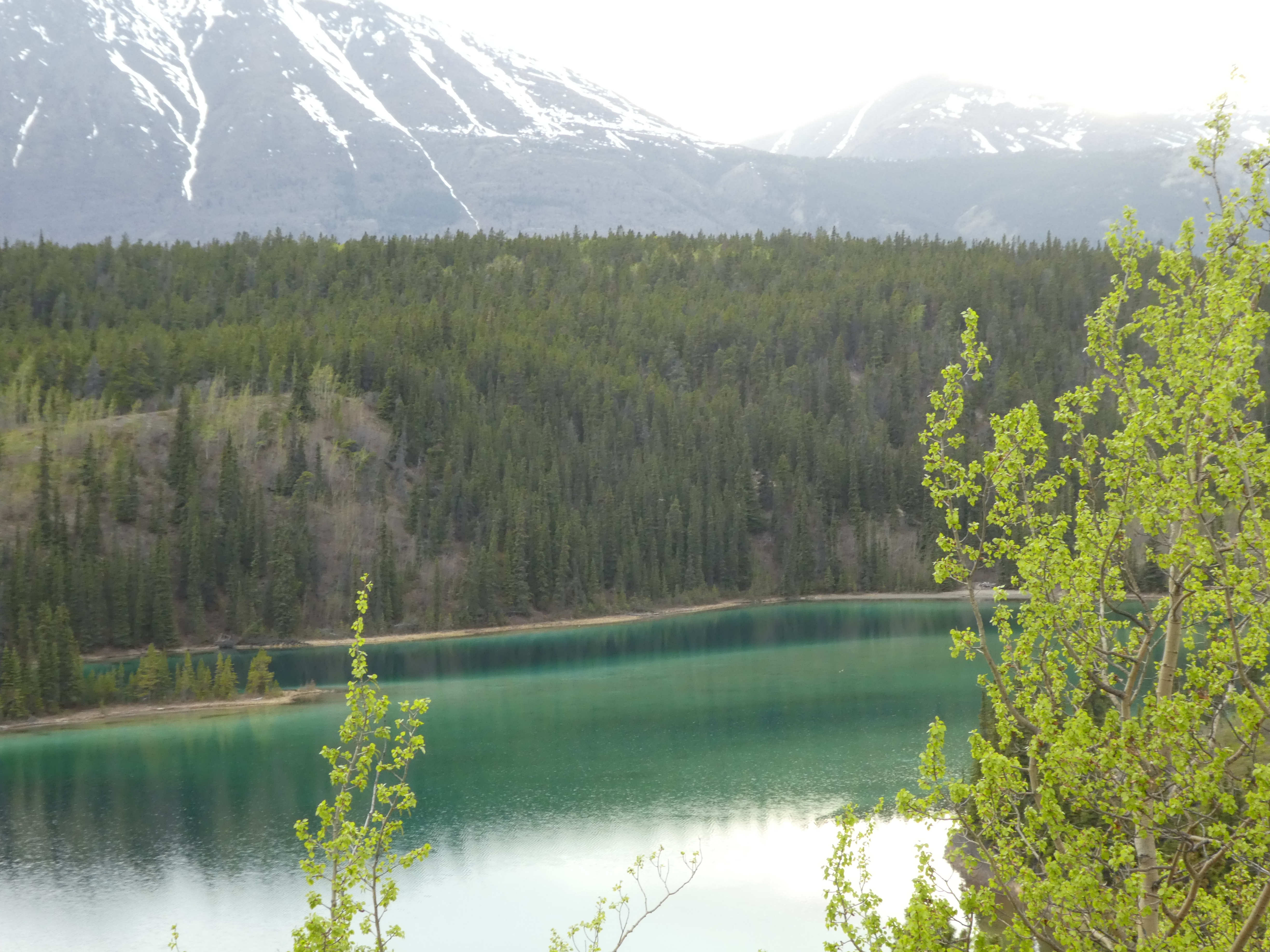
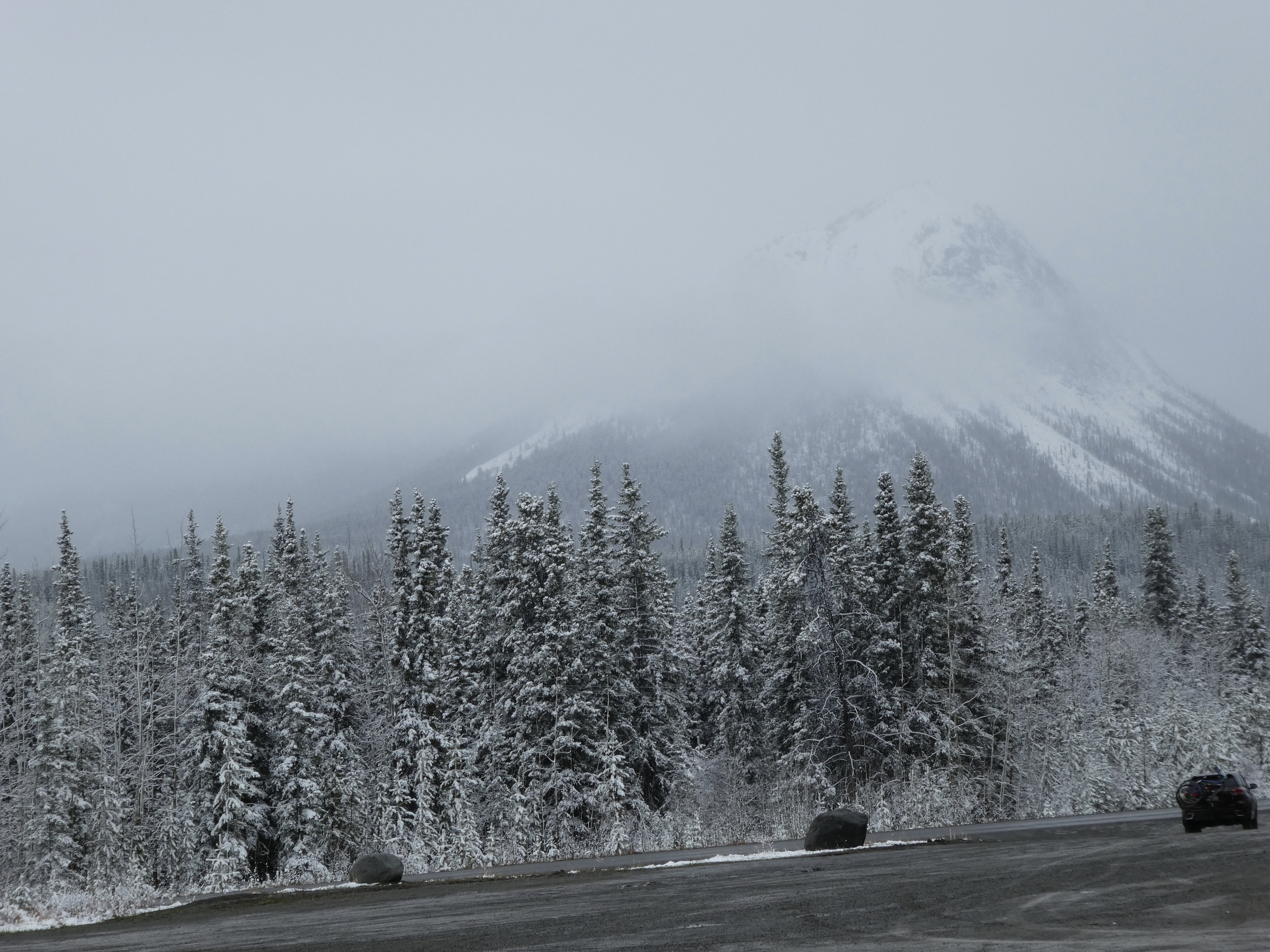
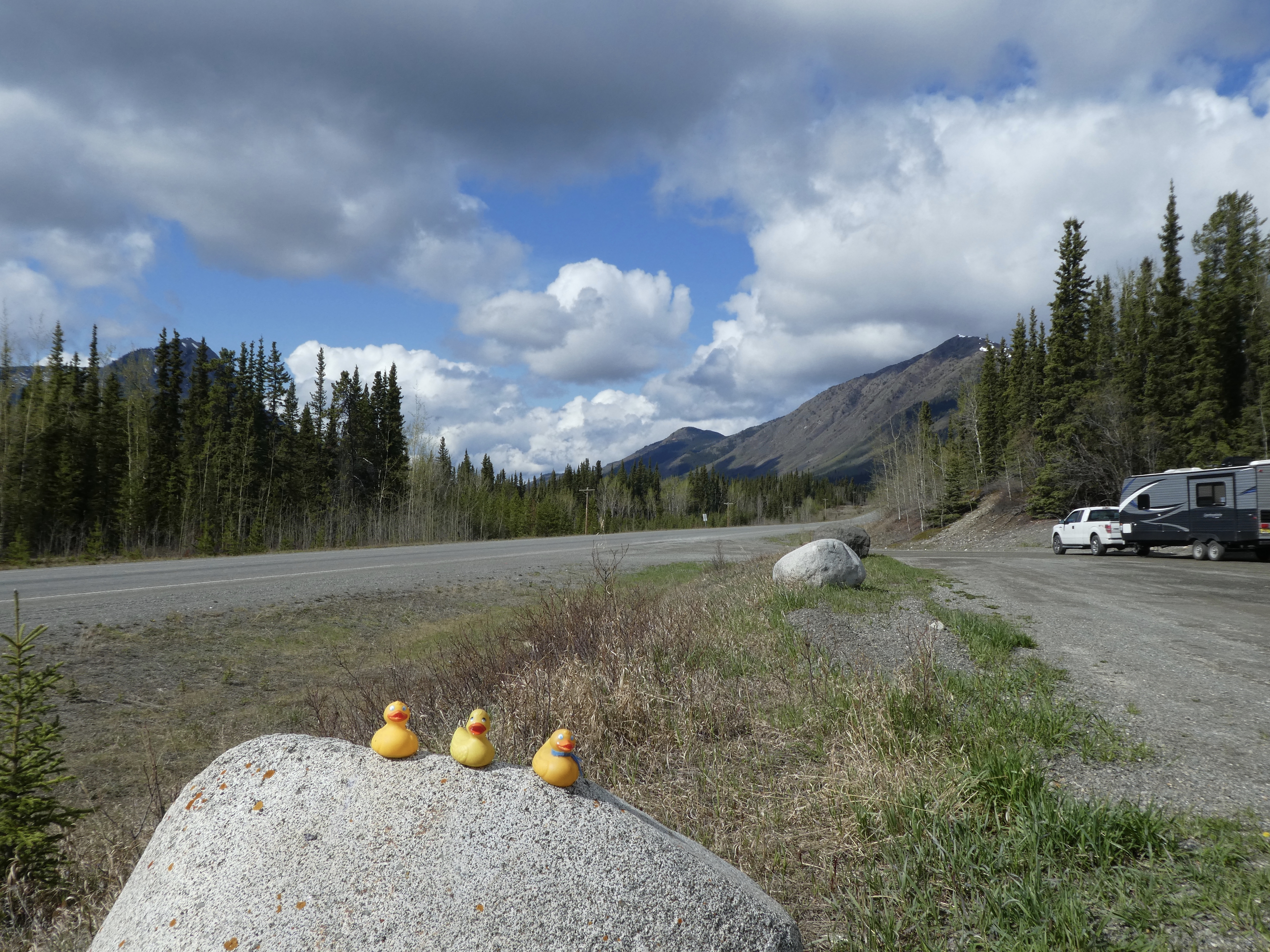
This is a really long bridge.   One of the longest we have seen on the Alaska Highway.   Another rest area appealed to us and to Chloe, our Colorado Traveling Dog.

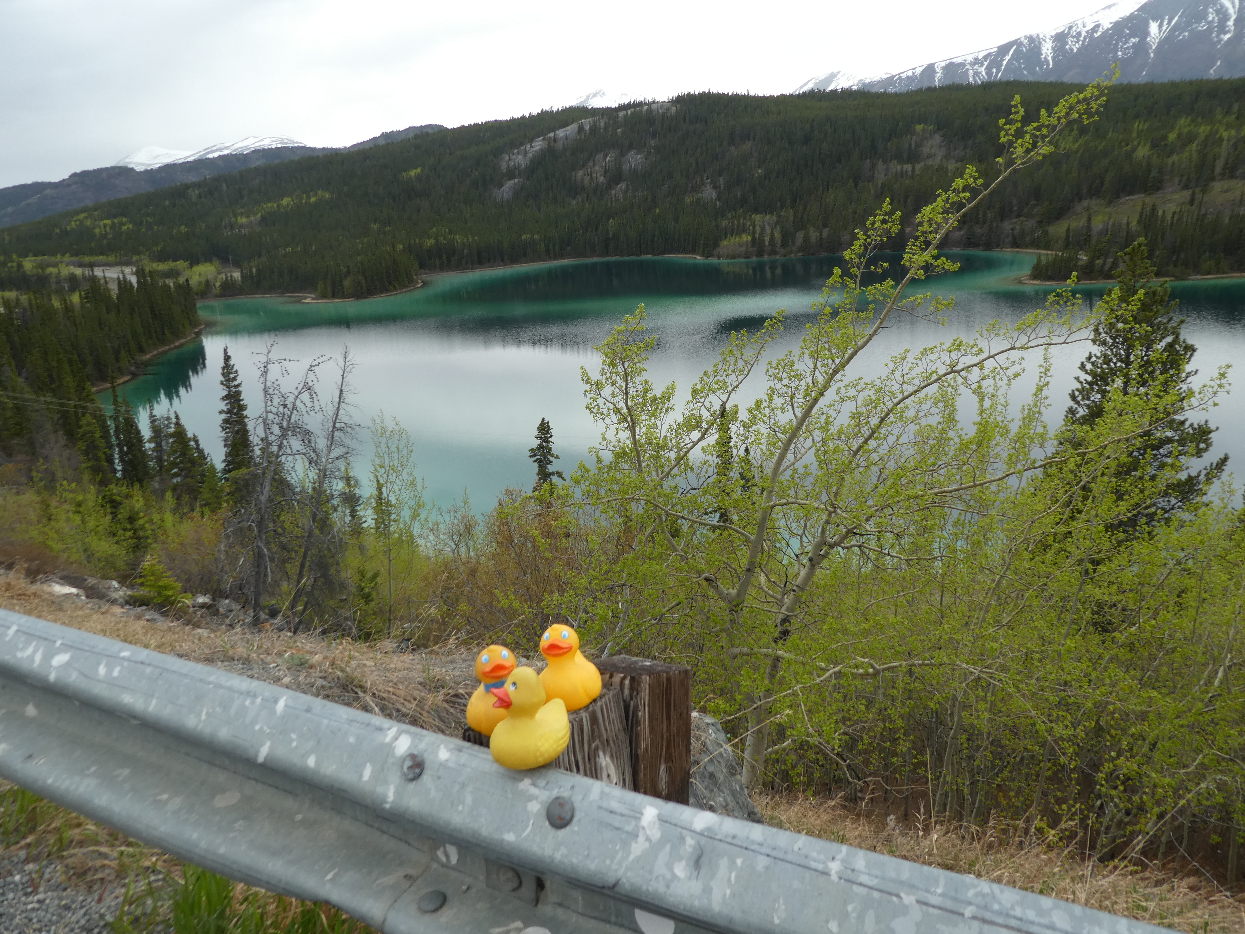
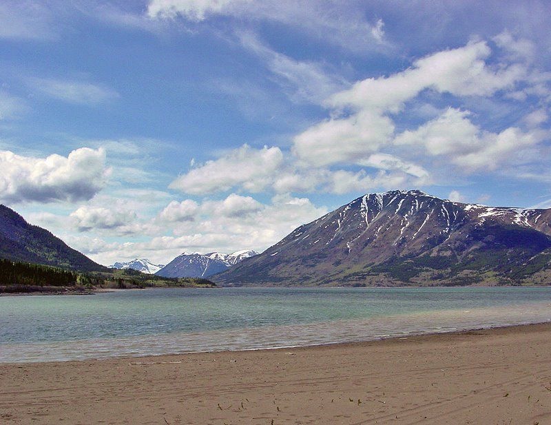
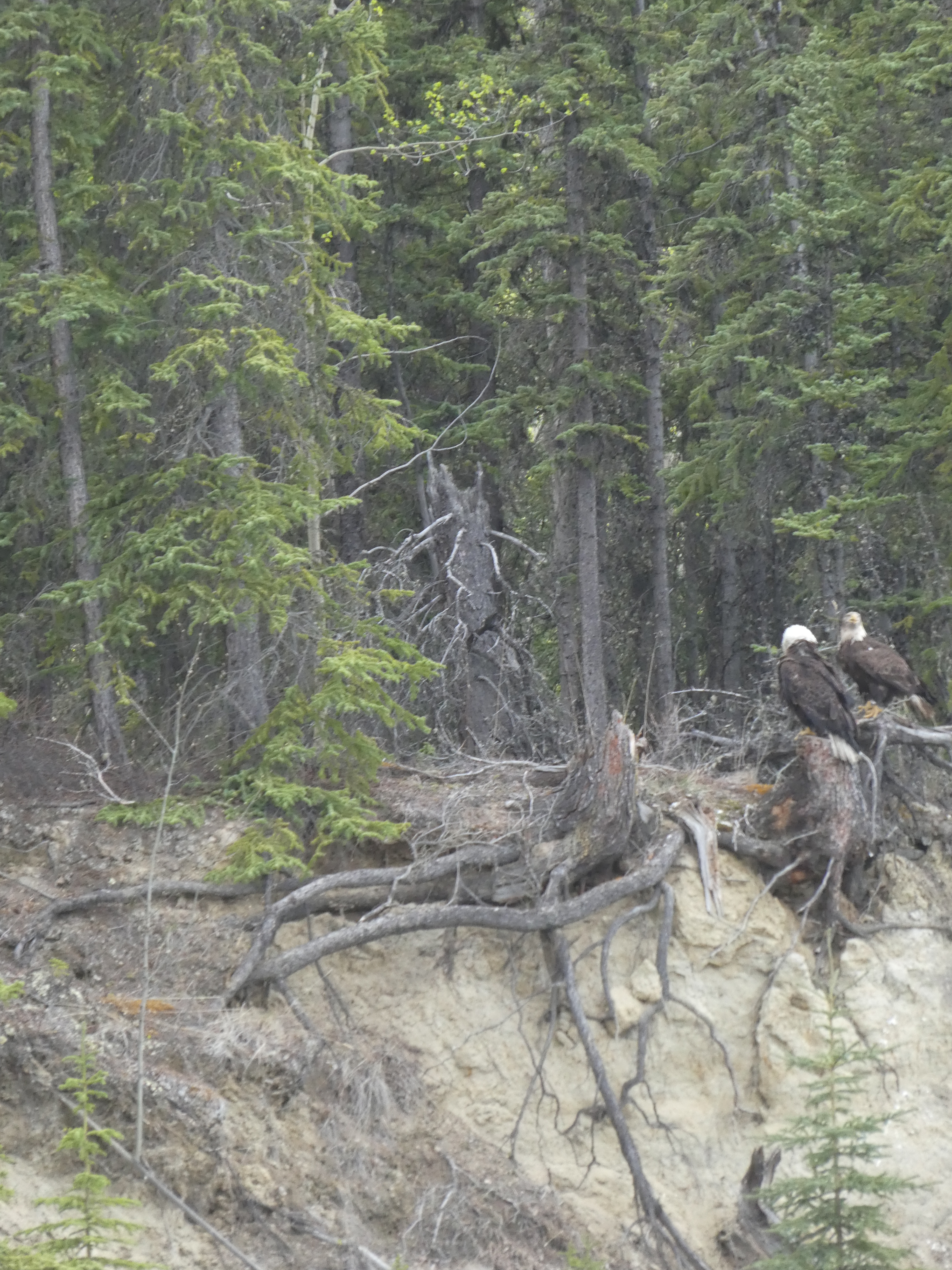
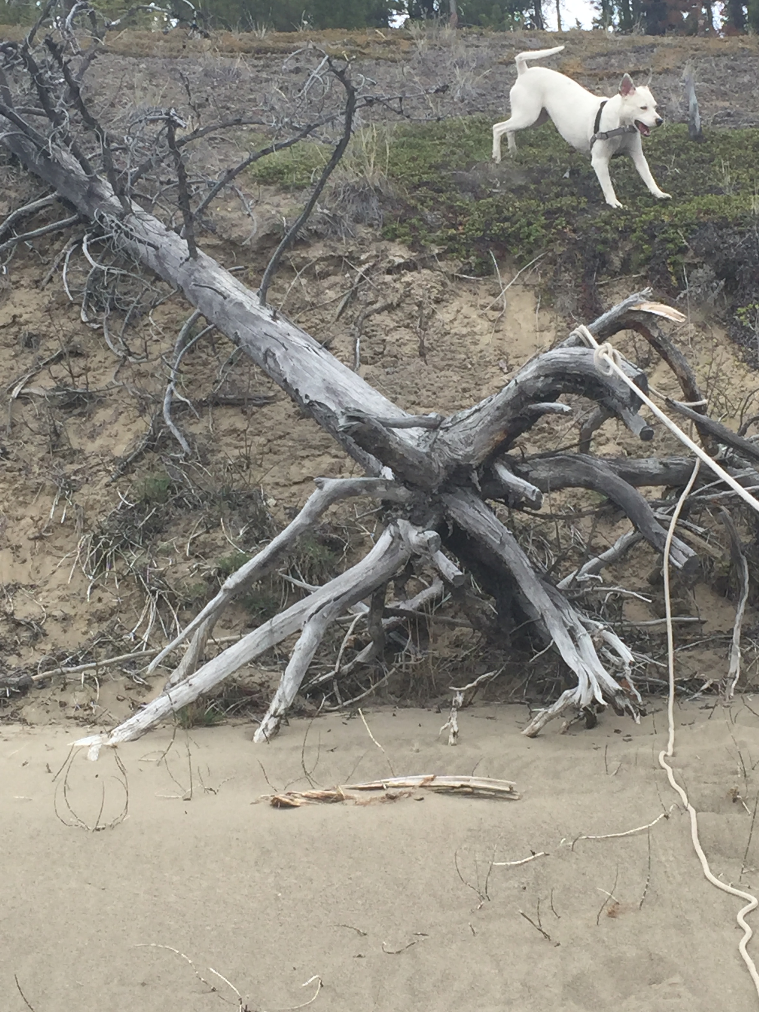
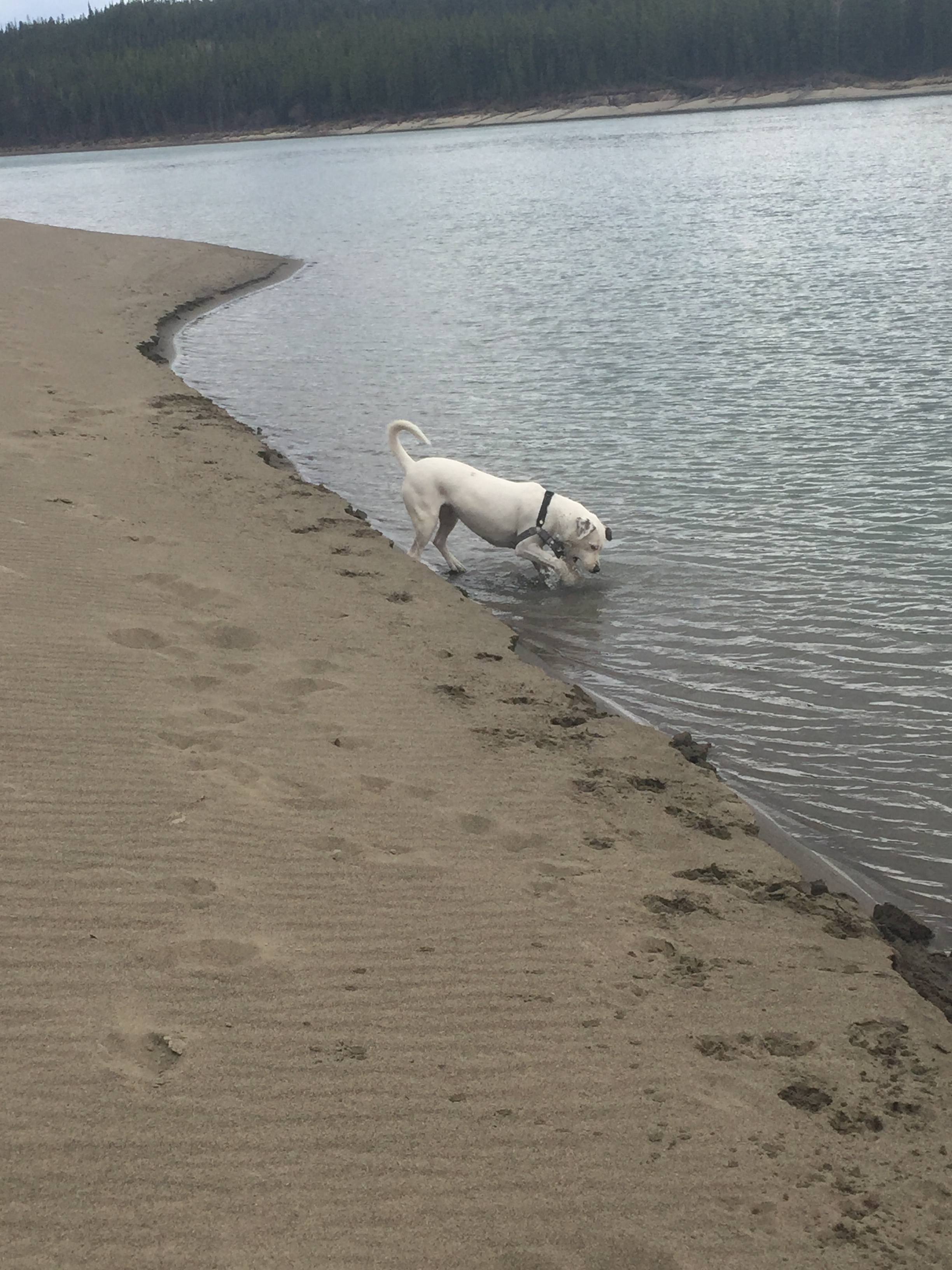
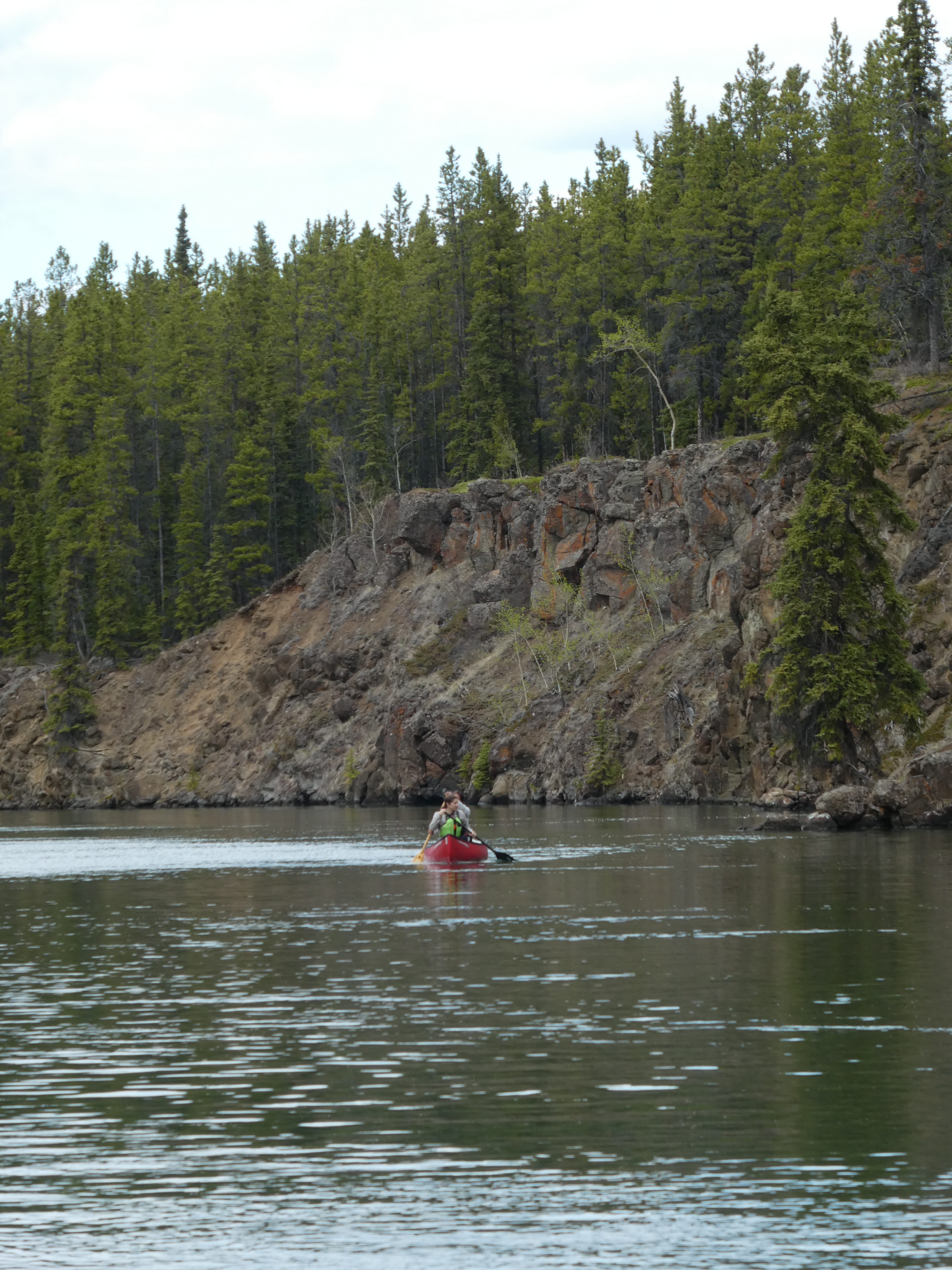
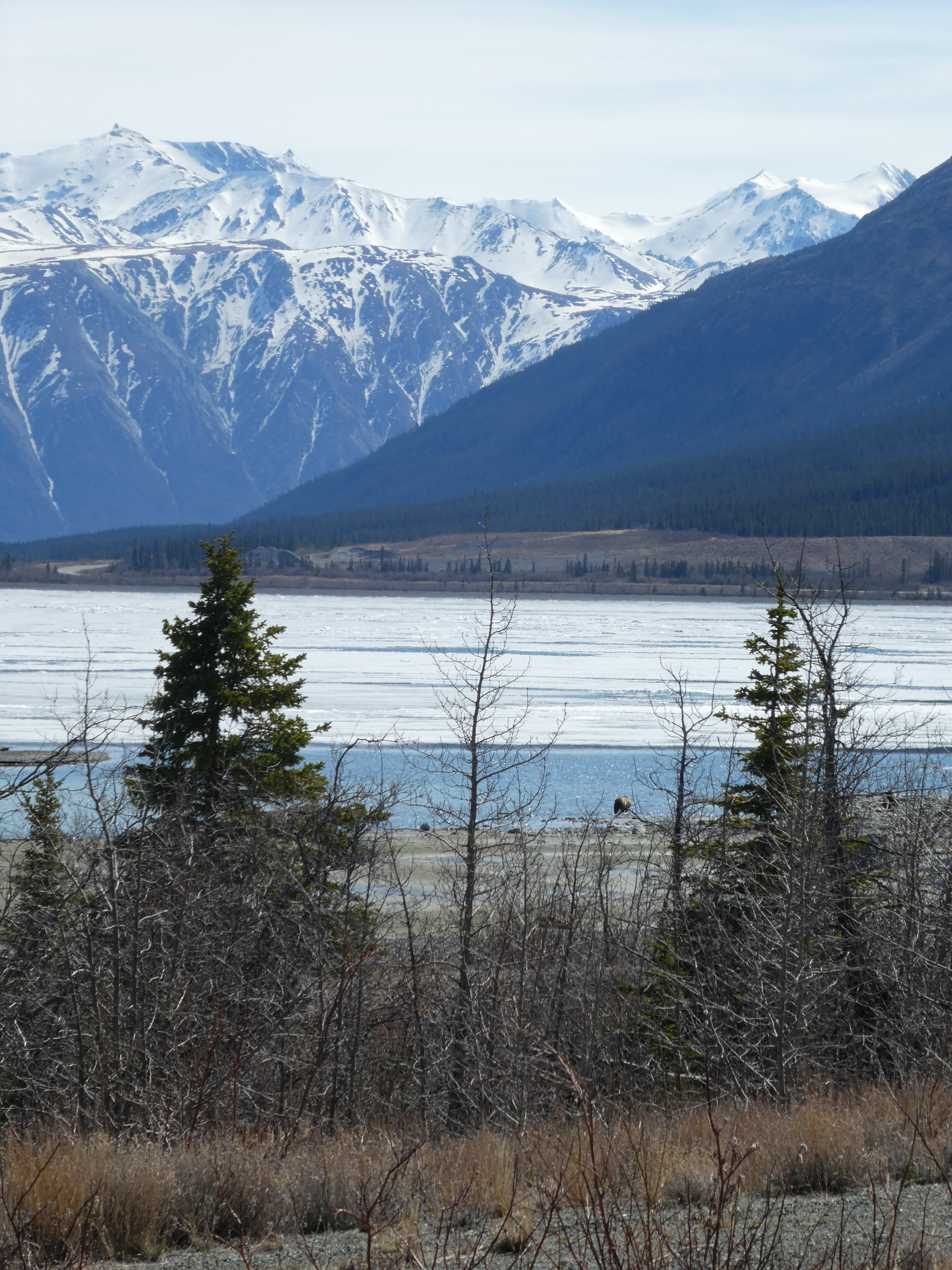
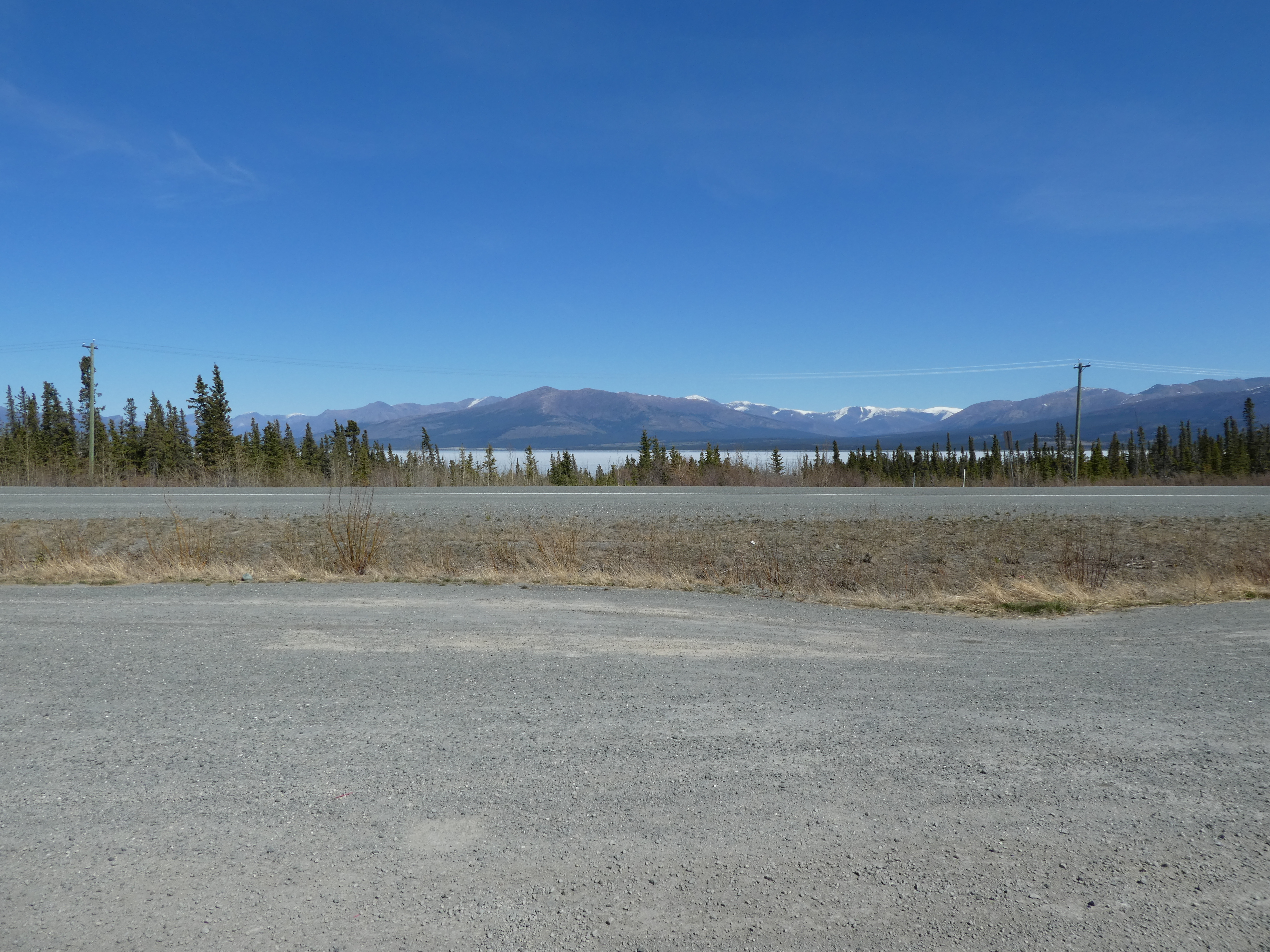
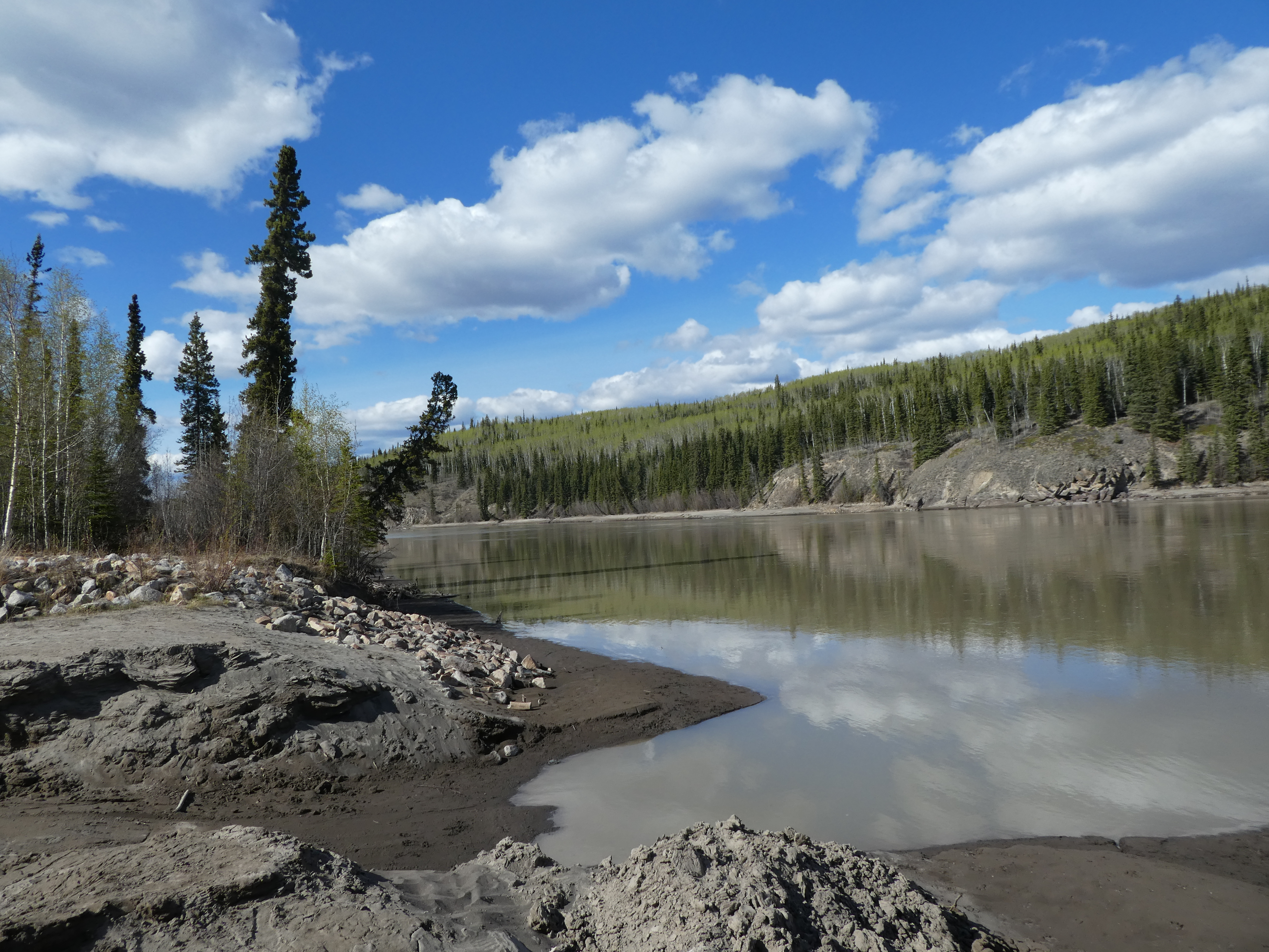
Another rest area by lake

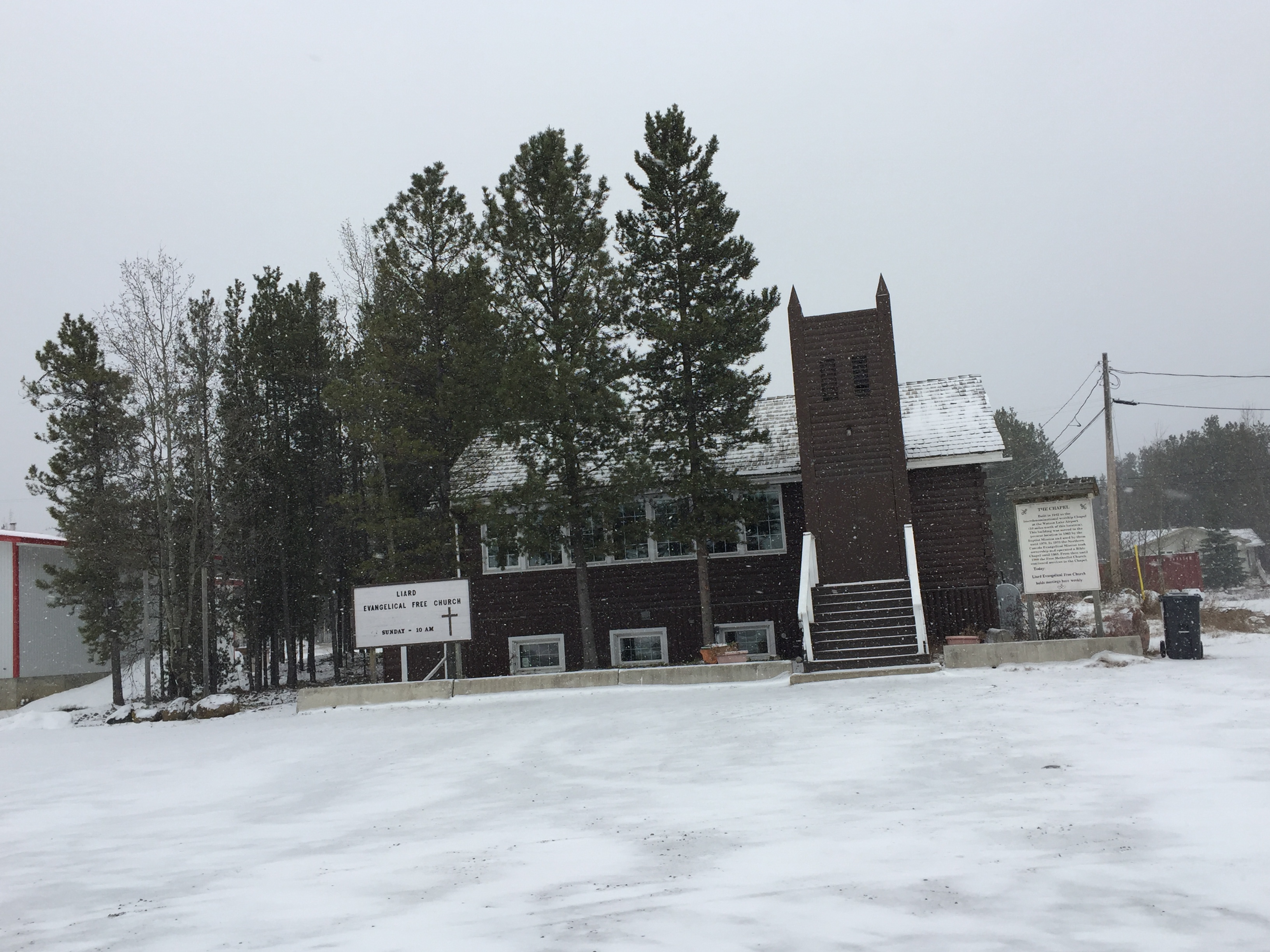
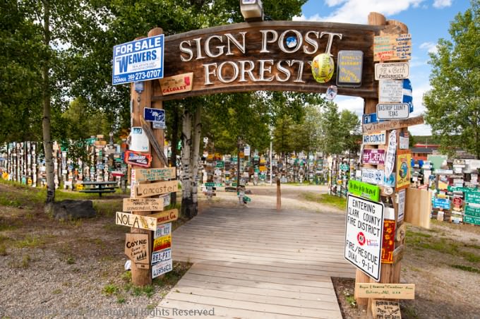
We wandered through the trees and admired the lake.   Chloe loved running and frolicking here.  Watson Lake is a town in the southern Yukon Territory.   We always stop here for food and a motel.   A main attraction on the Alaska Highway is the Sign Post Forest.

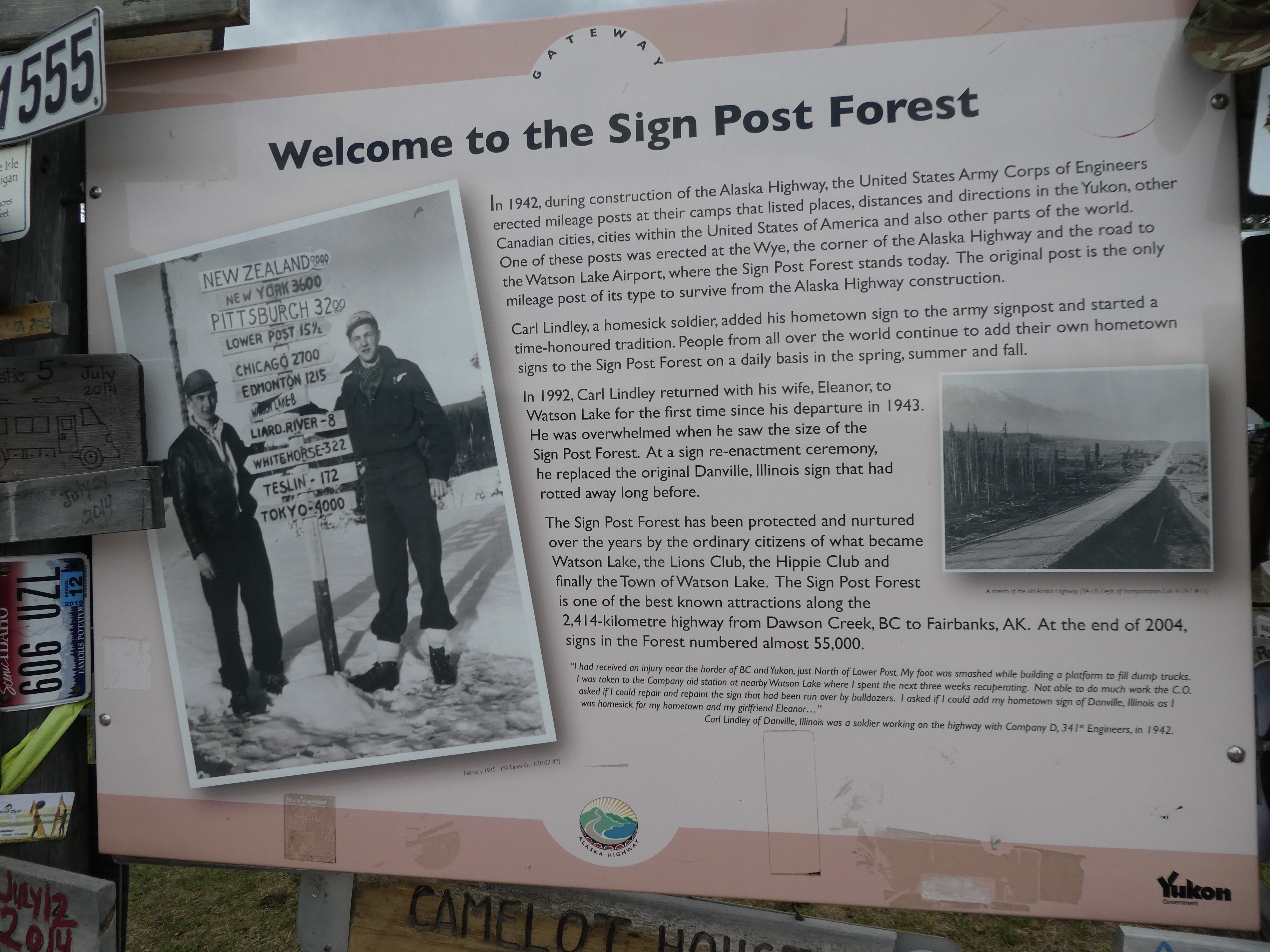
How Sign Post Forest began

We are fascinated with the thousands of signs here.   It was accidentally started when a worker was injured while building the Alaska Highway.   He was a little homesick for his home in Danville, Illinois.   While recovering, he put up a sign for his hometown of Danville.  Soon others added signs from their hometowns.
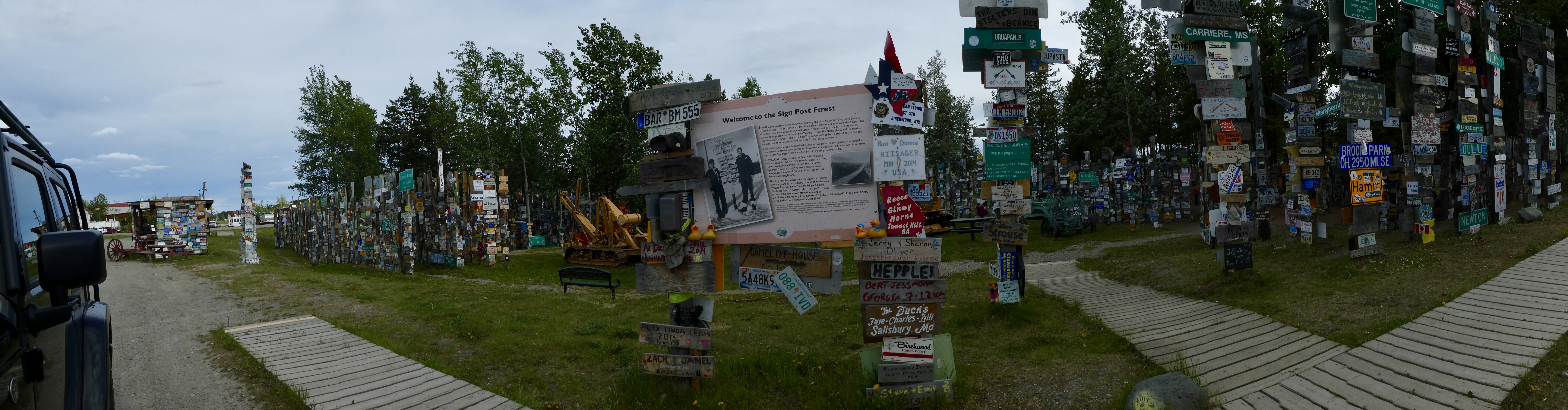
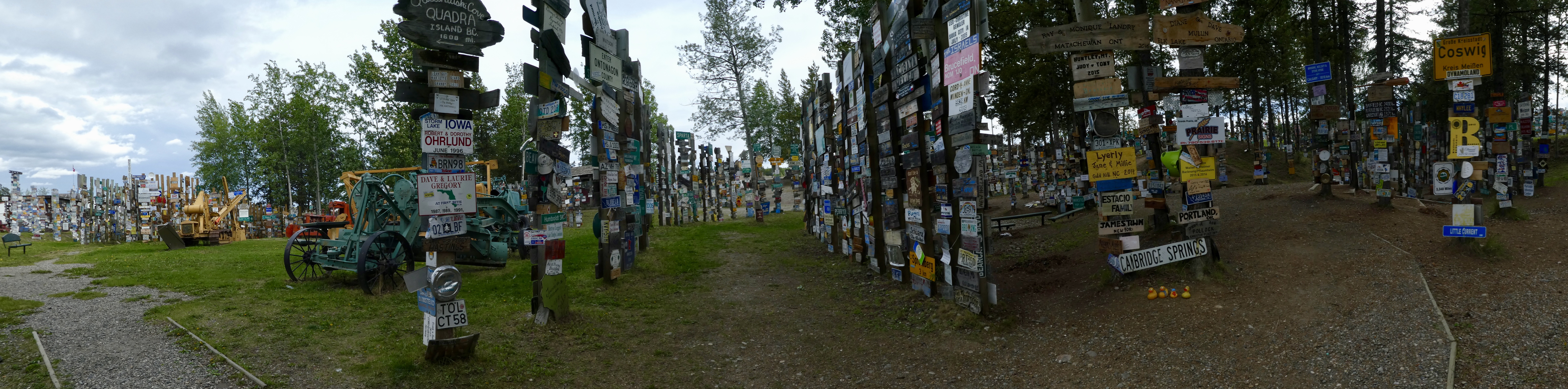
Sign Post Forest

You can see there are thousands of signs here now.
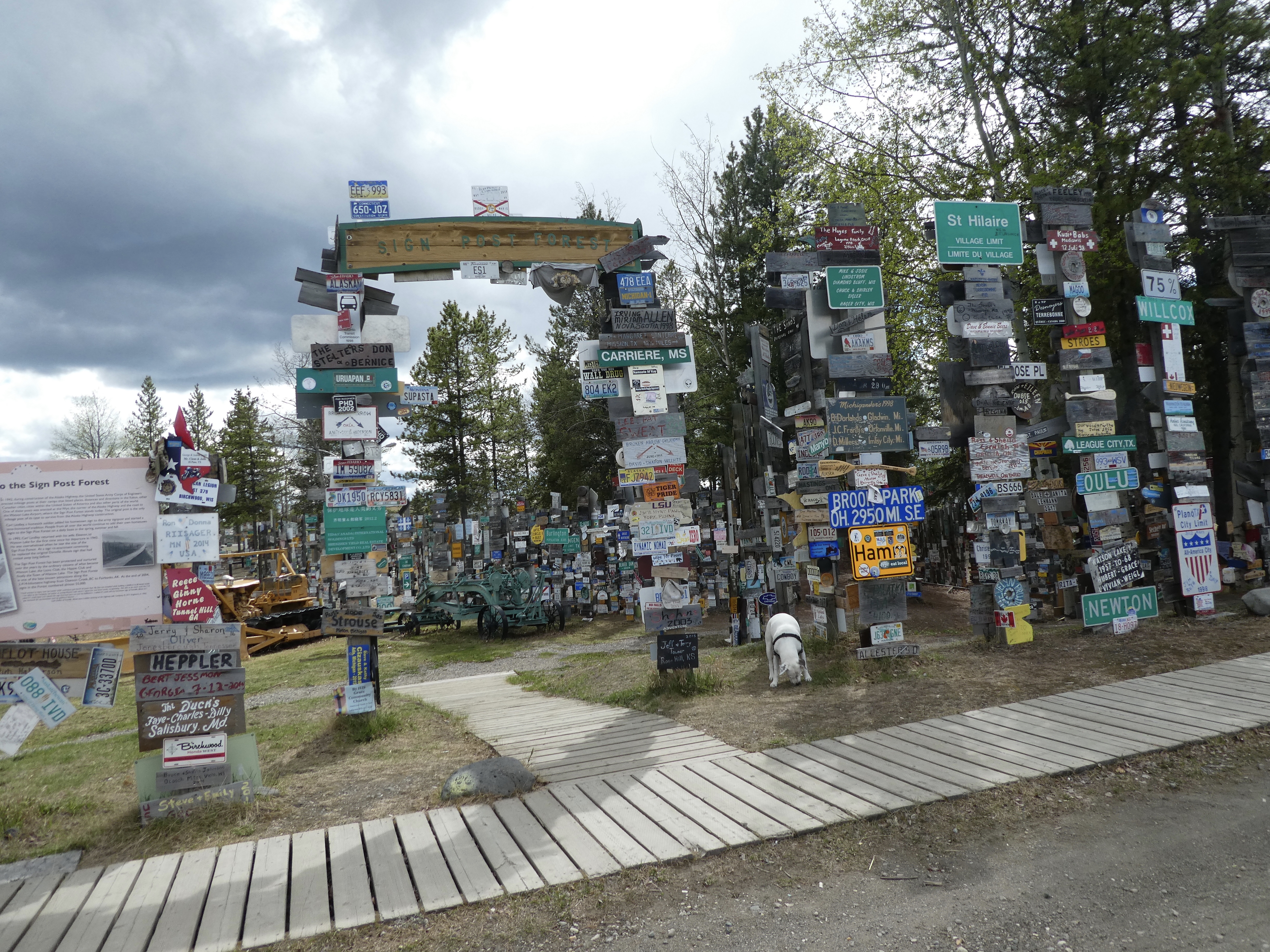
Sign Post Forest

It was impossible for mom to get a photo with all of them.   So many, and in every direction.
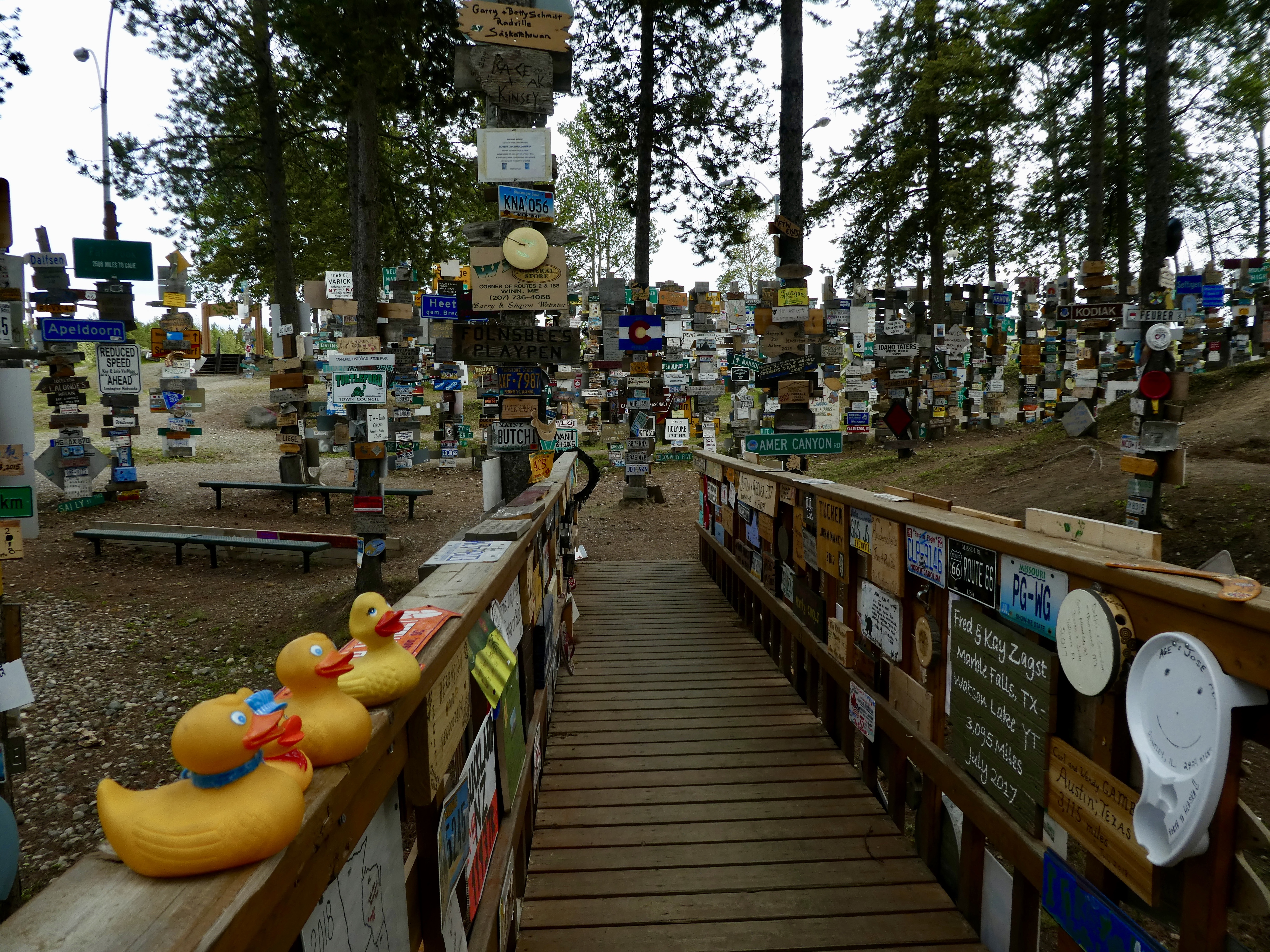
Sign Post Forest

We forget to make and bring a sign to add, but look under the second license plate from Wyoming.

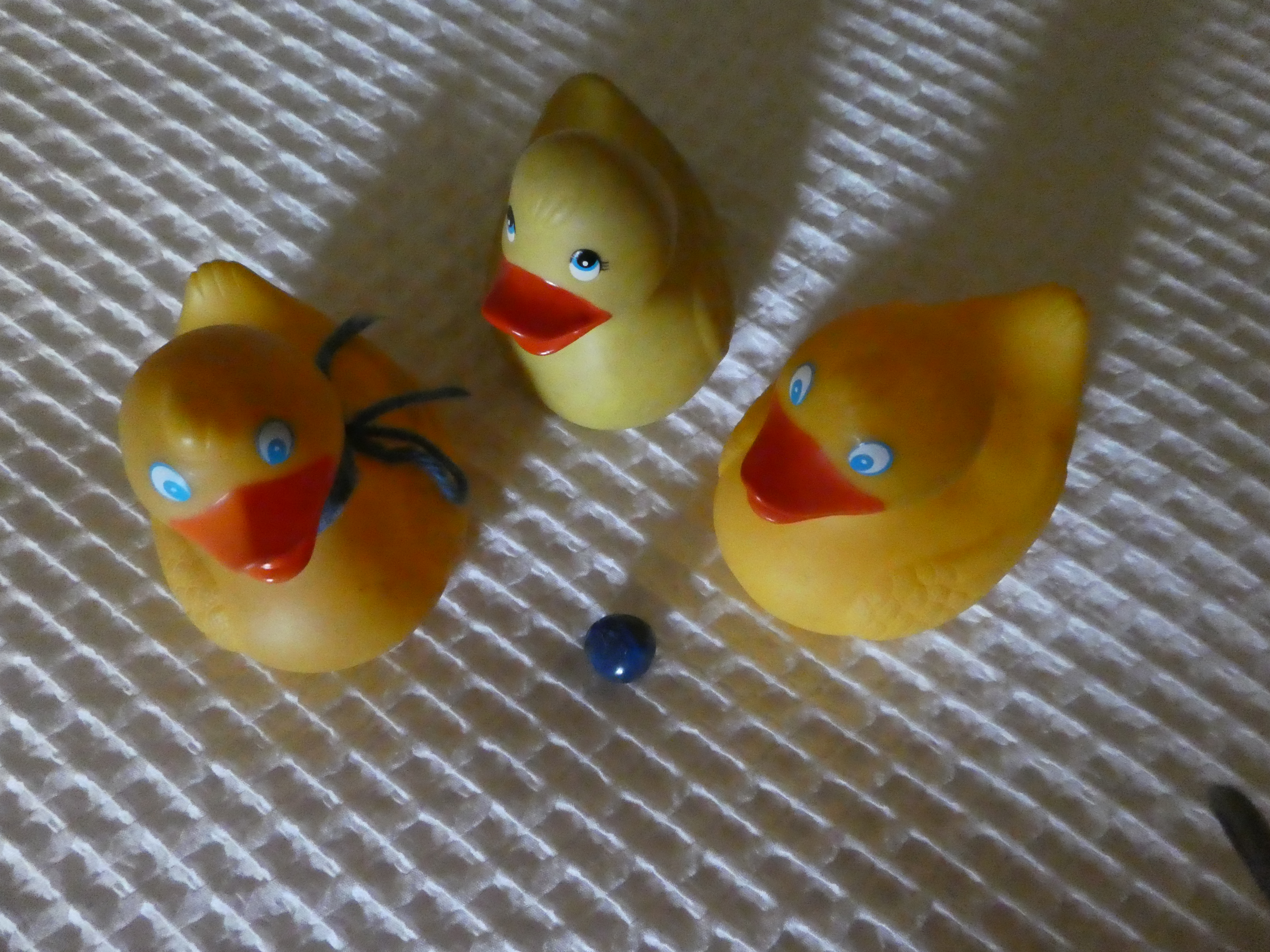
Card for Colorado Traveling Ducks

The business card with a blue border is ours.   It is for The Colorado Traveling Ducks.   And there is more.

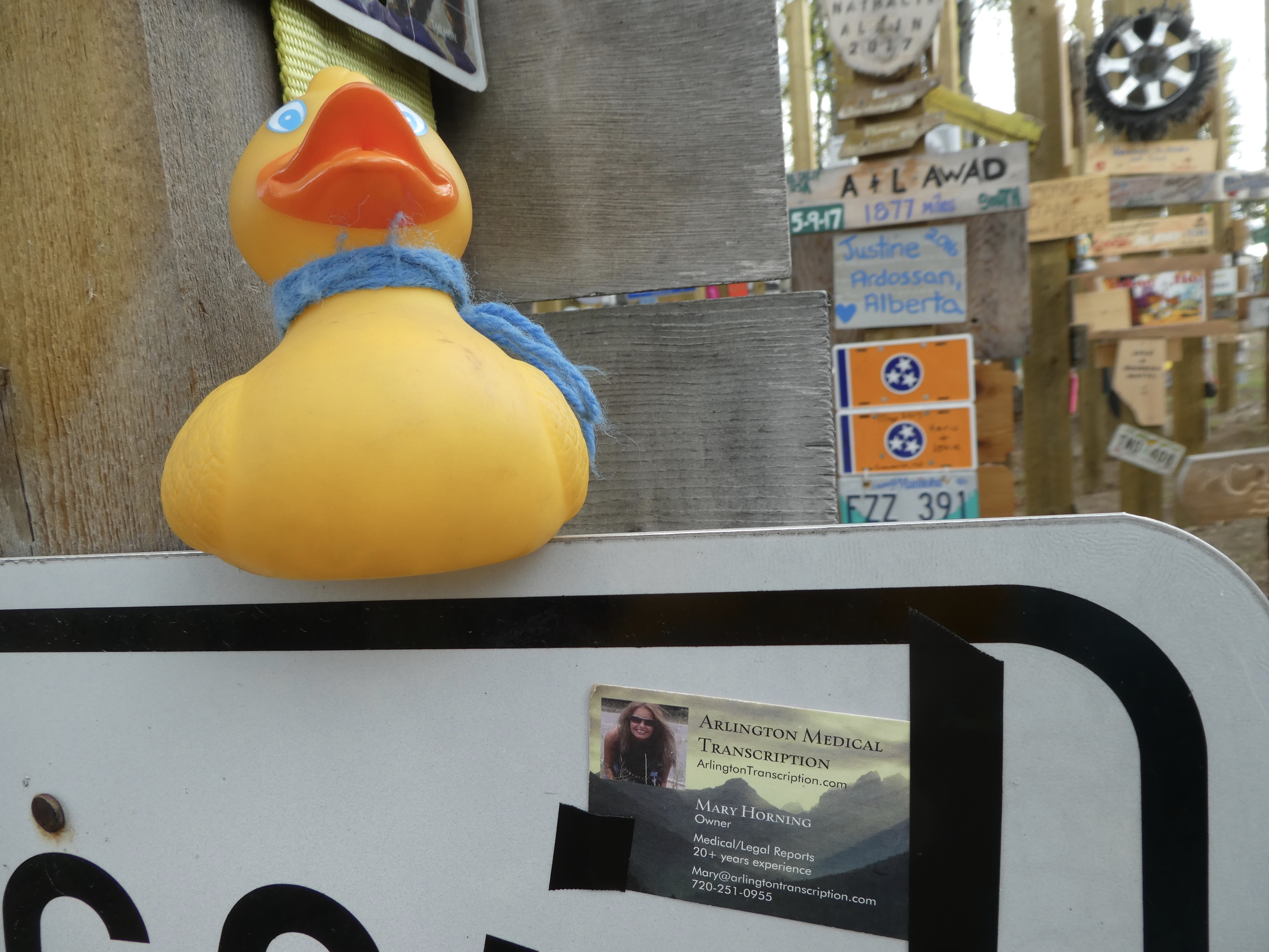
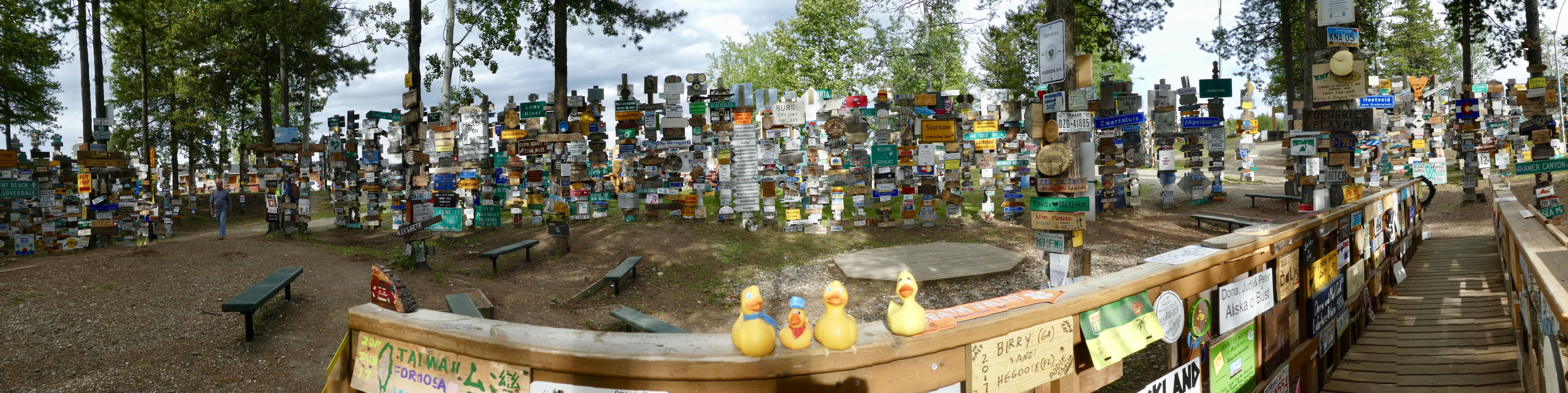
Card for Arlington Medical Transcription

Under Soapy Smith Duck, you can see a business card for Arlington Medical Transcription.   That is Soapy’s mom’s business.   No big signs for us, but we did leave some cards to tell others we were here also.   The Sign Post Forest is one of the major tourist stops on the Alaska Highway.   Just fun to see signs from all over the world.   If you go, maybe bring a sign to add to the forest.

Skagway back to Whitehorse with the Colorado Traveling Ducks

Skagway was a lot of fun.   The South Klondike Highway takes us from Skagway, back to Canada, onto the Alaska Highway and into Whitehorse.   Our last look at Skagway is beautiful.

Skagway with cruise ship

A cruise ship is in port today and the sky is cloudy, adding a sense of adventure and uncertainty.

Birds gliding over Tiaya Inlet

Further along the Tiaya Inlet, the birds fly over the water toward the mountains.   Leaving Alaska, clearing Canadian customs, we stop at Goat Lake Hydroelectric Project.

Goat Lake Hydroelectric Project

Goat Lake is high in the mountains.   Much of Pitch Fork Falls is clear of ice.

Pitchfork Falls

We love waterfalls.   The mountain scenery is beautiful.   Such a large attraction for this drive.   Passing through Carcross, passing the Carcross Desert, we had to make another stop at Emerald Lake.

Emerald Lake

We love the colors of the lake.   It seems that we are back in bear country.

Black bear

This black bear is in no hurry as he grazes by the road.   Something white is moving on the side of the mountain.

Dall sheep

Dall sheep are common in this area.   This one has been jumping around eating any available vegetation.   A sudden start from this sheep, and a few rocks slide down the mountain onto the road.   Our mini rockslide.   But enough to get us to move on.   But more animals.

Two grizzlies

Another mom and cub grizzly bear.   We certainly are enjoying seeing the bears and other animals.   The mountain scenery along this road is spectacular.

Love the rugged, snowy mountains

We were not planning on a side trip to Skagway, but we are so glad we went.   Skagway is fun, but this drive is outstanding.   And no traffic.   We hope you see this area for yourself.   It is beautiful.

Carcross Desert in Yukon Territory with Colorado Traveling Ducks

Today we are leaving the Alaska highway and going to Skagway.   Skagway is a port city in Alaska.   The Alaska Sate ferry, part of the Marine Highway stops here.   Skagway is a very popular cruise ship port.   It is also one of the few cities in southeast Alaska that are accessible by roads.   We will see tourist stops in Skagway, something missing from most of our road trip.   Let’s go.

Whitehorse, south to Carcross and continuing to Skagway

You have to see Carcross, Yukon Territory.   Carcross, Canadian Yukon Territory, situated on the shores of Lake Bennett, was formerly known as Caribou Crossing.

Carcross, YT on shore of Lake Bennett

But there was a problem.   The Yukon, British Columbia and Alaska all had towns named Caribou Crossing.  Mail delivery wasn’t so good.   So, now we have Carcross in the Canadian Yukon.

Carcross Visitor’s Center with Welcome Man Crest

The Yukon Visitor’s Center here has the “Welcome Man” crest.   As do the community buildings.

Carcross Community buildings

Also featured are totem poles.

Totem poles

These are made by Native carver, Keith Smarch.   Carcross was a stopping place for gold stampeders in the late 1890s.   It was also a stopping place on the White Pass and Yukon Railroad during that same gold rush.   But there is something special about Carcross.   It is home to the world’s smallest desert.

Carcross Desert

This small desert is 640 acres or 1 square mile (2.6 square kilometers).   Carcross Tagish First Nation has constructed a single track bike trail which attracts international cyclists.

Carcross Desert

This desert has mountains for a background and some trees.

Carcross desert along road

Carcross desert is right along the highway.   But it is really a desert?

Desert? Ancient lake bed?

It has been called the world’s smallest desert, but we learned that really is the remains of an ancient lake.   And insects?

Rare insects

This is the home to some rare insects and some even more rare insects that are only found here, in the Carcross Desert.

Carcross desert

One more view of the world’s smallest desert, with our dog Chloe.   A few miles north of Carcross Desert is Emerald Lake.

Emerald Lake

We Colorado Traveling Ducks love this lake.   It is sometimes referred to as Rainbow Lake.

Emerald Lake

Aren’t the colors fantastic?   We love the green in the water.   Our guide book says the color comes from blue-green light waves, reflecting off the white sediment of the lake bottom.   This white sediment, called marl, consists of fragments of decomposed shell mixed with clay.

Emerald Lake

But we just think it is beautiful.   If you drive between Whitehorse, Yukon Territory and Skagway, Alaska, be sure to stop and admire these lakes, and explore Carcross Desert.

Colorado Traveling Ducks Ride on the Yukon River

Captain Ken and his boat are on the Yukon River just south of downtown Whitehorse.

Captain Ken and our boat

Let’s get on the boat.   No other passengers, just 2 humans, 3 ducks and 1 dog with Captain Ken.

Heading down the Yukon

Heading down the Yukon.   The sun is sometimes out, but it is still cold.   Jackets and life vests keep the humans warm.  The wind from boating down the Yukon is cold, and rather strong.   We, the Colorado Traveling Ducks, are staying warm and safe in our travel bags.  That first picture is our only appearance on the Yukon River boat trip.

Entering Miles Canyon on Yukon River

Entering Miles Canyon, we are amazed at the green water.   Soapy’s mom and dog are in the front of the boat.

Historic Canyon City. Not much left now

This bench and sign is the only remains of Canyon City.   Canyon City was important as early miners waited here for transport through the canyon.

The Yukon River widens

We are now at a wider part of the Yukon River.

Eagles on the Yukon

These eagles did not pay much attention to us, but we noticed them.  Captain Ken docked the boat on the banks of the Yukon so we could get out, stretch our legs, and walk around.

Chloe on ridge along Yukon River

Chloe immediately climbed this steep hill for a better view.

Chloe coming down to Yukon River

Then decided to dash back down.

Chloe in the Yukon River

Climbing and running must have made Chloe thirsty.   The water is very cold and drops off fairly close to the edge.   But Chloe was careful.   Before heading back, Captain Ken had a contest about finding something that was not natural.   A little confusing, but Soapy’s mom found it.   A faint peace sign had been put on a mountain.  Not a good photo.   Soapy’s mom’s prize was a native blue rock.

We like native rocks. This is Soapy’s mom’s prize

It is pretty, but here it almost looks like and M & M candy.   The contest was fun and made us really look at the river bank.

Practicing for Yukon River Quest

We are heading back now.   These people are practicing for the Yukon River Quest.   That is the world’s longest annual canoe and kayak race.  Stand Up Paddleboarding is also included in the race, beginning in 2016.   They race 444.28 miles (715 km) from Whitehorse northwest to Dawson City, Yukon Territory.   The race began Wednesday, June 26, 2019, at noon.   The race will end 9:00 pm Saturday June 29, 2019.   This, the 21st year, there were 117 vessels, a new record, that competed.

Still patches of snow along Yukon

Back in Miles Canyon we again admire the green water and see the snow still on the canyon wall.   The canyon wall is basalt lava flows and cones that erupted and flowed across an ancient pre-glacial landscape in south central Yukon.   This was formed 8.5 million years ago.   Captain Ken said the lava seeped through the rock walls.   These balsalt walls are fascinating to see.  During the gold rush days, cruising this canyon was trecherous because of the White Horse Rapids.

Generating power on the Yukon

This hydroelectric power plant has tamed the White Horse Rapids, and provides power to the city of Whitehorse.

Almost back to our Jeep

Almost ready to dock and return to our Jeep.   We loved our trip on the Yukon River.   It was chilly, but we are so glad we went.  A great 3 hour trip!   You would enjoy a river trip also.

Kluane Lake to Whitehorse, Yukon Territory, with the Colorado Traveling Ducks

We are leaving the beautful Lake Kluane.

Leaving Kluane Lake

About an hour later we arrived at Haines Junction.

Passing through Haines Junction. With mandatory stop for gas

We stayed here on the way north.   This is really is a Junction.   You can drive to Haines, Alaska, a port city, or continue south on the Alaska Highway.  A rule of travel in the far north.   Never pass a gas station.   The next one may be closed or out of fuel.   So we stopped in Haines Junction for gas and fresh sodas.

Alaska highway heading to Whitehorse, Canadian Yukon

We are continuing south towards Whitehorse.   Arriving in Whitehorse, we walked along the Yukon River.

Evening on bench along Yukon River in Whitehorse

We appreciate the many benches along the river.

Totem Pole. Downtown Whitehorse

This totem pole downtown by the river, is such a wonderful reminder of the native Athabascan history.

Stools near Yukon River. Whitehorse

These nearby stools are dediated to the Whitehorse Mission School, 1947-1960.

White Pass & Yukon Route Train station in Whitehorse

The White Pass and Yukon Route train station was the end of the train between Skagway, Alaska and Whitehorse during the gold rush of the late 1890’s.  The narrow gauge train stopped running in 1982.   When my mom was younger, she and Soapy’s mom, her daughter, flew from Fairbanks to Whitehorse and took that train to Skagway.   They say it was beautiful!

Whitehorse train station also start and finish line for Yukon Quest dog race

This Whitehorse train station is also the Official Start/Finish line for the Yukon Quest.   That is a 1,000 mile dog sled race between Whitehorse and Fairbanks.   The race takes place in February and alternates starting and finish destinations each year.

Honoring firefighters

We liked this firefighter statue here in Whitehorse.

Firefighter’s Prayer. Whitehorse

And the firefighter’s prayer plaque.   We certainly appreciate firefighters everywhere.

Klondike Rib and Salmon restaurant. A favorite!

We enjoyed dinner at the Klondike Rib and Salmon restaurant.   This restaurant closes for the winter and just opened a couple days before we arrived.   Our moms ordered salmon and halibut.   Everything is delicious here.   Of course, desserts were ordered.

Huge brownie desserts

They each ordered brownie a la mode with caramel sauce.   These brownies are huge!  And so good.

Yukon Information Center Whitehorse

In the morning we visited the Yukon Information Center.   We got information on a tour that is operating in May.   We will show you where we went next time.

Beaver Creek to Kluane Lake, Yukon with Colorado Traveling Ducks

This was a great traveling day.   We didn’t travel several hundred miles, but we saw animals and a huge gold pan.   Leaving Beaver Creek, the most western Canadian community, our first stop was to see the world’s largest gold pan.

World’s largest gold pan

Here we are in Burwash Landing, Canadian Yukon.   This gold pan is 21 feet in diameter and features a gold miner panning for gold.   The picture of the gold miner is painted occasionally.   The last time was about 10 years ago.   It could use a new painting.   We  saw the Kluane Museum of History; not open while we were there.

Kluane Museum of History

Outside we enjoyed a great display of life after fires.   After fires, small plants and trees begin to emerge, attracting insects and small animals.   Then larger vegetation and larger animals.   The circle of life is regenerated after forest fires.

Outdoor museum

Also there is the outdoor exhibits of original buildings.   Burwash Landing was the traditional home of Southern Tutchona Athabascan Indians and was their summer camp.   In the early 1900’s, a trading post was established here by the Jacquot brothers.   Of course, for a short time gold mining was a major source of income.   We enjoyed the statues around the museum area.

Working on tractor

The tractor was rather surprising, but we liked it.   Food must be grown everywhere.   Burwash Landing, according to the 2011 census, has a population of 90 permanent residents.

Lake Kluane

Located on the southern shores of Kluane Lake, Burwash Landing is the administration center of the Kluane First Nation people.   Continuing down the Alaska Highway, we were happy to see this grizzly bear.

One grizzly bear

Isn’t she wonderful?  But wait.

Three grizzlies.   And motorcycle

Not one grizzly, but three.   Mom and her two cubs.   They stopped to roll and play in the road.   Then to the lake.

Mom and cubs heading to Kluane Lake. Bath time

After crossing the road, they approached Kluane Lake.   Here they will bathe and have a short swim in the cold Kluane Lake.

Kluane Lake

The few other vehicles that were on the road also stopped to watch this fabulous grizzly bear family.   Continuing south on the Alaska Highway, we soon reached Thachal Dhal Visitor’s Center.

Thachal Dhal Visitor’s Center

Unfortunately the Visitor’s Center had not yet opened for the season.   Most places on the Alaska Highway open in mid or late  May.   But there are enough motels, campgrounds and restaurants that are open year round that travelers can be comfortable any time.   Winter in the far north is the determining factor for most tourists, and when they want to travel.  Last year we stopped at the Thachal Dhal Visitor’s Center.   It is very interesting and definitely worth a stop.   It is a great place to see the Dall Sheep, during spring and fall.

Dall Sheep on mountain side

We did see some Dall Sheep on the mountain side.   They are fun to watch as they run and jump around the rocky mountain areas.   Also on our drive, we saw three caribou or reindeer playing in the woods by the road, and a moose in a lake, too far away for a photo.   We love seeing all the animals, the lakes, snow capped mountains and very little traffic.   We hope you drive the Alaska or Alcan Highway in late May or early June.   It is beautiful.

Leaving Fairbanks and Alaska with the Colorado Traveling Ducks

We are heading home??  What?? There is so much more to see.   We ducks do not want to go home yet.   Our moms say, don’t worry.   We will stop often on the way home to see different things than last year.   And a few of our favorites that we want to experience again.   OK.  Leaving Chena Hot Springs, our first stop is Salcha, Alaska at The Knotty Shop.

The Knotty Shop.

This is a great store, featuring items made in Alaska.   The name, Knotty Shop, comes from the knots or bumps (burls) on the trees.   Last year we stopped here so you can read more about it in older posts.   This year we purchased some clothing, t-shirts, sweats, and socks.   Also another Ulu knife.   A hand carved wooden basket, jewelry, Alaskan made jam and, of course, ice cream cones.  Lots of time shopping, so we spent the night at Alaska Steakhouse and Motel in Delta Junction, Alaska.

Alaska Steakhouse and Motel in Delta Junction, Alaska

At Delta we officially began driving on the Alaska Highway.

Heading southeast on Alaska Highway toward Canada

Beautiful scenery as we head toward the Canadian Yukon Territory.   We stopped at roadside rest areas often.

Roadside pullout. Great areas for walking and enjoying scenery.

Stopped to appreciate the breathtaking views.   Also, Chloe likes to get out of the car and do a little exploring.   So do the humans.   While driving, as we completed a curve in the road we startled a black bear and he ran down a path into the woods.   He was so cute to watch.   Of course, too fast to get a photo.   We arrived in Tok, Alaska, the last Alaskan town on the Alaska Highway.

Burnt Paw gift shop. Tok, Alaska

Our first stop was the Burnt Paw.   This is a great gift shop, a snack area, motel with cabins, and source of eqipment for dog sleds.

Tok, Alaska. Burnt Paw

Isn’t this a great dog sled at the store entrance?  More shopping.  Souvenirs, gifts and treats for Chloe.   Next stop in Tok was Fast Eddies.

Fast Eddies in Tok, Alaska

We stopped for food and it was delicious.   Since it was Mother’s Day, Fast Eddies was treating mothers to free dessert cupcakes.

Mother’s Day complementary dessert from Fast Eddie

We had Red Velvet and Lemon Meringue cupcakes.   Very tasty and we enjoyed them.   Thanks Fast Eddie!  Continuing toward the Yukon, we crossed the Tanana River a few times.

Tanana River in Alaska

We like this river.   You may remember last June we rode on the Tanana River while on Riverboat Discovery in Fairbanks.  We have arrived in the Yukon.

Enter Canada’s Yukon Territory

We cleared US and Canadian customs.   We stayed in Beaver Creek in the Yukon.   Beaver Creek RV and Motel was our home for the night.  Camping is a very popular way to travel but we prefer to stay in hotels.   At the campground we did enjoy these carved statues of early pioneers.

Historic figures in campground

The Visitor’s Center is across the street.

Yukon Visitor’s Center

The lady there was very friendly.   She even invited Chloe, Soapy Smith Duck’s dog, to come inside.  She likes dogs and told us about her sled dogs.   She told us much about Beaver Creek now and about Beaver Creek in the past.   Very interesting.   She suggested we stop at Our Lady of Grace Catholic Church.

Our Lady of Grace Catholic Church built around quonset hut

Isn’t it a quaint little church?   This church was built around a quonset hut left over from the days of the Alaska Highway construction.   Please take a little time to explore any town you visit.   We always find some interesting and unexpected things.

Still Diving North. Still Daily Snow with the Colorado Traveling Ducks

Yesterday’s snow and icy roads, the worst of the trip has ended.  We arrived at Haines Junction, in the Canadian Yukon.

Haines Junction, Yukon. Love the sign

And yes, you can drive to the Alaskan port city of Haines from here.   But we did not.   We are trying to get to Fairbanks or North Pole, Alaska to hire a new realtor.   Our motel in Haines Junction was very comfortable and had a good bar and restaurant nearby.

Alcan Motel in Haines Junction, Yukon Territory, Canada

So we were all happy.   We ordered our dinner and ate in our rooms.   We were exhausted.    Refreshed after a good night’s sleep, driving north, we met a new friend.

Canadian grizzly bear

This Canadian grizzly bear was too busy grazing to pay much attention to us, but we sure admired him.   That bump on his back is typical of grizzly bears, or so says our guidebook.  They can be ferious, but he looks so sweet and hugable.   This partially frozen lake caught our attention.

A winter wonderland

We love to see the winter landscape.   We just don’t love the cold.   Driving past Canadian customs, we have arrived in Alaska, USA.   There are several monuments and signs here.   The Welcome to Alaska.   Looking the other direction, the Welcome to the Yukon, and this friendship bench.

Friendship bench

Canada and the United States have been friends for years, so this bench is a nice place to pause and enjoy the view.   The International Boundary Post shows the actual border, marked by the suveyors.  Before the Alaska Highway, the borders were not so clearly marked.  We quicky cleared US customs and we continued north toward Delta Junction.

Delta Junction, Alaska. Official end of he Alaska Highway

This milepost in Delta Junction marks the official end of the Alaska Highway.  From here there is a main road heading south to Anchorage and Valdez.  Valdez is the end of the Alaska Pipeline, which carries oil from the fields of Prudhoe Bay on the Arctic Ocean to Port Valdez on the east side of Prince William Sound.   Here ships wait to carry crude oil into the Pacific Ocean and to various world ports.   Also at Delta Junction, you can drive on the Richardson Highway and go north to Fairbanks.   That is the route we drove.   We were in Delta Junction the first week of May and the Visitor’s Center was not yet open.   Many businesses along our route are only open during the warmer months.   At the Delta Junction Visitor’s Center they have lots of information signs outside.   And this statue of a giant mosquito.   Alaska does have giant mosquitos.   But since the center is not yet open, this mosquito is not yet in its best form.   This photo from last year shows what the mosquito will look like soon.

Mosquitos.

Well, we are only hours away from our next hotel in Fairbanks.

Heading north to Fairbanks, Alaska

Heading down the road, we will reach our Fairbanks destination tonight.

Colorado Traveling Ducks in Canada’s Yukon Territory

Continuing northbound, we are enthralled with the winter scenery.

Frozen River

This frozen river is so beautful.   It is definitely winter weather, some snow each day, and frozen water everywhere, but the days are much longer this far north.   The sun rises before 5:00 a.m. each morning and doesn’t set until after 10:00 p.m.   A few more minutes of daylight is added every day.   And this fellow is always a treat to view.

Black bear

He is one of the first bears we saw.   Actually, the earlier bears appeared and walked into the woods before mom got her camera out.   No matter how many bears we see, we stop to admire each one.   We stop at another rest area.

Picnic area. Statue dedicated to surveyors

This one has a nice picnic area, for later in the summer, and a marker remembering the surveyors that made this road possible.   We enjoy another view of a frozen river.   Imagine this picnic area in the summer, watching the river flow.   So beautiful and peaceful.  Next we see the wild buffalo along the side of the Alaska Highway.

Baby buffalo in the spring

The precipation does not seem to bother mom and baby.   But, as usual, the rain and snow start and stop.

Buffalo along the road

There are several young buffalo with moms here.   A little distance from mom and baby, the dads remain watchful.    Further north we leave British Columbia and enter Canada’s Yukon territory.

Welcome to the Yukon

Chloe, Soapy’s mom and three Colorado Traveling Ducks are happy to see this sign, marking progress on our northern travel.   You may remember that we drove this route last year.   That trip was one way, heading south.   We bought this blue Jeep from the estate of mom’s brother.   Both this year and last year we spent the night in Watson Lake, Yukon.  This time, there is snow on the ground and it is rather cold.

Snow around church in Watson Lake

We liked the Liard Evangical Free Church in Watson Lake.   Originally built in 1942 near the airport, the building was moved here in 1963.  This church is open to all.  Leaving Watson Lake in the morning, we soon encountered snow and icy roads.

Spring time in the Yukon

Driving was trecherous.   But there is beauty with the snow also.

Snow makes trees beautiful

These trees are beautiful.   We pulled into a rest area after the snow stopped.   Our Chloe likes to get out of the car and have some exercie.   Really, we all enjoy the stops.

Snowy mountains from rest area

The mountains blurred by snow are breathtaking to us.   But it is May now and we are ready for some spring warmth and sunshine.   Soon, we think.

Watson Lake. Colorado Traveling Ducks Visit Sign Post City

We are in Watson Lake.   This will be our last community in the Yukon Territory.   But what a community!  Driving into the community of Watson Lake, we see something unusual.

Are those sign posts?

Are these sign posts?   Oh yes.   Not just a few signs, but so many.

Sign Post Forest, Watson Lake

This is Watson Lake’s most famous attraction.

Sign Post Forest of Watson Lake

We are at the Sign Post Forest.   OK, but why are all these signposts here?

How did this start?

This sign explains the beginning.   Just think, all these signs are the result of a homesick American from Danville, Illinois.   Apparently he was not the only one suffering from a little homesickness.

Sign Post Forest, Watson Lake

Look at all these signs.   The Alaska Highway was started March 8, 1942.   More than 11,000 soldiers and engineers, 16,000 civilians and 7,000 pieces of equipment built this 1,500 mile road through the vast wilderness of northern Canada and Alaska.   In less than 9 months Dawson Creek, British Columbia and Delta Junction, Alaska were connected.    What an accomplishment.   Once Carl Lindley put up the first sign, the idea really caught on and everyone started putting up signs.

Sign Post Forest, Watson Lake

Even with these panoramas, there was no way mom could get photos to show the thousands of signs, everywhere.   We ducks enjoyed sitting on the bridge and reading some signs.

A bridge in Sign Post Forest, Watson Lake

We went to the Visitor’s Center in Sign Post Forest.   They were very helpful and so nice.   If humans have a sign to add to the forest, the Visitor’s Center will provide a hammer and guide humans to the area where new signs can be placed.   Our moms said if we ever come here again, we will bring a sign to add.

Sign Post Forest, Watson Lake

Leaving the Visitor’s Center, we looked more and are still rather speechless at all the signs.   Our guide book says Sign Post Forest is one of The Yukon’s most famous landmarks and contains over 72,000 unique signs.  Looking down the main street (The Alaska Highway), we liked the international flags.

Main Street, Watson Lake

As you can see, Watson Lake is not a large town.

Main Street, Watson Lake

According to Wikipedia, the 2016 census showed a population of 790 permanent residents.   Our hotel was clean and comfortable.   The restaurant served great food.   If you are looking for an interesting place to get away from it all, you might like Watson Lake, Yukon Territory, Canada.   Heading south in the morning, we once again saw an adorable bear along the road.   Of all the bear photos mom took, this just might be her favorite.

Favorite bear photo. Is he watching us?

Isn’t he looking right back at us as we look at and admire him.   We were thrilled to see bears along the road in the Yukon almost every day.   Continuing through the beautiful scenery, we left the Yukon Territory and entered beautiful British Columbia.

Leaving Yukon Territory and entering British Columbia

We are enjoying our scenic drive through Canada.