Aliens in California, Giant Watermelon in Utah with Zeb and Soapy Smith Duck

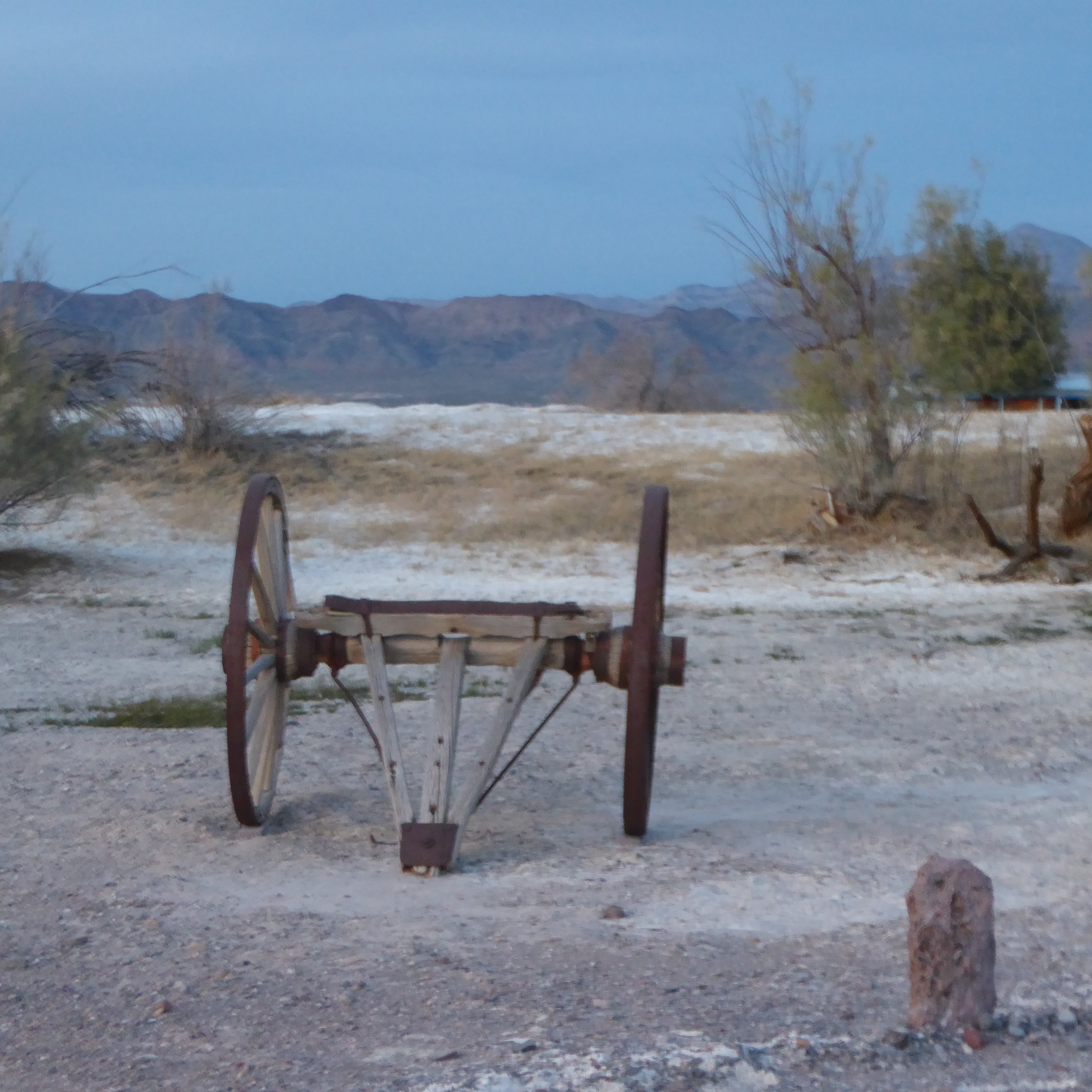
Arriving in Baker, California we see the world’s tallest thermometer.

World’s tallest thermometer in Baker, California

This thermometer is 134 feet tall and was turned on October 9, 1992.     Our moms are still looking on Roadside America, so we will be seeing the unusual in Baker.   This is really unusual!
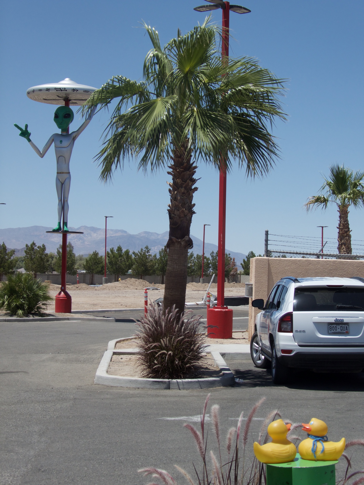
Fresh Alien Jerky

Aliens in the California desert?   Yes indeed.   Across from the thermometer we wander around Alien Fresh Jerky.

Alien Fresh Jerky

This sign also has a thermometer just under the pictures.   Temperatures in the desert are of interest to tourists.   We see aliens.
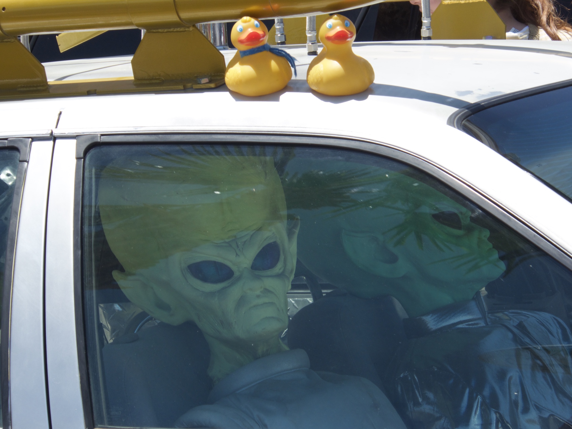
Aliens drive cars??

They are driving, here, in our desert?   Yes they are.   And here is the vehicle they drive.

Alien vehicle

Very futuristic, we ducks think.   Inside this store, we saw and sampled many types of jerky.   There are many varieties for humans to enjoy.   Also lots of other snacks and beverages, and a huge souvenir selection.   Alien t-shirts anyone?  There are plans to open a 3 story saucer shaped motel here also.   When it is completed, it will be advertised as “Gateway to Area 51.”   Area 51 is in Nevada, and regular people are not allowed there.   Rumors are plentiful of aliens in the area?   If humans aren’t allowed somewhere, they seem to have great imaginations for the reason.   We ducks won’t express our opinion, but if the area is ever open to the public, we will be there.   Humans like to eat, Roadside America had information on the Mad Greek Cafe, and here we are.
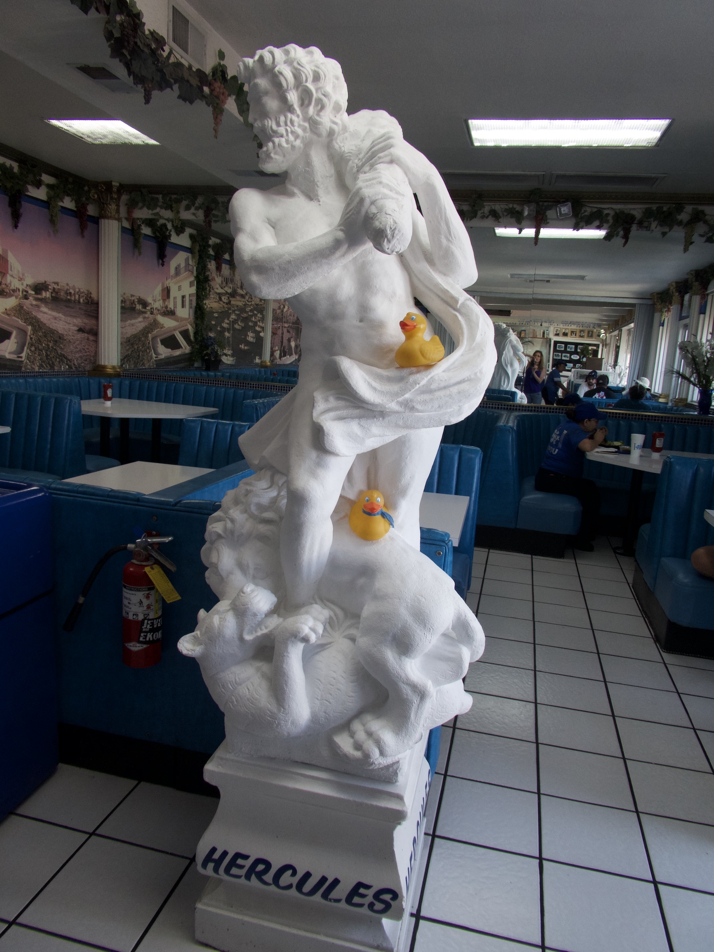
Mad Greek Cafe

Here is Hercules.

Inside Mad Greek Cafe

Inside, this restaurant looks like Greece.   Or so our moms say.   We ducks have not been to Greece, but our moms visited before we ducks were part of the family.   Outside is the hot desert, but inside we gaze at this cool looking harbor.

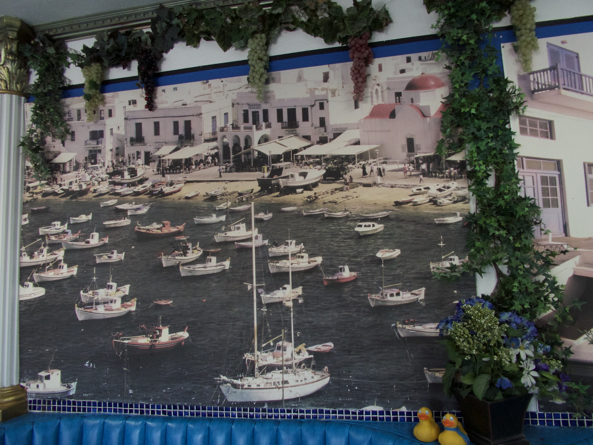
Great picture. A beautiful Greek harbor in the California desert.

There are Greek columns and statues in abundance here.

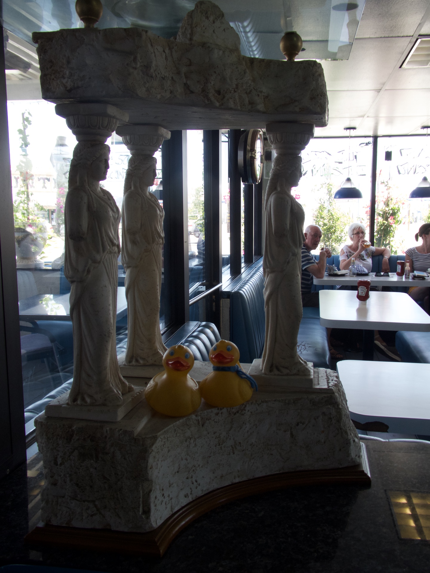
Statues inside Mad Greek Cafe

We really like this place, and the food was delicious and the prices were reasonable.   Next time we are here in the desert around Baker, California, we will enjoy another meal at the Mad Greek Cafe.   Baker is on Interstate 15, the main road from Los Angeles to Las Vegas, Nevada.   Back on the highway, we soon enter Nevada.

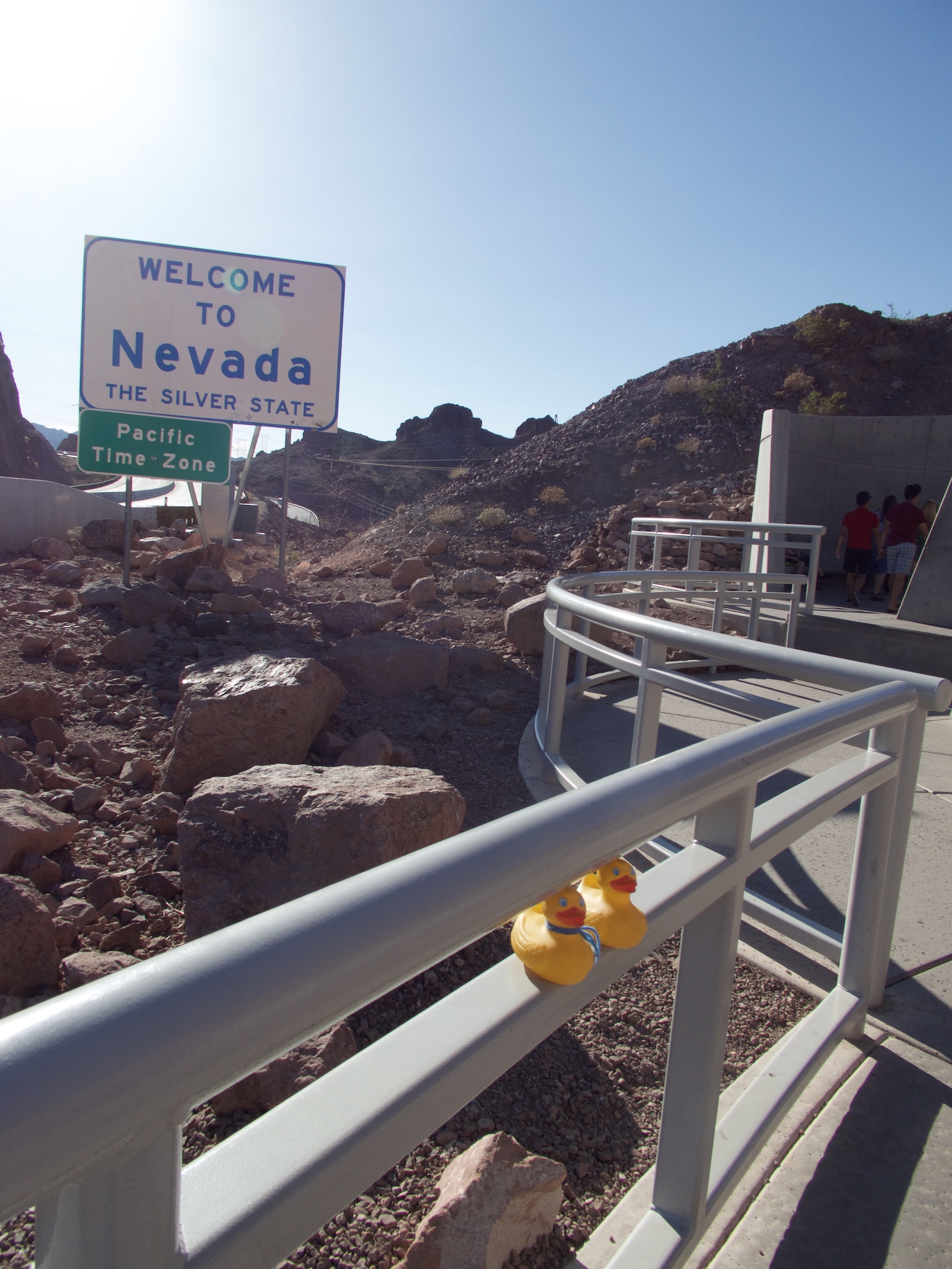
Entering Nevada by Hoover Dam and Lake Mead

Right on the state border is Hoover Dam and Lake Mead. We will join those other humans and take a look.   When the Hoover Dam was built, it was the highest dam in the world.   Not now, though.   Lake Mead is the biggest reservoir in the United States.

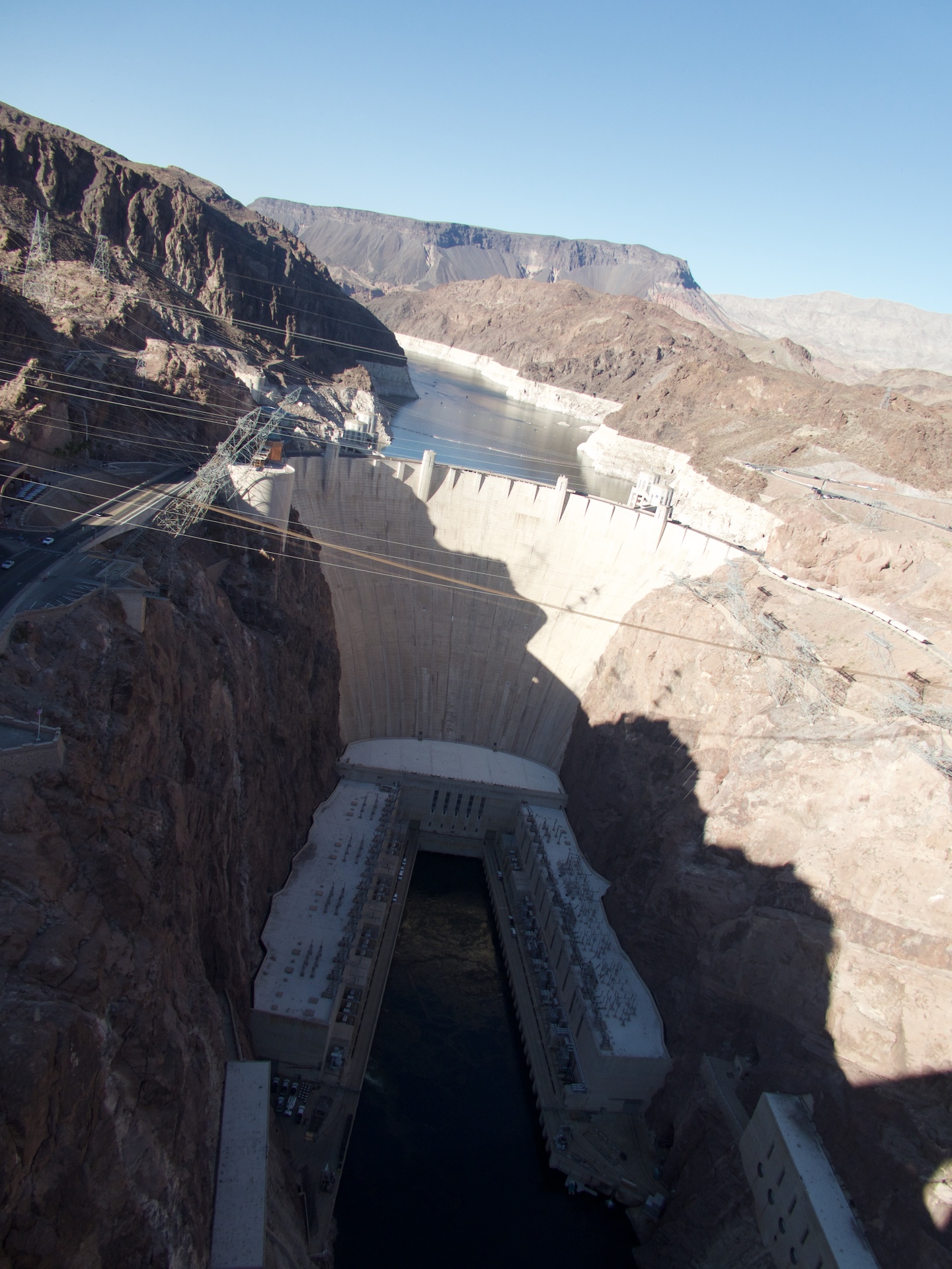
Lake Mead is formed by Hoover Dam

This is what we saw from the walkway.   This dam provides electricity for Las Vegas, Nevada.   As you can guess, Las Vegas really needs a lot of electricity.   We drove through Las Vegas, but did not stop.   That will be a destination for another time.   Leaving Nevada, we drove through a small part of Arizona, and then to Utah.   In Green River, Utah, we stopped to see the world’s largest watermelon slice.

Largest watermelon slice. Green River, Utah

This watermelon slice was built in the 1950’s for Green River’s Watermelon Days Festival.   For protection, it is under a roof.   We ducks are learning to love Roadside America.   We stop to see so many things we would miss, if moms didn’t look at http://www.RoadsideAmerica.com   When you are driving, stop to see unusual things.   We think you will enjoy it as much as we do.

The Unusual in Amboy, California with Zeb and Soapy Smith Duck

As humans say, “Back in the day”, Route 66 was the a highway in the United States.   What does that mean?   When automobiles were new, no super highways existed, and Americans wanted to take road trips, Route 66 was the answer.   Route 66 went from Chicago, Illinois to Santa Monica (Los Angeles) California.   Now, with interstate highways of 4 of more lanes, and bypassing many towns, Route 66 doesn’t have as much traffic, but it does hold fond, happy memories for so many Americans.   Leaving Arizona on Route 66, we entered the state of California.

Entering California from Arizona. Driving on Route 66

A few hours later, driving through the desert, we approached the now ghost town of Amboy, California.

Guardian lion of Route 66

This is one of two lions designated as Guardian Lions of Route 66.

Guardian lion of Route 66 with Zeb and Soapy

The side view of the guardian lion is nice, but Zeb and Soapy really add to the photo.    A few miles further and we are at Roy’s Cafe and Motel.

Roy’s Cafe and Motel

The sign is the tallest thing for miles in the desert.   Roy’s opened in the 1930’s and had its golden age in the 50’s and 60’s.   Driving near Amboy, the humans were reading Roadside America, learning about unusual roadside attractions.   There was a shoe tree near the guardian lions, but in 2010 the tree fell over.   Still a few shoes, but now a tree near Roy’s has shoes.

Shoe tree

We are ducks, but we don’t really understand why humans put their shoes in a tree.   But, our moms thought it was a great thing to see.   There are even more shoes on the ground.

More shoes

Guess it is not so easy to throw them into the tree.   Next we examined the trash pole.

Trash pole

Again, it must be a human thing.   But better to put trash on the pole than throw it on the ground.   We will never tell our moms, but it was rather fun to see this stuff.   I think Soapy’s mom put one of her business cards there with many other business cards.   Next stop was Amboy Crater.

Amboy Crater

This is a natural crater, and designated as a National Natural Landmark, by the United States government.   It is 250 feet high and 1,500 feet in diameter.  This is one of the youngest volcanic fields in the United States.   This crater is located in the Barstow-Bristol trough.   The crater straddles the boundary of the Mojave and Sonoran tectonic blocks.   The most recent eruption was 10,000 years ago.   Now, to the salt mines.

Tetra Technologies working salt mines

This area crosses Bristol Dry Lake and is the site of two large active salt mines.

Salt mines. Pyramids in front of salt from mine.

The row of pyramids in the foreground gets the attention on http://www.RoadsideAmerica.com.   These salt mines produce much of the sodium and sodium chloride used in high school chemistry classes.   Driving through the desert is fun, but I don’t think I would like to be here in summer with extremely high temperatures.   Amboy, California is south of the Mojave National Preserve and north of Joshua Tree National Park.  If you are traveling on Route 66 through the desert, we hope you will stop to see some unusual things, also.   Next time we will show you some unusual things in Baker, California, still in the desert.   It really is out of this world.

Joshua Tree National Park with Zeb, Soapy Smith and JB Duck

In the desert of southeast California, we entered Joshua Tree National Park.

We are entering Joshua Tree National Park

We are entering Joshua Tree National Park

As you know, this is the 100th anniversary of the National Park Service, so we are visiting some national parks this year.    The desert has so many types of vegetation and pretty cactus.

A silver color desert plant

A silver needled desert plant

This silver one caught our attention.   The western part of Joshua Tree National Park is in the Mojave Desert.   This desert is more than 3,000 feet above sea level.    This is a Joshua Tree.

We are in front of the Joshua Tree

We are in front of the Joshua Tree

Joshua trees are really a species of yucca plant and are a symbol of the Mojave Desert.   The waxy, spiny leaves expose little surface area, efficiently conserving moisture.   Joshua trees can grow over 40 feet tall–at the leisurely rate of an inch a year.   Our Joshua Tree has flowers.

Joshua Tree Blossom

Joshua Tree Blossom

Joshua Trees bloom February through April.   The flower is pollinated only by the Joshua moth, and branching occurs after flowering.   These trees are not scarce in Joshua Tree National Park, nor in the Mojave Desert.

Many Joshua trees

Many Joshua trees

They are referred to as the Tree of Life, similar to the Saguaro cactus in the Sonoran Desert.   The rock formations here are great also.   This is Skull Rock.

Skull Rock

Skull Rock

You know how it received that name.   The rocks were formed by underground volcanic activity eons ago and have evolved to todays rock formations.

Formed from underground volcanic activity

Formed from underground volcanic activity

We love them.   The eastern part of Joshua Tree National Park is in the Colorado Desert.   This desert is less than 3,000 above sea level.   The Colorado Desert is a lower, hotter and drier desert than the Mojave Desert.   The Colorado Desert is a sub division of the Sonoran Desert.   Of course there are no boundaries between the deserts, just a subtle, gradual change and the appearance of lower creosote bushes.

Creosote bushes

Creosote bushes

There are many Cholla Cactus here.

The Cholla Cactus Garden

The Cholla Cactus Garden

This fenced area is called the Cholla Cactus Garden.   Let’s go explore.

Let's go see the cactus garden

Let’s go see the cactus garden

The signs say not to touch the cactus, or even get too close.   The needles cause pain–going in and coming out of your body.   Here is new growth on the cactus.

New growth on the cholla cactus

New growth on the cholla cactus

When the needles turn brown and fall off, the remaining cactus arm resembles woven, hollow stalks.

The arms look hollow without needles

The arms look hollow without needles

Even though this is a sub division of the Sonoran Desert, the large cactus do not appear.   We did like this desert plant with the huge flowering blossom.

Desert plants blooming in March

Desert plants blooming in March

The desert is just so full of different vegetation and so many surprises.   We hope you visit Joshua Tree National Park, or some national parks in this, the Centennial year, of the National Park Service.

The Colorado Traveling Ducks Visit the Mojave Desert

We are driving into the Mojave Desert.

Mojave National Preserve

Mojave National Preserve

Looking around, there is not much vegetation, dry mountains around us, and 57 minutes with no other humans in sight.

Low vegetation in the desert

Low vegetation in the desert

These are Joshua Trees, also known as yucca palms.

Joshua Trees

Joshua Trees

There is a national park featuring Joshua Trees.   Very tall mountains add to the feeling of isolation.

Tall mountains add to isolation

Tall mountains add to isolation

A town on the horizon.   This is Kelso Depot and Visitor’s Center.

Kelso Depot and Visitor's Center

Kelso Depot and Visitor’s Center

The visitor’s center is not open yet this morning, so we just look.   From the mid 1940s until 1985 this was the jail for Kelso.

Kelso Jail with Soapy

Kelso Jail with Soapy

A 2 cell, strap-steel jail to confine drunks and other unruly individuals for a night or two.   The jail was originally west of Kelso Depot on the far side of Kelbaker Road.   That rascal, Soapy Smith Duck, better be careful…he may have to stay in jail in Kelso, California.   Kelso Dunes are the largest field of eolian sand deposits in the Mojave Desert.   They cover 45 sq. miles and reach heights of  600 feet.   Humans can walk to the dunes and climb to the top.  The dunes were formed 25,000 years ago.

A path to the Kelso Dunes

A path to the Kelso Dunes

Well, mom, let’s go.

Let's walk to the Dunes

Let’s walk to the Dunes

OK Ducks.   Let’s walk a little way in the sand, but not to the top of the dunes today.   Leaving Kelso Dunes, we pose for a photo with these wildflowers.

Wildflowers

Wildflowers

Remember, wild flowers in the desert were the reason for this road trip.   We are out of the Mojave National Preserve, but still in the Mojave Desert.   We like these trees with the bright orange.

We like the orange here

We like the orange here

We are not sure, but we think the lower plants turn orange when they die, and blew into the tree.   But it is pretty.   The Mojave Desert does have vegetation, but not very tall.

Mojave Desert. Rather barren

Mojave Desert. Rather barren

We like the harsh look of the desert.

China Ranch Date Farm in California with Zeb, Soapy Smith and JB Duck

We are going to a farm today, but a farm in the Death Valley area.   The date farm is 2 miles away.

China Ranch is 2 miles from here.

China Ranch is 2 miles from here.

Look at this road.   This will not be a farm like we usually see.

Is there really a farm down this road?

Is there really a farm down this road?

But even here, we see some cheerful wild flowers.

October rains brought flowers here also

October rains brought flowers here also

In previous years, mines were in these rocks.

Former mine

Former mine

You can see where the miners went in to get silver.   This is a date farm, but what do we, the Colorado Traveling Ducks, know about dates.

We did not know this

We did not know this

This sign tells us that dates are the oldest tree crop.   We did not know that.   These date trees are palm trees.

Date palm trees with Colorado Traveling Ducks in the grassy road

Date palm trees with Colorado Traveling Ducks in the grassy road

We are in the grassy road here.   Can you find us?   There are many types of palm trees.

Now we are sitting in the tree bark

Now we are sitting in the tree bark

We are sitting on the tree trunk, held up by date palm bark.   To move the dates from the date groves to the store, this truck can be used.

To move dates

To move dates

We like this truck.   How did a farm get here in death valley area?   Ah Foo started it.

How did a farm get here?

How did a farm get here?

This farm is possible because there is a river near here, and that is the water source for the farm.   The modest museum has some history and some items used on the farm in the earlier days.

A modest museum

A modest museum

This is a cute museum.   There is a gift shop here and a bakery.

China Ranch gift shop and wonderful bakery

China Ranch gift shop and wonderful bakery

We love bakeries.   We bought date cookies with white chips and date bread.

Let's eat!

Let’s eat!

This is a good place to sit and enjoy our treats.

Sit here and enjoy date treats

Sit here and enjoy date treats

We like China Ranch Date Farm.   For more information visit http://www.chinaranch.com  If you are near Death Valley in Tecopa, California we hope you visit the date farm.

The High and Low of Death Valley with Zeb, Soapy Smith and JB Duck

The largest national park south of Alaska reveals more secrets to the Colorado Traveling Ducks.  Driving to Dantes View, we gain elevation.   This, the most breathtaking viewpoint in the park, is 5,475 feet above the floor of Death Valley.   Looking to the floor of Death Valley from Dantes View, the green vegetation is a contrast to the dry earth.

From Dantes View

From Dantes View

The white ground below is a reminder that all minerals that are thrown in the valley, from volcanic activity, earthquakes or rain, will forever remain in Death Valley.   This land, below sea level, has no outlet to the sea, so everything stays here and is further altered by the forces of nature.

From Dantes View

From Dantes View

Not only is the floor of Death Valley covered with minerals, but the mountain walls of the valley exhibit colors and patterns from thousands of years of change.

From Dantes View

From Dantes View

Mom is experimenting with the panorama function on her camera.

Floor of Death Valley from Dantes View

Floor of Death Valley from Dantes View

We like the effect.   From the high point, let’s go to the floor of Death Valley.   We drive to Badwater Basin.

Badwater Basin

Badwater Basin

This is not only the lowest point in North America, but it is the lowest point in the Western Hemisphere.   There are not many places in the world where you can stand on dry land, below sea level.    Let’s go on the salt flats.

On the salt flats

On the salt flats

We are careful to only walk where it is allowed.   This environment is fragile and we do not want to destroy any of it.   We are happy to discover our national parks.   Did you know that the National Park Service is 100 years old in 2016?   Now we turn our backs to the salt flats and look at the rock wall.

Standing 282 feet below sea level

Standing 282 feet below sea level

If you look closely you will see a white rectangular sign marking sea level.   The sign is about half way up the wall and 2/3 to the right of this photo.   The information signs say that Death Valley Basin is still dropping.   Today we are 282 feet below sea level.   Hundreds of years from now, these salt flats probably will be further below sea level.     We only spent a couple days in Death Valley National Park, but you could spend a day, a week, or months here and never see everything.   The park is huge and the land is constantly changing.   The rain and flooding from September gave us the wildflowers this spring.   In the park, you can receive wildflower updates.   You may want to view the best flower display.   We loved all the flowers, but our photos are not the best.   You may want to use google to see more pictures.   But we were happy with these flowers.

A few wildflowers by the road

A few wildflowers by the road

We hope you enjoy some national parks this year.

Death Valley National Park to Tecopa, California with the Colorado Traveling Ducks

Driving through Death Valley National Park, we spotted the road in 20 Mule Team Canyon.

We want to drive in the canyon

We want to drive in the canyon

Let’s go.   On a dirt road we followed the dried river bed.

Dried river bed in canyon

Dried river bed in canyon

And, yes this is the road.

Dirt road

Dirt road

Let’s hope there is no sudden rain and flash flooding.   There was none.   Just beautiful sunny skies.   Even the mountains look dry.

Even rocks look dry

Even rocks look dry

Remember, Death Valley usually only receives 2 inches of moisture annually.   And the summers are extremely hot.   This was a short 3 mile loop, but we loved it.   The desert mountain landscape fascinates us.   In this area of the park, these are typical rock formations.

Typically Death Vally scenery in this part of park

Typically Death Vally scenery in this part of park

Next turn off for us is Zabriskie Point which overlooks what is referred to as the Badlands.

Zabriskie Point

Zabriskie Point

Within the lake bed are rich layers of Colemanite and Uluxite, minerals often referred to as Borax.   Strip mining was used until a 1976 law close the park to prospecting and gave the National Park Service more control over mining activity.   There is still some private mines in operation in the park, but no strip mining.   Pacific Coast Borax Company was a major mining company, but by the 1920s their mining activity had slowed.

Zabriskie Point

Zabriskie Point

The company turned to tourism by opening the elegant Furnace Creek Inn in 1927, with great success.    Christian B. Zabriskie was vice president and general manager of Pacific Coast Borax Company during the transition from mining to tourism.   This lookout, Zabriskie Point, is named for him.   Aren’t park information signs great?   Much of this landscape was formed by water and earthquakes.   However the black layer here is lava that oozed out onto the ancient lake bed.

Black lava on tops of mountains

Black lava on tops of mountains

Hot water followed the lava, bringing minerals such as borax, gypsum and calcite with it.   Isn’t geology fascinating?   We left the park for the evening, but we will return in the morning.   Driving into Death Valley Junction, we saw the Amargosa Opera House and Hotel.   This is now an historic building and cultural center.

Amargosa Opera House

Amargosa Opera House

Marta Becket was  professional dancer who danced at Radio City Music Hall and performed on Broadway in New York City.   A flat tire on a camping trip led her to Death Valley Junction where she fell in love with the theater.   She renovated it and renamed it Amargosa Opera House.   She remains in Death Valley Junction, performing until she officially retired in 2012.   She still lives there, and live performances are still performed at the Opera House.

Performances scheduled this year

Performances scheduled this year

We thought the doors to the Amargosa Opera House were wonderful.

Beautiful doors to Opera House

Beautiful doors to Opera House

We spent the night at Tecopa, California.   There are many hot springs in the area and we enjoyed soaking in the hot water.    The ground is white from minerals.

Minerals in Tecopa, CA

Minerals in Tecopa, CA

There is a variety of minerals, but salt is in there also.    Yes, mom tasted it.   We liked this wagon in Tecopa.

Wagon in Tecopa

Wagon in Tecopa

The evening sky was so clear, we saw thousands of brilliant stars.   We are enjoying our time in the desert.

Wildflowers in Death Valley 2016

We are entering California.

Hello California

Hello California

Where are the beaches?   Mom says we are not going to the beach.   The desert is in bloom.   That means there are wildflowers blooming where usually no flowers bloom.   Entering Death Valley National Park, we will look for wildflowers.

Going into Death Valley National Park

Going into Death Valley National Park

This desert usually receives 2 inches of rain annually and summer temperatures over 120 degrees are normal.   Here are a few flowers.

Purple flowers

Purple flowers

We like purple, and of course yellow is one of our favorite colors.   These white flowers are pretty, also.

White flowers

White flowers

And the flowers are growing in gravel like soil.   Mom buys potting soil for our flowers and needs to water every few days.   The flowers are beautiful this year, but mom did not get very good photos.

Thousands of flowers blooming

Thousands of flowers blooming.   Find yellow ducks in yellow flowers

Looking online you will see better views of flowers.   A fellow traveler we met at dinner one evening, suggested we take Artists Drive to see flowers.

We are in the flowers

We are in the flowers

We did, and also went to Artists Palette.   Artists Palette shows colors of the mountains.

Volcanic rocks of many colors

Volcanic rocks of many colors

Over 5 million years ago repeated volcanic eruptions blanketed the landscape, depositing ash and minerals.    The volcanic minerals were chemically altered by heat and water, with variable amounts of oxygen and other introduced elements.   Chemical analysis have identified iron, aluminum,magnesium and titanium,but no copper.   Some of the colored minerals here include red hematite and green chlorite.   We love the information signs in national parks.   Further along Artists Drive, we admired this  splash of turquoise mountain.

Color of Caribbean in rocks here.

Color of Caribbean in rocks here.

Just like  huge turquoise wave in the Caribbean Sea.   Here are a few more of this years wildflowers.

Different purple flowers

Different purple flowers

This bush is even producing small yellow flowers.

Bush has tiny yellow flowers

Bush has tiny yellow flowers

We especially liked these flowers.

Wildflowers really are growing wild this year.

Wildflowers really are growing wild this year.

This was our first time in Death Valley.    We were fascinated by the entire landscape and we will show you more next time.   You should see Death Valley soon.   You will like it also.